Who Fatally Assaulted Alan From Antrim?
Alan Meekin has been found murdered at Belfast Castle, where he was a frequent visitor to the beautiful gardens. It is believed that Alan was likely murdered elsewhere and so the hunt for clues starts at Waterworks Park in Belfast. Our best but overworked investigator needs your help to solve the case.
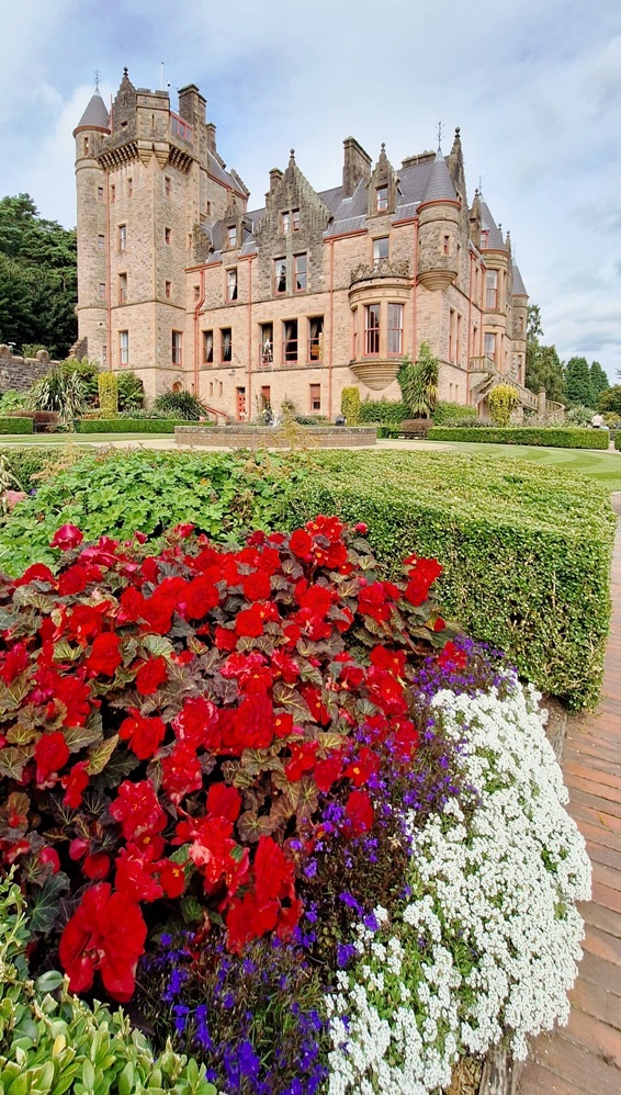 The Antrim Castles Whodunit Hunt starts in North Belfast and ends at Antrim.
- This is a self-guided, driving murder mystery trail.
- Visit historic sites and beautiful gardens as you try and crack the case. See Belfast and Antrim castles and pass another castle en-route (hence the trail name), beautiful gardens, Northern Ireland’s very own White House, mills, historic sites in Antrim… and more!
- Over 30 clues to solve squeezed into a Whodunit booklet that has extra historical and tourist info!
- The driving route is a mere 26 miles / 42km! There is about 2 ¾ miles / 4 ½ km of walking in total across all of the clues.
- Allow 4-5 hours to solve this murder mystery, excluding extended refreshment stops.
- Accessibility – it is generally fairly flat where all clues are to be found.
- Email clue help facility if you get stuck.
To purchase this Whodunit Hunt with credit / debit / Amex card please click here.
To pay using Paypal click here to order this trail.
The starting point is at the playground entrance to Waterworks Park, North Belfast, close to the point we’ve marked on the map below:

(c) 2023 – the term ‘Whodunit Hunt’, associated logo, website content, and all Whodunit Hunt routes, ideas, photos, are all protected by copyright. Any copying, impersonation or distribution of anything embraced by our copyright is intellectual theft and therefore unlawful and illegal. Please respect the law as well as all of our hard work.
Who Tortured Terry To His End?
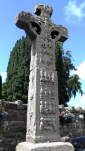
Terry Williams has been found dead at the old cross at Donaghmore. Crime scene investigators suggest Terry’s body was left here to confuse us and that he was murdered elsewhere… but where? He frequently explored the area that the Torrent River flows, and beyond, and your clue hunt is focussed here. Our detective is struggling to get to the bottom of the evidence collected and needs your help.
 The Torrent Trail is a driving Whodunit Hunt that starts at Donaghmore and ends at Aughnacloy. It is a self-guided, murder mystery trail.
- Your 42 mile / 67 km route takes in a wealth of historic sites! See impressive Irish Crosses and a detailed replica, a castle ruin, an ancient hill fort, visit an old cottage where the parent of a past U.S. president lived… and lots more!
- 26 clues to solve, and loads of historical info snippets squeezed into our booklet to give you as much value as possible.
- Only 1 ¼ miles / 2 km of walking in total on this Whodunit Hunt that must be done to solve clues. However there are several optional short walks if you wish, along the River Torrent, up to a Neolithic tomb thousands of years old, in a ‘royal’ forest, and to the magical St Patrick’s Chair.
- Allow 4-5 hours to solve this murder mystery, excluding refreshment stops or extra walks.
- Accessibility – it is mostly flat where the clues are to be found, apart from a short hill ascent to Clogher Fort.
- Email clue help facility if you get stuck
To purchase this Whodunit Hunt with credit / debit / Amex card please click here.
To pay using Paypal click here to order this trail.
The starting point is at Donaghmore, near Dungannon as shown in the map below:
(c) 2023 – the term ‘Whodunit Hunt’, associated logo, website content, and all Whodunit Hunt routes, ideas, photos, are all protected by copyright. Any copying, impersonation or distribution of anything embraced by our copyright is intellectual theft and therefore unlawful and illegal. Please respect the law as well as all of our hard work.
Who Culled Carrie In Carrickfergus?
The body of Carrie Musgrave has been found in Carrickfergus and we need your help to confirm our suspicions about the murder. Although Carrie’s body was found at the base of the castle walls, she didn’t fall and we don’t believe this was where the murder was committed either. Only by following the clue trail can the circumstances of her death be revealed…
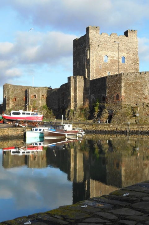 This is a self-guided, circular walking Whodunit Hunt murder mystery trail.
- Carrickfergus has a long history, having been inhabited as a town for around 850 years! The shoreline is dominated by the impressive castle, but there is much more to see. Along the clue trail you’ll learn about the town’s rise as a port, how it was surrounded by over a kilometre of walls (which you’ll see the remains of), learn about the part Edward & Robert The Bruce played in its history, see an historic church… and more!
- The route is approx 2 miles / 3 km.
- This Whodunit trail is crammed with 32 clues as well as several pieces of historical information and ghost stories too!
- Allow two hours to solve the case, excluding refreshment stops.
- Accessibility – this is generally a fairly flat route, with only occasional moderate inclines and no steps to navigate.
- Email clue help facility if you get stuck.
To purchase this Whodunit Hunt with credit / debit / Amex card please click here.
To pay using Paypal click here to order this trail.
The starting point is beside Carrickfergus Castle:
(c) 2023 – the term ‘Whodunit Hunt’, associated logo, website content, and all Whodunit Hunt routes, ideas, photos, are all protected by copyright. Any copying, impersonation or distribution of anything embraced by our copyright is intellectual theft and therefore unlawful and illegal. Please respect the law as well as all of our hard work.
Who Liquidated Colm Along The Lecale Coast?
Colm O’Brien has been found murdered in the village of Rossglass and our best investigator is struggling to narrow down leads. We need your help to confirm their suspicions and crack the case! It is believed that Colm was murdered outside of the village and so the clue trail starts near Newcastle, at the ancient Maghera Church and Round Tower site.
 The Lecale Coast Trail is a self-guided, non-circular driving Whodunit Hunt.
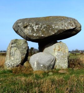
- This murder mystery trail is jam-packed with historic sites along a driving route of only 30 miles / 50 km. See neolithic sites including the portal tomb shown in the photo and a large stone circle, numerous castles with seven in the coastal town of Ardglass alone, a church over a thousand years old… and more!! Also enjoy beautiful coastal scenery and learn about characters who shaped the area’s history.
- Generally moderate walking, about 3 miles / 5 km in total spread across all of the clues. Sensible shoes necessary (e.g. trainers) for the walk to the stone circle clue.
- Allow at least four hours to solve this murder mystery, excluding refreshment stops.
- Accessibility – walking terrain is generally fairly flat, but a few clues do require reasonable mobility.
- Assorted places for refreshment along the route in many towns and villages.
- Email clue help facility if you get stuck.
To purchase this Whodunit Hunt with credit / debit / Amex card please click here.
To pay using Paypal click here to order this trail.
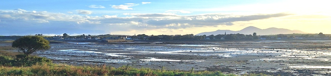
The starting point is shown in the map below.
(c) 2023 – the term ‘Whodunit Hunt’, associated logo, website content, and all Whodunit Hunt routes, ideas, photos, are all protected by copyright. Any copying, impersonation or distribution of anything embraced by our copyright is intellectual theft and therefore unlawful and illegal. Please respect the law as well as all of our hard work.
