Barnesmore Gap Trail

Who Killed Leo From Letterkenny?

Leo McInure from Letterkenny has been found murdered! Our best investigator is struggling to conclude the case and needs your help to solve the murder. Although his body was found dumped at the side of the road at Barnesmore Gap it is believed that he was murdered elsewhere. So it is recommended to start the hunt for clues at Letterkenny, where he lived.
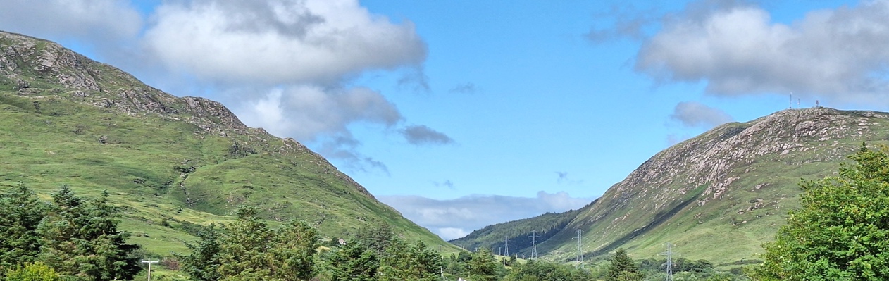
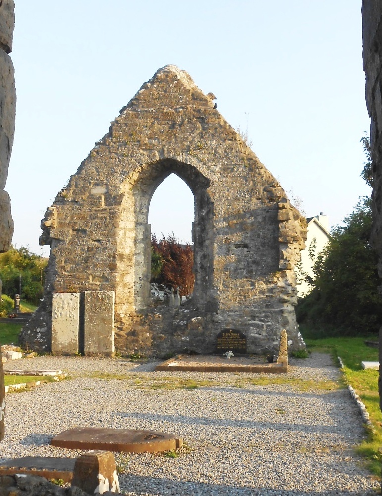
  • The Barnesmore Gap Trail is so named as the road traverses this scenic gap as it passes the Bluestack Mountains. Starting at Letterkenny, you’ll proceed to the pretty ancient village of Raphoe, pass through Stranorlar, see beautiful Lough Eske, and solve a few remaining clues in Donegal town. See beautiful churches, stunning mountain and lake scenery, learn about the potato famine… and more!
  • We’ve squeezed 30 clues into this self-guided, driving murder mystery trail, with lots of historical information in our Whodunit Hunt booklet so you get to know a little more about the places you’re visiting.
  • The route is 64 km / 40 miles and there are generally moderate amounts of walking at each of the clue stops. You could do an extra walk in Drumboe Woods en route if you wanted to pause your clue hunting there.
  • We suggest allowing 4-5 hours to complete this Whodunit Hunt, excluding extended refreshment stops…. so it’s great for a wee day out.
  • Accessibility – once out of the car the terrain is generally fairly flat, albeit with one short, steep hill at the start.
  • Note, if you live halfway along the trail (such as at Stranorlar) then start by solving the clue closest to where you live, solve remaining clues and then drive up to Letterkenny and solve the remaining clues back to where you started!

To purchase this Whodunit Hunt with credit / debit / Amex card please click here and type Barnesmore in the ‘Special Requests’ field at the start of the purchase page.

To pay using Paypal click here (or in the menu) to order this, or any other, Whodunit Hunt.

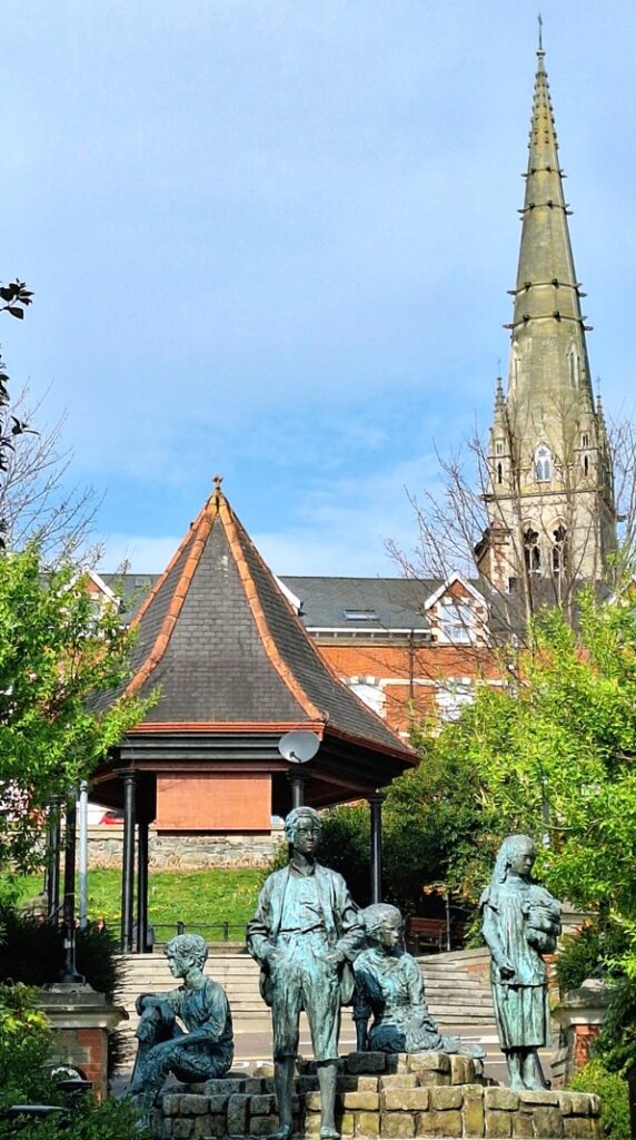
The starting point is at the bottom of Market Square in Letterkenny, opposite the Market Centre entrance, shown below:

crime scene tape on white

(c) 2023 – the term ‘Whodunit Hunt’, associated logo, website content, and all Hunt routes, ideas, images and photos, are protected by copyright. Any copying/distribution of anything embraced by our copyright is intellectual theft and therefore unlawful and illegal. Please respect the law as well as numerous years of our hard work.

Inishowen Peninsula Trail

Who Murdered Mary From Moville?

Mary Malone from Moville has alas been found murdered. Even our best investigator is still trying to link the evidence together and thus needs your help to solve the case. Mary’s body was found at the graveyard beside the Cooley Cross near Moville – we believe she was killed elsewhere, but feel it best to start your hunt for clues at the cross.
  • The Inishowen Peninsula Trail Whodunit Hunt is a self-guided, driving murder mystery trail. It starts near Moville and ends at the impressive Grianan of Aileach which dates back to the 1st Century and provides a fantastic view of the route you’ve come.
  • The clue route includes historic sites spanning almost 2,000 years of history, including ancient Irish crosses, monastic sites, a saint’s grave, and more! You’ll also see much stunning coastal and mountain scenery too.
  • The clue route is 85 km, or about 53 miles. There is generally very moderate walking at all of the clue stops.
  • If you wish, and provided that time allows, there is the opportunity to pause in your clue hunting at Malin and visit impressive Malin Head nearby, the most northerly point in Ireland.
  • We suggest allowing five hours to complete this Whodunit Hunt, excluding extended refreshment stops.
  • Accessibility – once out of the car the terrain is generally quite flat.

To purchase this Whodunit Hunt with credit / debit / Amex card please click here and type Inishowen in the ‘Special Requests’ field at the start of the purchase page.

To pay using Paypal click here (or in the menu) to order this, or any other, Whodunit Hunt.

The starting point is at the Cooley Cross near Moville, shown below:

crime scene tape on white

(c) 2023 – the term ‘Whodunit Hunt’, associated logo, website content, and all Hunt routes, ideas, images and photos, are protected by copyright. Any copying/distribution of anything embraced by our copyright is intellectual theft and therefore unlawful and illegal. Please respect the law as well as numerous years of our hard work.

Donegal

Who Done In Don From Donegal?

Donald McGinley has alas been found murdered in the popular historic town of Donegal. Although his body was found in the Diamond of Donegal we’re not at all sure that the murder was committed here. So the hunt for clues starts at the main town car park beside the river.
  • The Donegal Whodunit Hunt is a self-guided, walking murder mystery trail.
  • Discover numerous historic spots along the clue trail in Donegal including the ancient abbey, the impressive castle, the railway museum, churches… and more! Learn about the history of the town too, and characters that shaped it over hundreds of years.
  • The clue route is 2 km / 1 ¼ miles.
  • The Whodunit Hunt booklet is packed with almost 30 clues to solve as well as several extra pieces of historical information!
  • The recommended time for this murder mystery is two hours, excluding refreshment stops.
  • Accessibility – the route is mostly quite flat with no steps.

To purchase this Whodunit Hunt with credit / debit / Amex card please click here and type Donegal in the ‘Special Requests’ field at the start of the purchase page.

To pay using Paypal click here (or in the menu) to order this, or any other, Whodunit Hunt.

The starting point is at the far end of the main car park beside the river, near the statue shown in the map below:

crime scene tape on white

(c) 2023 – the term ‘Whodunit Hunt’, associated logo, website content, and all Hunt routes, ideas, images and photos, are protected by copyright. Any copying/distribution of anything embraced by our copyright is intellectual theft and therefore unlawful and illegal. Please respect the law as well as numerous years of our hard work.

Driving Hunts

driving direcionsIf you have access to a vehicle / motorbike (or are a super cyclist) try a driving Whodunit Hunt! All take you to several amazing places, include stunning scenery, and reveal much history. Some are circular routes (i.e. start / end points are nearby) while others are linear. Directions are given all along the route.

We have 30 Driving Whodunit Hunts available, with more to come. Click location links below for more detail or use the map at the bottom of the page to find trails in a particular area.

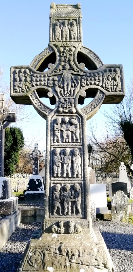
  • In County Antrim are three driving Whodunits – the Antrim Coast trail (starts at Larne), our Antrim Castles trail (starts north Belfast), and our magical Belfast Narnia Trail.
  • If you want to start off small or are short on time try our Torr Road Taster Trail starting at Cushendun.
  • Our best-selling deluxe Ards Peninsula trail starts at Bangor and ends at Grey Abbey.
  • Two driving Whodunits start in Dundalk – the Blackrock Coastal Trail and our Patrick Kavanagh Trail which follows in the footsteps of the famous Irish poet. The Cooley Peninsula trail starts at Newry and ends near Dundalk, with beautiful coastal scenery.
  • The Boyne Valley drive starts at the amazing Monasterboice Crosses site in County Louth (shown in the photo).
  • The Cavan Lakelands trail explores the beautiful lakes of County Cavan. Our Ancient East Churches trail starts at Kingscourt and ends in County Monaghan at the amazing tin church of Laragh.
  • Our first Whodunit in County Kildare is the Clane-Maynooth driving trail.
  • The Diamond Trail starts near Loughgall and ends at historic Tynan village.
  • In County Donegal are the Inishowen Peninsula and Barnesmore Gap Trails, the former having particularly stunning scenery.
  • On the Glenshane-Heaney Trail visit the area where Seamus Heaney grew up, traverse the Glenshane Pass, and stop at numerous historic sites with stunning countryside.
  • The Harry Ferguson Trail is a taster Whodunit Hunt following in the footsteps of the famous inventor.
  • The Lecale Coast Trail, starting at Maghera near Newcastle and ending in Ardglass, is jam-packed with ancient historic sites!
  • The Lough Neagh trail explores the western side of the Lough from Oxford Island to historic Cranfield Church.
  • The Lower Lough Erne Trail stops at numerous historic sites all around the lough.
  • The Athboy-Abbey Trail starts near ancient Athboy, visiting fabulous sites including Fore Abbey. A more recent launch is our Meath-Fingal Coast Trail that explores the coastline from Drogheda to Rush.
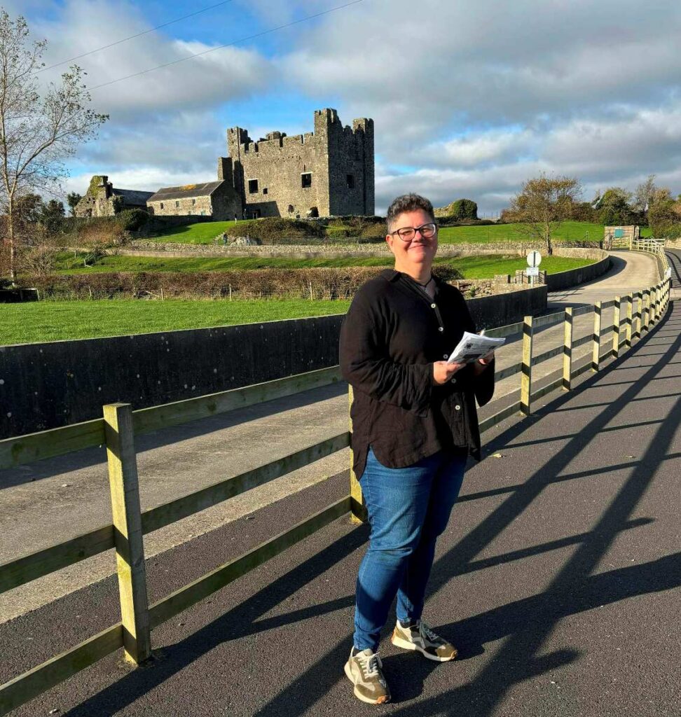
  • Newry & Mourne area has several driving Whodunits – Mourne Coast, Mourne Mountains, Slieve Croob, and Slieve Gullion trails. Our Newry Canal Trail murder mystery also starts on the outskirts of Newry.
  • Our Sperrins trail explores the many historic sites in this mountainous area.
  • Follow in the footsteps of St Patrick on our St Patrick’s Trail which starts at historic Inch Abbey, Downpatrick.
  • The Tassagh Trail starts at Markethill in County Armagh and ends at Darkley Wood with the fairies!
  • The Torrent Trail (named after the river) starts at Donaghmore, near Dungannon, and ends at Aughnacloy.

Most clues are suitable for wheelchair users or those with prams as our detectives have determined accessible routes as far as possible. The amount of walking is usually less than on Walking Hunts and spread across several clue stops. Check individual trail pages for full details.

Note: if you want to try a driving Whodunit Hunt but it’s inconvenient to drive to the start point, simply begin with the clue that is closest to you and, once you get to the last clue, drive to the start and solve the rest of the clues!

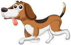
On Driving Whodunit Hunts, the majority of clues aren’t far from where you park, so an accompanying dog could be left in the car if you wish. Very occasionally, several clues are at one stop and in such cases it’s best to take your pet with you – maybe your dog can help sniff out a clue! 🙂

The map below shows available driving Whodunit Hunts indicated by a purple car symbol. Those coloured orange are for future launch – if you’re interested in hearing about them, please contact us and we’ll email you when they’re available.

Use the card or Paypal link in the page of whichever Whodunit Hunt you are interested in to purchase it.

crime scene tape on white

(c) 2023 – the term ‘Whodunit Hunt’, associated logo, website content, and all Whodunit Hunt routes, ideas, photos, are all protected by copyright. Any copying, impersonation or distribution of anything embraced by our copyright is intellectual theft and therefore unlawful and illegal. Please respect the law as well as all of our hard work.