Who Killed Leo From Letterkenny?
Leo McInure from Letterkenny has been found murdered! Our best investigator is struggling to conclude the case and needs your help to solve the murder. Although his body was found dumped at the side of the road at Barnesmore Gap it is believed that he was murdered elsewhere. So it is recommended to start the hunt for clues at Letterkenny, where he lived.
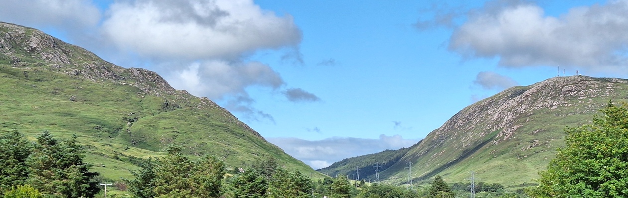
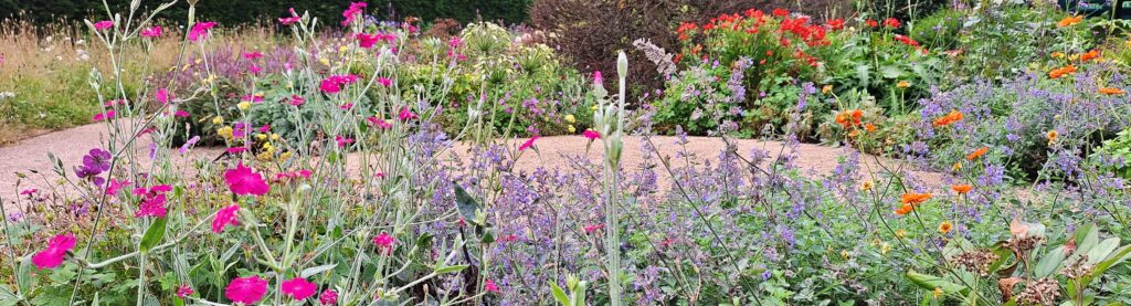
 The Barnesmore Gap Trail is so named as the road traverses this scenic gap as it passes the Bluestack Mountains. Starting at Letterkenny, you’ll proceed to the pretty ancient village of Raphoe, pass through Stranorlar, see beautiful Lough Eske, and solve a few remaining clues in Donegal town. See beautiful churches, stunning mountain and lake scenery, learn about the potato famine… and more!
- We’ve squeezed 30 clues into this self-guided, driving murder mystery trail, with lots of historical information in our Whodunit Hunt booklet so you get to know a little more about the places you’re visiting.
- The route is 64 km / 40 miles and there are generally moderate amounts of walking at each of the clue stops. You could do an extra walk in Drumboe Woods en route if you wanted to pause your clue hunting there.
- We suggest allowing 4-5 hours to complete this Whodunit Hunt, excluding extended refreshment stops…. so it’s great for a wee day out.
- Accessibility – once out of the car the terrain is generally fairly flat, albeit with one short, steep hill at the start.
- Note, if you live halfway along the trail (such as at Stranorlar) then start by solving the clue closest to where you live, solve remaining clues and then drive up to Letterkenny and solve the remaining clues back to where you started!
To purchase this Whodunit Hunt with credit / debit / Amex card please click here and type Barnesmore in the ‘Special Requests’ field at the start of the purchase page.
To pay using Paypal click here (or in the menu) to order this, or any other, Whodunit Hunt.
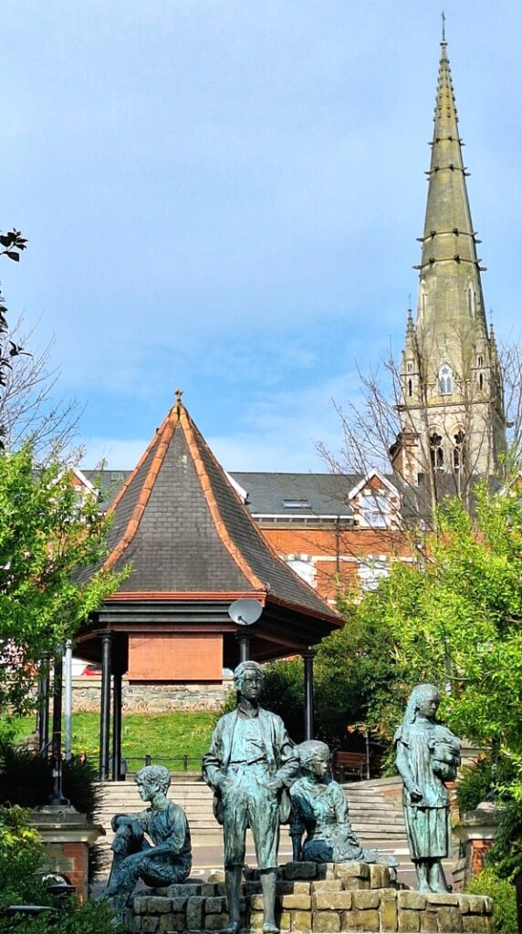
The starting point is at the bottom of Market Square in Letterkenny, opposite the Market Centre entrance, shown below:

(c) 2023 – the term ‘Whodunit Hunt’, associated logo, website content, and all Hunt routes, ideas, images and photos, are protected by copyright. Any copying/distribution of anything embraced by our copyright is intellectual theft and therefore unlawful and illegal. Please respect the law as well as numerous years of our hard work.
Who Murdered Mary From Moville?
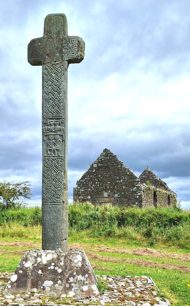
Mary Malone from Moville has alas been found murdered. Even our best investigator is still trying to link the evidence together and thus needs your help to solve the case. Mary’s body was found at the graveyard beside the Cooley Cross near Moville – we believe she was killed elsewhere, but feel it best to start your hunt for clues at the cross.
-
 The Inishowen Peninsula Trail Whodunit Hunt is a self-guided, driving murder mystery trail. It starts near Moville and ends at the impressive Grianan of Aileach which dates back to the 1st Century and provides a fantastic view of the route you’ve come.
- The clue route includes historic sites spanning almost 2,000 years of history, including ancient Irish crosses, monastic sites, a saint’s grave, and more! You’ll also see much stunning coastal and mountain scenery too.
- The clue route is 85 km, or about 53 miles. There is generally very moderate walking at all of the clue stops.
- If you wish, and provided that time allows, there is the opportunity to pause in your clue hunting at Malin and visit impressive Malin Head nearby, the most northerly point in Ireland.
- We suggest allowing five hours to complete this Whodunit Hunt, excluding extended refreshment stops.
- Accessibility – once out of the car the terrain is generally quite flat.
To purchase this Whodunit Hunt with credit / debit / Amex card please click here and type Inishowen in the ‘Special Requests’ field at the start of the purchase page.
To pay using Paypal click here (or in the menu) to order this, or any other, Whodunit Hunt.
The starting point is at the Cooley Cross near Moville, shown below:
(c) 2023 – the term ‘Whodunit Hunt’, associated logo, website content, and all Hunt routes, ideas, images and photos, are protected by copyright. Any copying/distribution of anything embraced by our copyright is intellectual theft and therefore unlawful and illegal. Please respect the law as well as numerous years of our hard work.
Who Killed Kevin From Kingscourt?
Kevin King from Kingscourt has been found murdered and our chief investigator needs your help to solve the crime. Although his body was found at Bailieborough square, we think he may have been murdered elsewhere. So the trail for clues starts at Kingscourt, where he lived.
 This Whodunit Hunt is a self-guided, driving murder mystery trail. It starts at Kingscourt and ends at the unique tin church of Laragh.
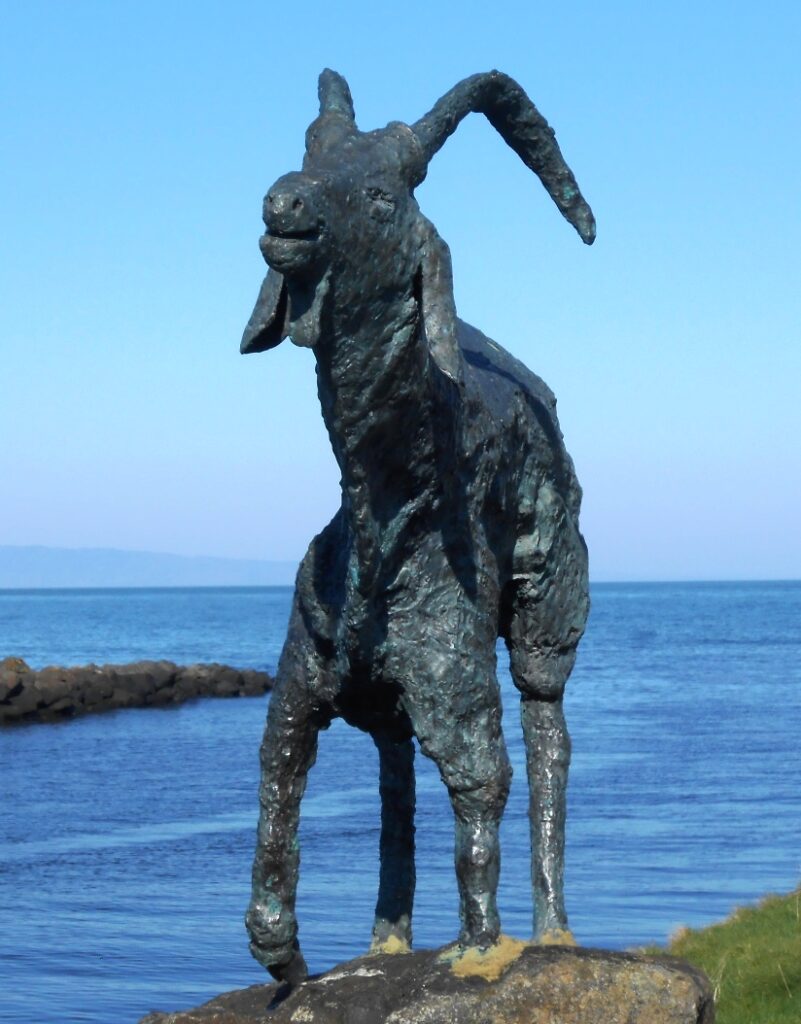
- The Ancient East Churches trail visits a variety of historic spots in Counties Cavan and Monaghan. See beautiful churches, enjoy a lovely forest walk, explore the main street of Ballybay, learn about historic Bailieborough town and an ancient fair, see beautiful lakes, an unusual statue of an elk… and more!
- We’ve squeezed nearly 30 clues into this trail with lots of historical information added to the Whodunit booklet so that you get to know just a little more about the places you’re visiting.
- The route is 78 km (almost 49 miles).
- The total walking distance spread across all of the clue stops is 5 ¾ km / 3 ½ miles. This includes a lovely woodland walk of 2 ½ km / 1 ½ miles at Bailieborough Demesne – if you wanted to use up two of your clue helps instead of walking this distance you could do this if you wished… though in the spring the bluebells are beautiful here.
- We suggest allowing 4-5 hours to complete this Whodunit Hunt, excluding extended refreshment stops…. so it’s great for a wee day out.
- Accessibility – once out of the car the terrain is fairly flat, with mostly moderate slopes. Reasonable mobility is required to do the forest walk. Alternative routes can be found around steps.

To purchase this Whodunit Hunt with credit / debit / Amex card please click here and type AE Churches in the ‘Special Requests’ field at the start of the purchase page.
To pay using Paypal click here (or in the menu) to order this, or any other, Whodunit Hunt.
The starting point is at the church in Kingscourt shown below:
(c) 2023 – the term ‘Whodunit Hunt’, associated logo, website content, and all Hunt routes, ideas, images and photos, are protected by copyright. Any copying/distribution of anything embraced by our copyright is intellectual theft and therefore unlawful and illegal. Please respect the law as well as numerous years of our hard work.
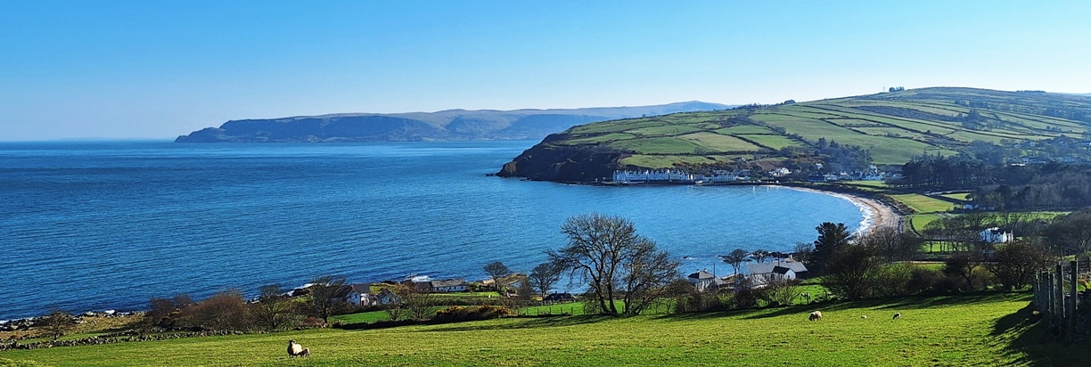
Who Killed Clara From Cushendun?
Local beauty Clara Baxter has been found murdered! Her body was found dumped at Murlough Bay and alas her remains are anything but pretty! Evidence suggests the murder was committed elsewhere, and she was known to be a good swimmer. So start your hunt for clues at Cushendun and see where they take you…
 This is a self-guided, driving murder mystery ‘taster trail’, for if you’re short on time or want to try a mini driving Whodunit Hunt to see if you’ll like them. We hope you do!
- Explore the stunning coastline between the quaint village of Cushendun and Ballycastle. You’ll discover a number of historic spots as you go including Ballycastle Friary, standing stones, Carra Castle, and also learn about the history of Cushendun! There’s also a Game Of Thrones location near the starting point!
- The little Whodunit Hunt booklet for this murder mystery is still packed with 14 clues, full directions, and a couple of snippets of history and trivia. It costs only £3.99!
- The recommended time for this murder mystery is 1 ½ – 2 hours; any walking to be done is completely flat, unless you wish to do the short climb up Torr Head for beautiful views.
- The driving route is 16 miles / 26 km and there is a total of one mile (1 ½ km) of walking across all of the clues.
To purchase this Whodunit Hunt with credit / debit / Amex card please click here.
To pay using Paypal click here (or in the menu) to order this, or any other, Whodunit Hunt.
The starting point is at Cushendun, shown in the map below:
(c) 2023 – the term ‘Whodunit Hunt’, associated logo, website content, and all Hunt routes, ideas, images and photos, are protected by copyright. Any copying/distribution of anything embraced by our copyright is intellectual theft and therefore unlawful and illegal. Please respect the law as well as numerous years of our hard work.
 Tired of having the same old team-building events at pubs / restaurants? Looking for a new, fun, and very affordable idea for hen & stag days or a college / uni event? Then why not have a murder mystery themed event with one of our Whodunit Hunt trails!
The cost per booklet of our walking Whodunit Hunts is £6.99 and (standard length) driving Whodunit Hunts is £7.99 if sent by email (or Euro equivalents)… so very affordable! Taster trails cost only £3.99!
 We give a discount for buying multiple Whodunit Hunt booklets, depending on the number of copies needed. If you want us to print (on premium quality paper) and post your booklets then the discount will, at the least, give you free printing and postage.
For a team event we advise teams of 2-3 people (although four is doable too) with one booklet per team. Booklets provided will each have a unique case id for each team to submit an answer (and get clue help). After purchase, we supply guidance on running your event and indicate the best place(s) for your teams to meet near the starting point.
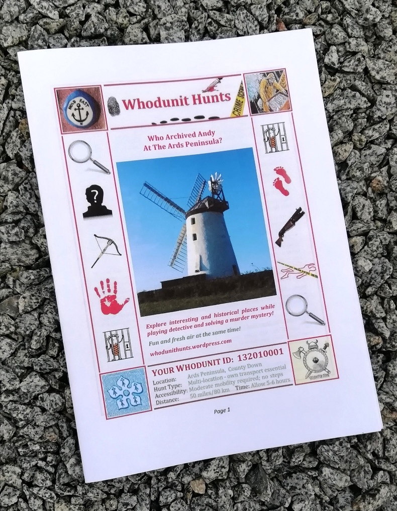
The photo shows an example booklet. If printing the booklets yourself, click this printing link for guidance.
Payment is by either card or Paypal – we’ll supply payment instructions when you’ve concluded the details of your event with us.
To make an enquiry just fill in the form below and we’ll get back to you with a quote and any queries that we may have about your event.
(c) 2023 – the term ‘Whodunit Hunt’, associated logo, website content, and all Hunt routes, ideas, images and photos, are protected by copyright. Any copying/distribution of anything embraced by our copyright is intellectual theft and therefore unlawful and illegal. Please respect the law as well as numerous years of our hard work.
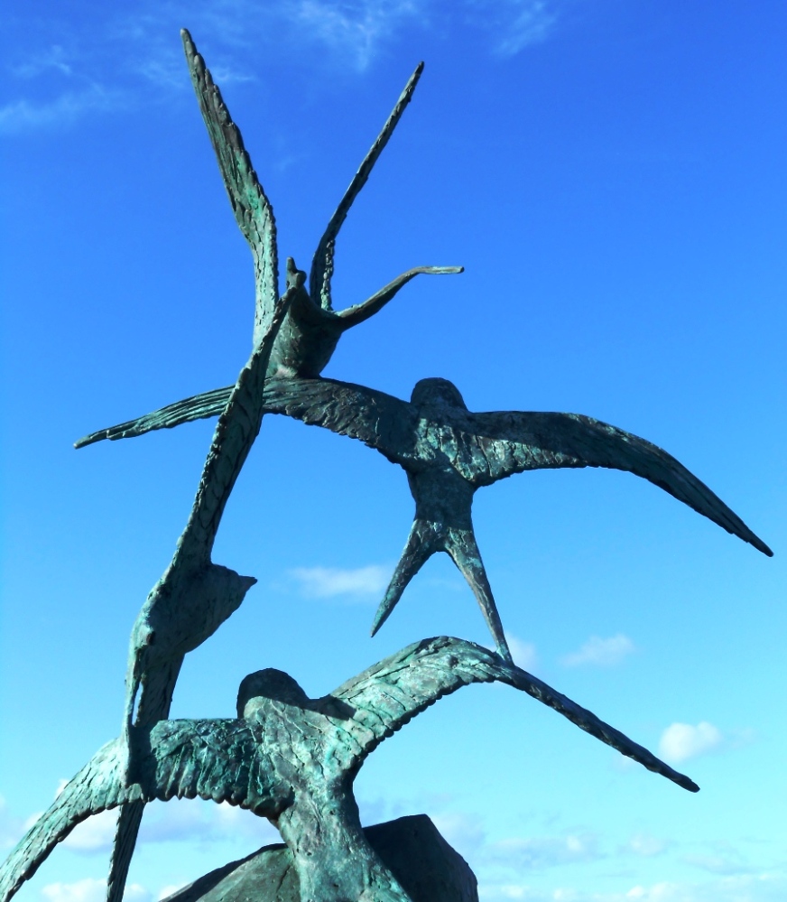
Who Struck Down Sean From Skerries?
Sean Black has been found murdered at the windmill in Skerries, close to the visitor centre, and our best but overworked investigator needs your help to solve the case. We believe he was killed elsewhere so your search for clues starts at Drogheda, where he worked.
 The Meath-Fingal Coast Trail is a self-guided, driving murder mystery trail. This Whodunit Hunt starts at Drogheda and ends at Rush.
- The clue route includes numerous historic sites and beautiful coastal scenery. You’ll see castles, seaside towns, assorted modern sculptures, windmills, a ruined church, an unusual ‘structure’… and more! Learn about the history and evolution of the area as you go and find out where St Patrick landed here too!
- We’ve squeezed 30 clues into this trail with lots of historical information added to the Whodunit booklet.
- The linear clue route is only 49 km (or about 31 miles). The total walking distance spread across all of the clues is up to 5 ½ km / 3.4 miles but you can reduce this by 1 km / 0.6 miles if you drive your vehicle down Ardgillan Castle’s driveway from its car park to solve one clue.
- We suggest allowing at least four hours to complete this Whodunit Hunt, excluding extended refreshment stops.
- Accessibility – once out of the car the terrain is generally quite flat, with only occasional moderate slopes; there are no steps.
- For refreshments, you will pass coffee shops, a number of bars and restaurants, and stores along the route.
To pay using Paypal click here (or in the menu) to order this, or any other, Whodunit Hunt.
To purchase this Whodunit Hunt with credit / debit / Amex card please click here and type Meath-Fingal Coast in the ‘Special Requests’ field at the start of the purchase page.
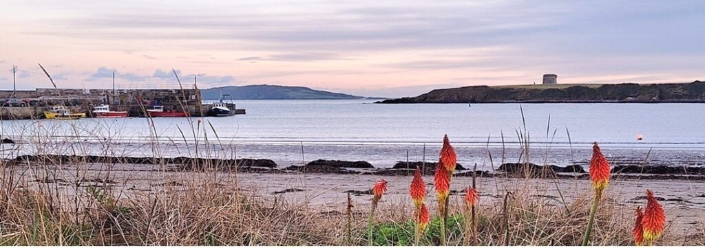
The starting point is at the Scotch Hall bus stop at Drogheda, shown below, with the route then heading along the R150 out of the town:
(c) 2023 – the term ‘Whodunit Hunt’, associated logo, website content, and all Hunt routes, ideas, images and photos, are protected by copyright. Any copying/distribution of anything embraced by our copyright is intellectual theft and therefore unlawful and illegal. Please respect the law as well as numerous years of our hard work.
 For an absolutely unique gift, treat someone to a Whodunit Hunts Gift Voucher! Or treat yourself to a multi-trail discount voucher!
Multi-trail e-vouchers are like a mini-subscription – choose five Whodunit Hunts as and when you want them with a voucher price offering a 10% discount compared to individual trails. Or you can buy an e-voucher for just a single trail.
The cost of e-vouchers with booklets emailed to the recipient is:
- Walking Whodunit Voucher: £6.99,
- Driving Whodunit Voucher: £7.99,
- Multi-Trail (5) Walking Voucher: £31.50,
- Multi-Trail (5) Mixed Voucher: £34.00 – choose a mix of up to 3 driving Whodunit Hunts and the remainder walking ones.
If you prefer the gift recipient to get their booklet(s) in the post then the e-voucher prices are:
- Single-trail Walking/Driving Whodunit E-voucher: £1.95 additional cost if living in UK or £3.60 for ROI addresses,
- Multi-Trail (5) Walking E-voucher: £41.00 (NI addresses only),
- Multi-Trail (5) Mixed E-voucher: £43.50 (NI addresses only).
To pay for vouchers by credit / debit / AMEX card click here instead of using the form below. It gives a more seamless order / checkout experience – set the date to when you want the voucher to be sent and in ‘Special Requests’ put the email of the recipient (if not you), their address if having booklets posted, and any message to be sent with the e-voucher.
To pay by Paypal use the form below and we’ll email an invoice with the amount to send. You can pick however many trails you want on a walking or driving voucher with Paypal. If your card isn’t in GBP, Paypal converts from your home-currency to GBP so you know you’re sending the right amount.
Please check your junk/spam folder if you haven’t heard back from us in a while – invoices are usually sent in 10-15 minutes.
Please Contact Us for any queries about voucher purchases or your order.
(c) 2023 – the term ‘Whodunit Hunt’, associated logo, website content, and all Hunt routes, ideas, images and photos, are all protected by copyright. Any copying/distribution of anything embraced by our copyright is intellectual theft and therefore unlawful and illegal. Please respect the law as well as all of our hard work.
Who Fatally Assaulted Alan From Antrim?
Alan Meekin has been found murdered at Belfast Castle and our best but overworked investigator needs your help to solve the case. It is believed that Alan was likely murdered elsewhere and so the hunt for clues starts at Waterworks Park in Belfast.
 The Antrim Castles Whodunit Hunt starts in North Belfast and ends at Antrim.
- This is a self-guided, driving murder mystery trail.
- Visit historic sites and beautiful gardens as you try and nail the criminal for this case. See Belfast and Antrim castles and pass another castle en-route (hence the trail name), beautiful gardens, Northern Ireland’s very own White House, mills, various historic sites in Antrim… and more!
- Over 30 clues to solve squeezed into a Whodunit booklet that has extra historical and tourist pointers!
- The driving route is only 26 miles, or 42km! There is about 2¾ miles / 4½ km of walking in total across all of the clues.
- The recommended time for this murder mystery, excluding extened refreshment stops, is 4-5 hours.
- Accessibility – it is generally fairly flat where all of the clues are to be found.
To purchase this Whodunit Hunt with credit / debit / Amex card please click here.
To pay using Paypal click here (or in the menu) to order this, or any other, Whodunit Hunt.
The starting point is at the playground entrance to Waterworks Park, North Belfast, close to the point we’ve marked on the map below:
(c) 2023 – the term ‘Whodunit Hunt’, associated logo, website content, and all Whodunit Hunt routes, ideas, photos, are all protected by copyright. Any copying, impersonation or distribution of anything embraced by our copyright is intellectual theft and therefore unlawful and illegal. Please respect the law as well as all of our hard work.
Who Liquidated Laura In The Lower Lough Erne Area?
Laura Irvine’s body has been found at the shore of Lower Lough Erne but a post mortem confirmed that drowning wasn’t the cause of death. Our investigators have uncovered much evidence but are struggling to tie it all together and thus need your help to solve the murder.
 The Lower Lough Erne Whodunit Hunt starts at Trory Jetty and ends at the outskirts of Enniskillen. It is a self-guided, driving murder mystery trail with a near-circular route.
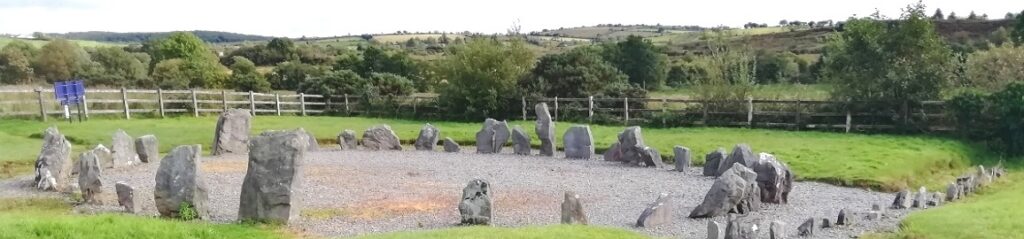
- Enjoy beautiful lakeside scenery while visiting a plethora of historic places! You’ll see neolithic sites including a stone circle and strange carved figures, numerous castles, a famine grave, historic sites related to World War II… and more!
- Almost 30 clues to solve!
- The driving route is 77 miles / 123 km, with clues spread all around the Lough area; 13 miles of this route is along Lough Shore Road between clue stops at Belleek and Tully Castle. There is about 2¼ miles / 3¾ km of walking in total.
- The recommended time for this murder mystery, excluding refreshment stops and return journey, is about 5 hours.
- Accessibility – it is generally flat where the clues are to be found, with no steps that must be navigated.
To purchase this Whodunit Hunt with credit / debit / Amex card please click here.
To pay using Paypal click here (or in the menu) to order this, or any other, Whodunit Hunt.
The starting point is at Trory Jetty on the lower east shore of the Lough, shown in the map below:
(c) 2023 – the term ‘Whodunit Hunt’, associated logo, website content, and all Hunt routes, ideas, photos, are all protected by copyright. Any copying, impersonation or distribution of anything embraced by our copyright is intellectual theft and therefore unlawful and illegal. Please respect the law as well as all of our hard work.
Who Murdered Maeve From Maynooth?
Maeve O’Mahony from Maynooth has alas been found murdered. Although Maeve’s body was found at Maynooth Castle we’re not at all sure that the murder was committed here and so the evidence trail starts at the Bodenstown Graveyard. We hope you can help us to conclude this ghastly murder mystery.
 This Whodunit Hunt is a self-guided, driving murder mystery trail. It starts between Sallins and Clane and ends at Maynooth… hence the name.
- You’ll start by seeing the memorial stone of a key figure in Ireland’s drive for independence. En-route you’ll see the ruins of an impressive friary, two sites where monasteries were founded over 1,300 years ago, visit a town that was involved in Ireland’s cotton industry and read about its history, see assorted historical sites in Maynooth… and more!
- The clue route is only 32 km / 20 miles! There is generally moderate walking for most clues, with approximately 4 km / 2.5 miles in total spread across all of the clues.
- There are nearly 30 clues to solve. We suggest allowing 3-4 hours to complete this Whodunit Hunt, excluding prolonged refreshment stops.
- Accessibility – once out of the car the terrain is generally quite flat, with only occasional moderate slopes; there are no steps.
- For refreshments, Clane and Maynooth have a variety of options including bars, coffee shops, restaurants and convenience stores.
To pay using Paypal click here (or in the menu) to order this, or any other, Whodunit Hunt.
To purchase this Whodunit Hunt with credit / debit / Amex card please click here and type Maynooth in the ‘Special Requests’ field at the start of the purchase page.
The starting point is shown below:
(c) 2023 – the term ‘Whodunit Hunt’, associated logo, website content, and all Hunt routes, ideas, photos, are all protected by copyright. Any copying, impersonation or distribution of anything embraced by our copyright is intellectual theft and therefore unlawful and illegal. Please respect the law as well as all of our hard work.
