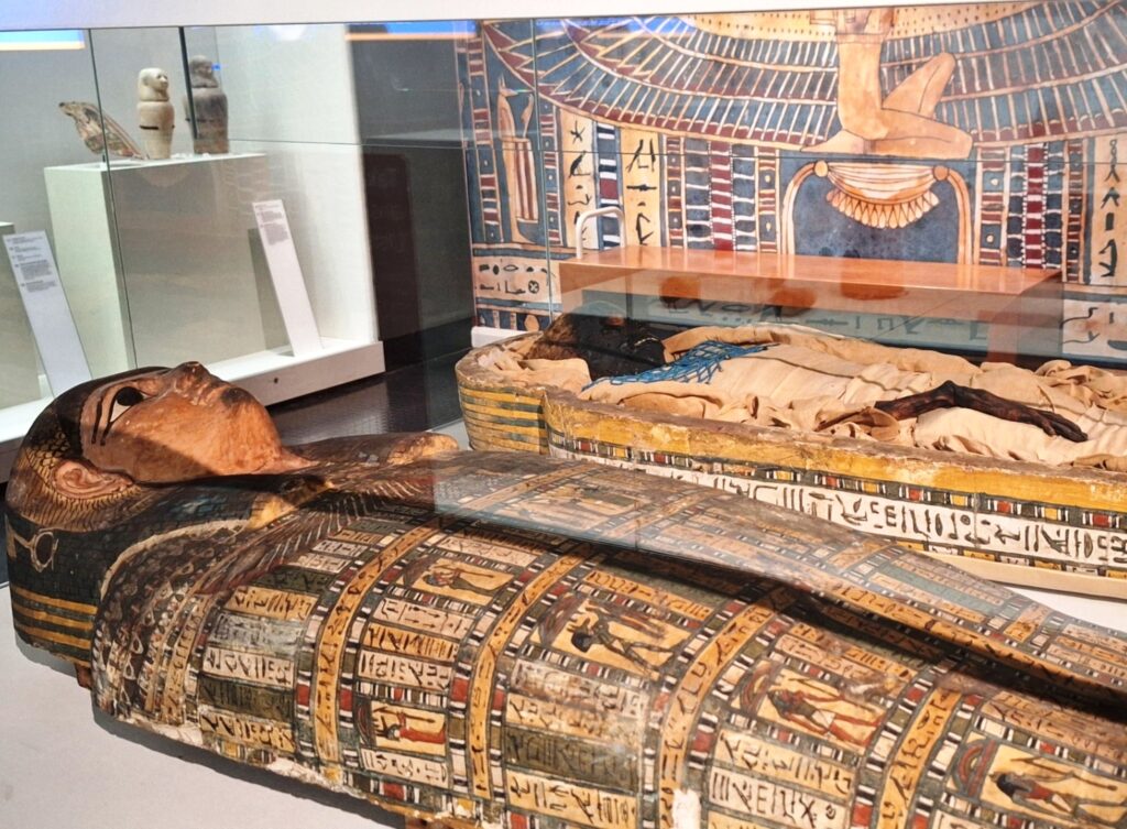
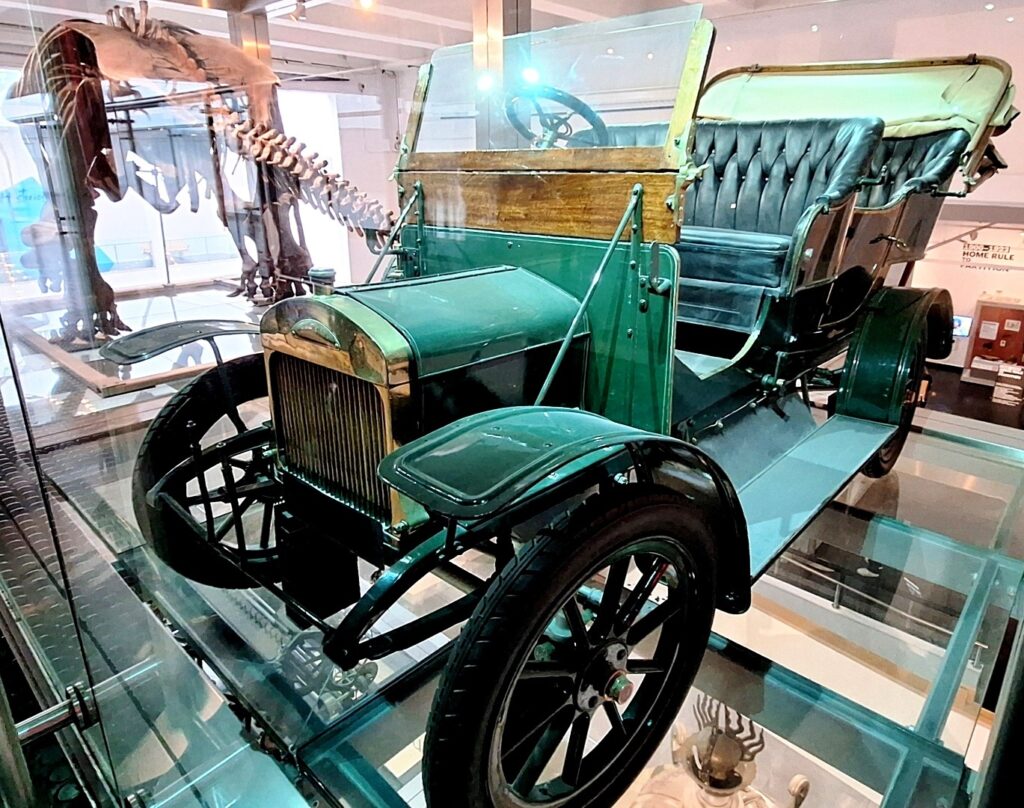
Who Annihilated Ursula And Delivered Her To The Ulster Museum?
As you might expect, the Ulster Museum have occasional deliveries of new artefacts and exhibits to put on display but it’s fair to say they weren’t expecting to find the body of Ursula Powers when a recent delivery was opened! The clues collated from evidence confirm she was killed somewhere in Belfast – intriguingly, the mystery behind her death can be unravelled by following the clue trail around the floors of the museum using some of the very interesting items on display to solve the case clues!
 The Ulster Museum Whodunit Hunt is our first indoor self-guided murder mystery trail… perhaps the only indoor one commecially available in the UK or Ireland!
- Travel back in time as you discover a wealth of history from recent decades all the way back to the time of the dinosaurs! There are countless interesting exhibits covering so many eras and subjects to see, including the famous mummified Takabuti in the Egyptian room, dinosaur skeletons, a polar bear and huge replica Irish cross… and SO much more!
- We have designed a route around the museum taking in some of the most interesting and key things to see.
 Over 35 clues to solve in a Whodunit Hunt booklet with additional historical information and less than half a mile of walking. Perfect for cold or wet days!
- The recommended time for this murder mystery is 2-3 hours, excluding any break for refreshment… though it depends upon how long you linger at various exhibits along the way. Note, the museum is closed on Mondays.
- Accessibility – the museum has lifts and ramps for those preferring to avoid steps.
- Refreshments – the Ulster Musem has a cafe while there are numerous options nearby.
To pay using Paypal click here (or in the menu) to order this, or any other, Whodunit Hunt.
To purchase this Whodunit Hunt with credit / debit / Amex card please click here.

(c) 2023 – the term ‘Whodunit Hunt’, associated logo, website content, and all Hunt routes, ideas, images and photos, are protected by copyright. Any copying/distribution of anything embraced by our copyright is intellectual theft and therefore unlawful and illegal. Please respect the law as well as numerous years of our hard work.
Who Killed Kerry At Derrymore?
Kerry Moore has been found murdered in Derrymore House estate and, with our big case load, we need your help to solve the murder. Although Kerry’s body was found at the entrance to the house, the absence of blood around the body suggests this was not where the murder was committed and she may have even been murdered beyond the estate walls!
 The Derrymore Whodunit Hunt is a self-guided, walking murder mystery trail.
- Derrymore Estate near Newry is a lovely spot for woodland walks in landscaped grounds with a view of the Mournes, but it’s also rich in history with an elegant old cottage, a Quaker Meeting House, an old rath, and attractive gate lodges. In spring and summer the flowers are lovely!
- This murder mystery is jam packed with over 30 clues to solve in a booklet containing several pieces of extra historical information about the estate and nearby Bessbrook.
- The clue route is 1.9 miles, or about 3 km. The recommended time for completing it, excluding refreshment stops, is about two hours.
- Accessibility – the route has no steps and paths generally are either flat or with moderate inclines.

To purchase this Whodunit Hunt with credit / debit / Amex card please click here.
To pay using Paypal click here (or in the menu) to order this, or any other, Whodunit Hunt.
The trail of clues is confined to the Derrymore Estate, which is shown in the map below. Access to the estate, and parking at it, are free.
(c) 2023 – the term ‘Whodunit Hunt’, associated logo, website content, and all Hunt routes, ideas, images and photos, are protected by copyright. Any copying/distribution of anything embraced by our copyright is intellectual theft and therefore unlawful and illegal. Please respect the law as well as numerous years of our hard work.
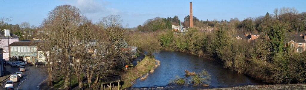
Who Wrecked Randalstown Ray’s Life?
Ray Campbell has been found dead at the base of the old railway viaduct, but the autopsy suggests that he was killed before being thrown off the bridge. However, with a large number of cases to solve, detectives need your help to conclude this case.
 This Whodunit Hunt is a self-guided murder mystery trail on foot.
- Randalstown is a small town with a huge amount of heritage so you’ll see loads of historic sites on our figure-of-eight walk here that takes you over the railway viaduct! See an unusually shaped church, the viaduct of course and the ancient road bridge, the gate lodge to Shane’s Castle, learn about the history of its buildings and the mill here, nearby Game Of Thrones filming locations… and more!
- The clue route is almost 1 ½ miles, or about 2 ½ km.
- This Whodunit booklet is packed with 33 clues to solve (the most we’ve ever squeezed into a walking Whodunit) and several pieces of extra historical information and trivia not seen en route.
- Allow a full two hours to solve this murder mystery, excluding refreshment stops.
- Accessibility – the route is generally fairly flat, with only moderate inclines and no steps.
To purchase this Whodunit Hunt with credit / debit / Amex card please click here.
To pay using Paypal click here (or in the menu) to order this, or any other, Whodunit Hunt.
The starting point and car park is shown in the map below:
(c) 2023 – the term ‘Whodunit Hunt’, associated logo, website content, and all Hunt routes, ideas, photos, are all protected by copyright. Any copying, impersonation or distribution of anything embraced by our copyright is intellectual theft and therefore unlawful and illegal. Please respect the law as well as all of our hard work.
 Tired of having the same old team building events at pubs / restaurants? Looking for a new, fun, and very affordable idea for hen & stag days or a college / uni event? Then why not have a murder mystery themed event with one of our Whodunit Hunt trails!
The cost per booklet of our walking Whodunit Hunts is £6.99 and (standard length) driving Whodunit Hunts is £7.99 if sent by email only (or Euro equivalent)… so very affordable for a team event!
 But we’ll give some discount for buying multiple copies of a Whodunit Hunt trail, depending on the number of copies needed. If you want us to print (on premium quality paper) and post your booklets then the discount will, at the least, offer you free printing and reduced or free postage.
For a team event we advise having teams of 2-3 people (although four is okay too) with one booklet per team. Booklets provided will have a unique case id allowing each team to submit an answer. After purchase, we’ll supply guidance on running your event and indicate the best place(s) for your teams to meet near the starting point of the chosen trail.
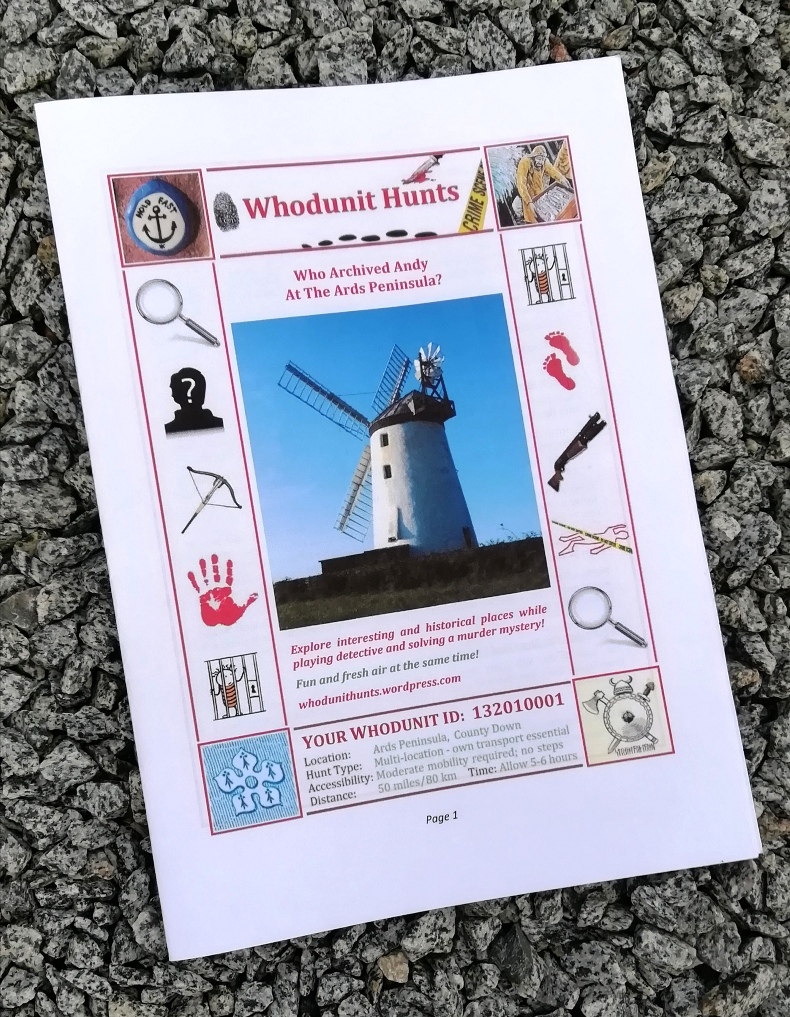
The photo shows an example booklet. If printing the booklets yourself, click this printing link for guidance.
Payment is by either card or Paypal – we’ll supply payment instructions when you’ve concluded the details of your event.
To make an enquiry just fill in the form below and we’ll get back to you with a quote and any queries that we may have about your event.
(c) 2023 – the term ‘Whodunit Hunt’, associated logo, website content, and all Hunt routes, ideas, images and photos, are protected by copyright. Any copying/distribution of anything embraced by our copyright is intellectual theft and therefore unlawful and illegal. Please respect the law as well as numerous years of our hard work.
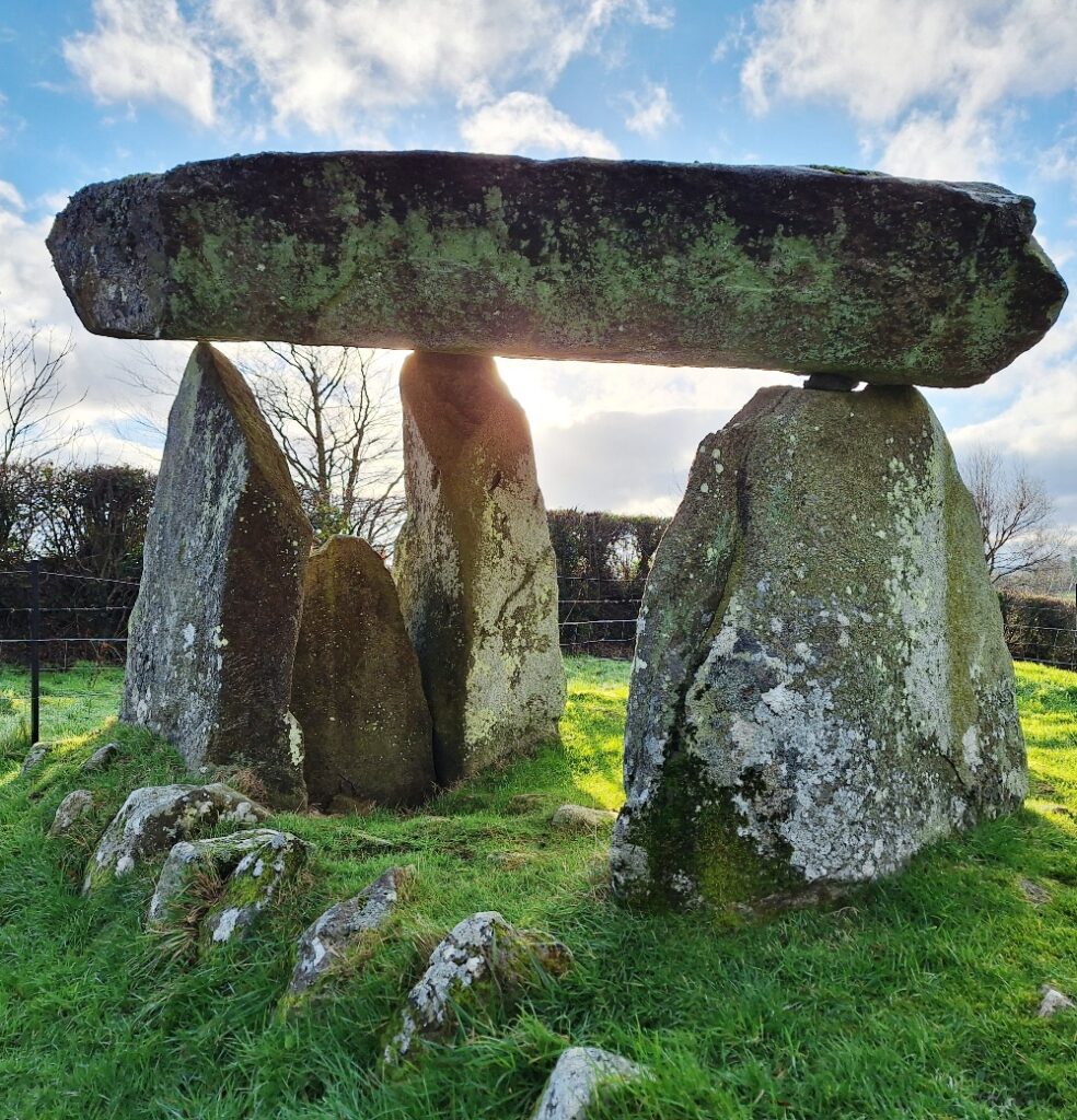 Ballykeel dolmen dates back around 5,500 years to 3,500 BC! It’s a great example of a tripod dolmen (or portal tomb) and is of the same type as the Legananny Dolmen (that can be seen on our Slieve Croob Whodunit Hunt in County Down) which is only a mile or two from Slieve Croob mountain.
Ballykeel Dolmen was only excavated in 1965 and had to be partially re-erected during excavations in 1965 that had begun two years earlier because the large capstone on top had fallen. Those investigations indicated that the tomb had been previously disturbed and, likely, some items taken – however, it still unearthed three highly decorated ‘Ballyalton’ bowls, hundreds of shards of pottery and some flint tools including a javelin head. High levels of phosphates found on the chamber floor confirm it was used for ancient burials.
This dolmen was at the southern end of a large cairn that measured approximately 10 * 30 metres. Most of this cairn has, with age, unsurprisingly disappeared but two parallel lines of stones can still clearly be seen. When it was originally built it would have had the appearance of that shown in the reconstruction photo below:
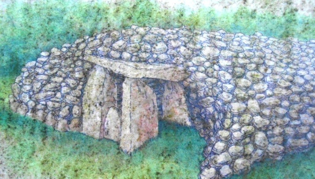
Known locally as ‘The Hag’s Chair’, the cairn is associated with the Cailleach, the mythical goddess of Winter. Legend has it that she would fly down from her home on Slieve Gullion to sit on the dolmen at Ballykeel, which served as her throne. Sacred rituals and ceremonies were likely performed here in ancient times.
(c) 2023 – the term ‘Whodunit Hunt’, associated logo, website content, and all Hunt routes, ideas, photos, are all protected by copyright. Any copying, impersonation or distribution of anything embraced by our copyright is intellectual theft and therefore unlawful and illegal. Please respect the law as well as all of our hard work.
Who Bumped Off Brian In Ballymena?
Brian McCarthy has alas been found murdered in Ballymena. Our chief detective is struggling to conclude the case and needs your help to solve this murder mystery. The evidence trail starts near the Museum/Arts Centre building, on Bridge Street, where Brian used to work.
 The Ballymena Whodunit Hunt is a self-guided murder mystery trail on foot.
- Investigate Ballymena closely and one finds quite a number of historic places, even if the original Ballymena castle is no more, as it began life as a town around 400 years ago. You’ll see many historic buildings (especially ones with beautiful Georgian architecture on Ballymoney Road), old churches, Ballymena’s very own Pentagon, learn about the history of its shops and markets, read ghost stories… and more!
- The clue route is almost 1 ½ miles, or about 2 ½ km. It starts/ends at the Mid-Ulster Museum/Arts Centre.
- This Whodunit booklet is packed with 28 clues to solve and several pieces of extra historical information not seen en route.
- The recommended time for this murder mystery is about 2 hours, excluding refreshment stops.
- Accessibility – the route is generally fairly flat, with only moderate inclines.
To purchase this Whodunit Hunt with credit / debit / Amex card please click here.
To pay using Paypal click here to order this, or any other, Whodunit Hunt.
(c) 2023 – the term ‘Whodunit Hunt’, associated logo, website content, and all Whodunit Hunt routes, ideas, photos, are all protected by copyright. Any copying, impersonation or distribution of anything embraced by our copyright is intellectual theft and therefore unlawful and illegal. Please respect the law as well as all of our hard work.
Who Struck Down Sean From Skerries?
Sean Black has been found murdered at the windmill in Skerries, close to the visitor centre, and our best but overworked investigator needs your help to solve the case. We believe he was killed elsewhere so your search for clues starts at Drogheda, where he worked.
 The Meath-Fingal Coast Trail is a self-guided, driving murder mystery trail. This Whodunit Hunt starts at Drogheda and ends at Rush.
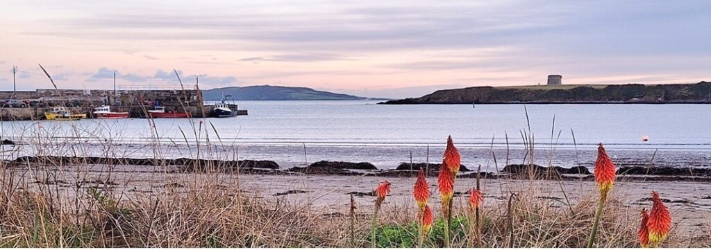
- The clue route includes numerous historic sites and beautiful coastal scenery. You’ll see castles, seaside towns, assorted modern sculptures, windmills, a ruined church, an unusual ‘structure’… and more! Learn about the history and evolution of the area as you go and find out where St Patrick landed here too!
- We’ve squeezed 30 clues into this trail with lots of historical information added to the Whodunit booklet.
- The linear clue route is only 49 km (or about 31 miles). The total walking distance spread across all of the clues is up to 5 ½ km / 3.4 miles but you can reduce this by 1 km / 0.6 miles if you drive your vehicle down Ardgillan Castle’s driveway from its car park to solve one clue.
- We suggest allowing at least four hours to complete this Whodunit Hunt, excluding extended refreshment stops.
- Accessibility – once out of the car the terrain is generally quite flat, with only occasional moderate slopes; there are no steps.
- For refreshments, you will pass coffee shops, a number of bars and restaurants, and stores along the route.
To pay using Paypal click here (or in the menu) to order this, or any other, Whodunit Hunt.
To purchase this Whodunit Hunt with credit / debit / Amex card please click here and type Meath-Fingal Coast in the ‘Special Requests’ field at the start of the purchase page.
The starting point is at the Scotch Hall bus stop at Drogheda, shown below, with the route then heading along the R150 out of the town:
(c) 2023 – the term ‘Whodunit Hunt’, associated logo, website content, and all Hunt routes, ideas, images and photos, are protected by copyright. Any copying/distribution of anything embraced by our copyright is intellectual theft and therefore unlawful and illegal. Please respect the law as well as numerous years of our hard work.
 For an absolutely unique gift, why not treat someone to a Whodunit Hunts Gift Voucher! Or treat yourself to a multi-trail discount voucher!
Multi-trail vouchers are like a mini-subscription – choose five Whodunit Hunts as and when you want them with a voucher price at a discount of about 10% compared to individual trails. The cost of our vouchers is:
- Walking Whodunit Voucher: £6.99 per trail,
- Driving Whodunit Voucher: £7.99 per trail,
- Multi-Trail (5) Walking Voucher: £31.50,
- Multi-Trail (5) Mixed Voucher: £33.99 – choose a mix of up to 3 driving Whodunit Hunts and the remainder walking ones.
We can print/post your voucher though only if paying by Paypal – the charge for this is £1.90 if you live in the UK, £3.60 for Irish addresses. For voucher pricing in other currencies, see Paypal comments below.
You can pay for emailed vouchers by credit / debit / AMEX card instead of using the form below by clicking here. It gives a more seamless order & checkout experience – set the date to when you want the voucher to be sent, ‘Groups’ to the number of trails (on Walking/Driving vouchers only), and in ‘Special Requests’ put the email of the recipient (if not you) and any message to be sent with the voucher.
To pay by Paypal use the form below and we’ll email an invoice with the amount to send. You can pick however many trails you want on a walking or driving voucher! If your card isn’t in GBP, Paypal converts from your home-currency to GBP so you know you’re sending the right amount.
Please check your junk/spam folder if you haven’t heard back from us in a while – invoices are usually sent in 5-10 minutes.
Please Contact Us for any queries about voucher purchases or your order.
(c) 2023 – the term ‘Whodunit Hunt’, associated logo, website content, and all Hunt routes, ideas, images and photos, are all protected by copyright. Any copying/distribution of anything embraced by our copyright is intellectual theft and therefore unlawful and illegal. Please respect the law as well as all of our hard work.
Who Culled Cathy In Caledon?
Evidence suggests that courageous Cathy put up a brave fight for her life, but alas she has been found murdered in the beautiful village of Caledon. We recommend you start your hunt for evidence at the car park on Mill Street as her body was found there, however we think it was likely that the crime was carried out elsewhere.
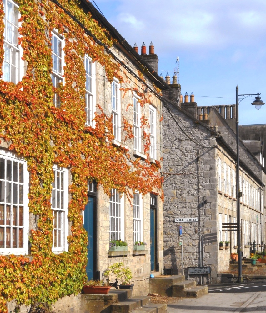 The Caledon Whodunit Hunt is a self-guided murder mystery trail on foot.
- Caledon, County Tyrone, is a pretty, quaint village with much grand Georgian architecture dating back over 200 years. You’ll see the mill ruins, numerous historic buildings, pretty floral displays… and more! Learn about the mills that were built here, the origins of the village before that, and the development of Caledon and the Alexander family that helped create it.
- The clue route is almost 1 ½ miles, or about 2 ¼ km. It starts/ends at the car park on Mill Street, shown in the map below.
- This Whodunit booklet is packed with 28 clues to solve and lots of pieces of historical information.
- The recommended time for this murder mystery is 1 ½ hours, excluding any stops for refreshment. You can extend your stay in the village with a walk along the river… or a delicious scone at the coffee shop on the main street!
- Accessibility – the route is generally fairly flat, with only moderate inclines… though the Mill Street hill is a bit steeper.
To pay using Paypal click here (or in the menu) to order this, or any other, Whodunit Hunt.
To purchase this Whodunit Hunt with credit / debit / Amex card please click here.

(c) 2023 – the term ‘Whodunit Hunt’, associated logo, website content, and all Hunt routes, ideas, images and photos, are protected by copyright. Any copying/distribution of anything embraced by our copyright is intellectual theft and therefore unlawful and illegal. Please respect the law as well as numerous years of our hard work.
Who Fatally Hurt Harry In Holywood?
Harry Woods has alas been found murdered in Holywood, North Down, and our over-worked investigator needs your help to bring the case to a close. We recommend you start your search for clues at Holywood’s historic priory, as his body was found there; however, detectives think the body was left there to confuse us and believe the murder was carried out elsewhere.
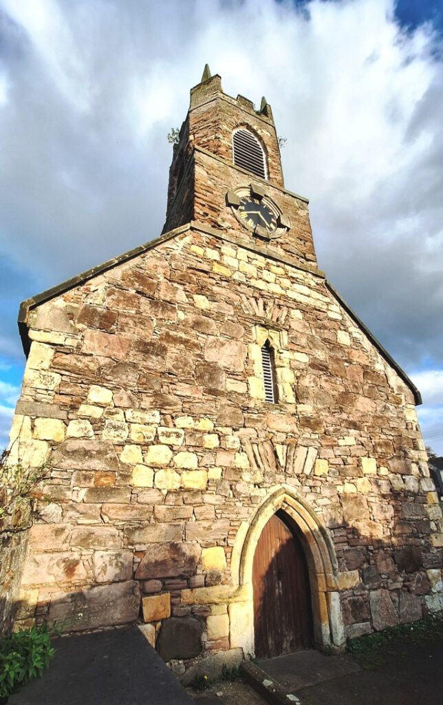 The Holywood Whodunit Hunt is a self-guided, walking murder mystery trail.
- Much of Holywood is designated a conservation area, preserving the grand 19th Century architecture that resulted from wealthy industrialists and merchants moving here after the railway opened in 1848. Along the clue trail you’ll come across quite a number of historic buildings, including of course the ruined priory; the only maypole on the island of Ireland is here too!
- The route is only 1¼ miles, or about 2 km, and fairly flat too, so perfect for those who don’t want to walk so much. The clue trail starts/ends at the priory (see map below).
- The Whodunit Hunt booklet is packed with nearly 30 clues to solve as well as several pieces of extra historical information.
- The recommended time for this murder mystery is 1½ – 2 hours. Extend your visit here with a refreshment stop at one of Holywood’s great coffee shops, cafes, or restaurants.
- Accessibility – this is a generally quite flat route, although some streets have moderate inclines.
To pay using Paypal click here (or in the menu) to order this, or any other, Whodunit Hunt.
To purchase this Whodunit Hunt with credit / debit / Amex card please click here.
(c) 2023 – the term ‘Whodunit Hunt’, associated logo, website content, and all Hunt routes, ideas, images and photos, are protected by copyright. Any copying/distribution of anything embraced by our copyright is intellectual theft and therefore unlawful and illegal. Please respect the law as well as numerous years of our hard work.
