Who Bludgeoned Bert In Belturbet?
Trail currently unavailable as clue route to be re-checked due to missing or vandalised signs :-/
Bert O’Brien has been found murdered in the historic town of Belturbet. Our investigator on the case is struggling to make sense of the evidence and needs your help to solve the murder. Although Bert’s body was found in the river, the coroner soon ruled out drowning during his examinations. The starting point is the Mill Walk car park where spots of blood were first found – see where the evidence leads you…
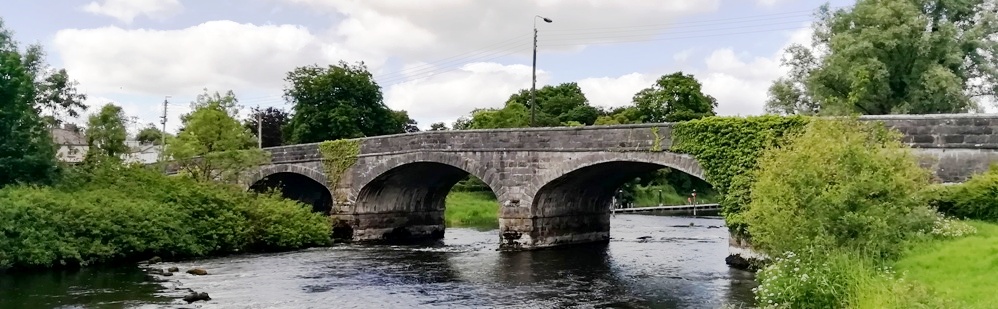
- This Whodunit Hunt is a self-guided, walking murder mystery trail.
- There is much to discover on the clue trail at Belturbet, pleasantly situated overlooking the River Erne. Visit the site of an old castle, the former railway station, enjoy a river walk, learn about the numerous historic spots in the town which dates back to the 12th Century, read ghost stories… and more!
 Over 30 clues to solve in a booklet packed with extra historical details not found en-route!
- The route is 2½ miles, or about 4km.
- The recommended time to solve this Whodunit Hunt, excluding refreshment stops, is 2-3 hours.
- Accessibility: this is generally quite a flat route, with no steps, but there are a couple of hills to navigate.
- For refreshments you will pass local stores, takeaways, bars and a restaurant.
The starting point is at the Mill Walk car park at the bottom of the hill near Kilconny Bridge, shown below.

(c) 2023 – the term ‘Whodunit Hunt’, associated logo, website content, and all Whodunit Hunt routes, ideas, photos, are all protected by copyright. Any copying, impersonation or distribution of anything embraced by our copyright is intellectual theft and therefore unlawful and illegal. Please respect the law as well as all of our hard work.
Who Murdered Mary In Moneymore?
Mary Mahon has alas been found murdered in the historic village of Moneymore. We recommend you start your murder trail at the Manor House beside the roundabout in Moneymore, as her body was found dumped there, however detectives think the murder was carried out elsewhere.
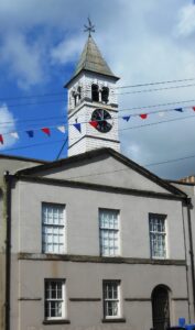 This Whodunit Hunt is a self-guided, walking murder mystery trail.
- Moneymore used to be a thriving market town 200 years ago. Explore the main spots on its heritage trail and solve a murder mystery at the same time! Numerous historic sites and buildings to see, also learn about the village’s part in the area’s lime industry, its railway history, an ancient battle, even read a ghost story!
- The clue route is about 1.4 miles / 2 ½ km.
- 25 clues to solve in a booklet packed with several pieces of extra historical trivia.
- Allow 1½ hours to solve this murder mystery, excluding any stops for refreshment.
- Accessibility – no steps to navigate, some streets are slightly hilly.
- Refreshments – takeaways, a cafe, and a tearoom along the clue route.
- Email clue help facility if you get stuck.
To purchase this Whodunit Hunt with credit / debit / Amex card please click here.
To pay using Paypal click here to order this trail.
The starting point is at the old Manor House building, shown below:
(c) 2023 – the term ‘Whodunit Hunt’, associated logo, website content, and all Hunt routes, ideas, images and photos, are protected by copyright. Any copying/distribution of anything embraced by our copyright is intellectual theft and therefore unlawful and illegal. Please respect the law as well as numerous years of our hard work.
Who Tortured Terry To His End?
Terry Williams has been found dead at the old cross at Donaghmore. Crime scene investigators suggest Terry’s body was left here to confuse us and that he was murdered elsewhere… but where? He frequently explored the area that the Torrent River flows, and beyond, and your clue hunt is focussed here. Our detective is struggling to get to the bottom of the evidence collected and needs your help.
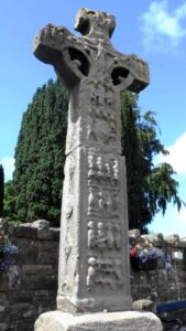 The Torrent Trail is a driving Whodunit Hunt that starts at Donaghmore and ends at Aughnacloy. It is a self-guided, murder mystery trail.
- Your 42 mile / 67 km route takes in a wealth of historic sites! See impressive Irish Crosses and a detailed replica, a castle ruin, an ancient hill fort, visit an old cottage where the parent of a past U.S. president lived… and lots more!
- 26 clues to solve, and loads of historical info snippets squeezed into our booklet to give you as much value as possible.
- Only 1 ¼ miles / 2 km of walking in total on this Whodunit Hunt that must be done to solve clues. However there are several optional short walks if you wish, along the River Torrent, up to a Neolithic tomb thousands of years old, in a ‘royal’ forest, and to the magical St Patrick’s Chair.
- Allow 4-5 hours to solve this murder mystery, excluding refreshment stops or extra walks.
- Accessibility – it is mostly flat where the clues are to be found, apart from a short hill ascent to Clogher Fort.
- Email clue help facility if you get stuck

To purchase this Whodunit Hunt with credit / debit / Amex card please click here.
To pay using Paypal click here to order this trail.
The starting point is at Donaghmore, near Dungannon as shown in the map below:
(c) 2023 – the term ‘Whodunit Hunt’, associated logo, website content, and all Whodunit Hunt routes, ideas, photos, are all protected by copyright. Any copying, impersonation or distribution of anything embraced by our copyright is intellectual theft and therefore unlawful and illegal. Please respect the law as well as all of our hard work.
Who Murdered Monica In Monaghan?
Monica Keogh murdered in Monaghan!! Our best investigator is struggling to tie up the case and needs your help to solve the murder. Although Monica’s body was found in the Diamond, we believe this was not where the murder was committed and recommend you start your hunt for clues at the gates to the Cathedral where she attended services.
 This Whodunit Hunt is a self-guided, walking murder mystery trail.
- Monaghan is a busy town with many historic spots! Along the clue trail you’ll see many of them, including the cathedral, former Market House, and the Diamond with its Rossmore Memorial.
- The clue route is 2 ¾ km / 1 ¾ miles.
- Whodunit Hunt booklet packed with 30 clues to solve as well as several extra pieces of historical trivia!
- Allow at least two hours to solve this murder mystery, excluding refreshment stops.
- Accessibility – the route is mostly fairly flat, but there are a few hilly streets, primarily from the cathedral into town; you can avoid the latter by parking at the bottom of the hill after the first three clues if you wish.
- Refreshments – coffee shops, cafes, restaurants, and bars available.
- Email clue help facility if you get stuck.
To purchase this Whodunit Hunt with credit / debit / Amex card please click here and type Monaghan in the ‘Special Requests’ field on the purchase page.
To pay using Paypal click here to order this trail.
The starting point is at the foot of the cathedral steps, as shown in the map below, with free parking on the side street:
(c) 2023 – the term ‘Whodunit Hunt’, associated logo, website content, and all Hunt routes, ideas, images and photos, are protected by copyright. Any copying/distribution of anything embraced by our copyright is intellectual theft and therefore unlawful and illegal. Please respect the law as well as numerous years of our hard work.
Who Buried Henry In Hillsborough?
The body of Henry Hale was unearthed by a curious dog beside the plane sculpture at Hilsborough Lake! But detectives believe he was murdered elsewhere and quite likely outside the village of Royal Hillsborough. With a big case load, our chief detective needs your help to conclude the case.
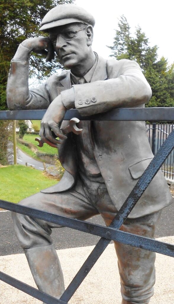 This is a self-guided driving Whodunit Hunt ‘taster trail’ for if you want to start small with driving Whodunit Hunts or don’t have much time.
- Starting at Hillsborough Lake the clue trail takes you to several sites associated with famous inventor and extraordinary pioneer Harry Ferguson who was born in the area. Also visit an ancient fort site dating back over 1,000 years and an old motte and bailey almost as old! All this packed into a driving route of only 23 miles / 37 km long!!
- Still 14 clues to solve in our mini Whodunit booklet which of course also has full directions and several snippets of history and trivia squeezed into it! There is only one mile / 1.6 km of walking in total.
- Allow 1 ½ – 2 hours to solve this murder mystery, excluding refreshment stops.
- Accessibility – the route is generally flat.
- Email clue help facility if you get stuck.
To purchase this Whodunit Hunt with credit / debit / Amex card please click here.
To pay using Paypal click here to order this taster trail.
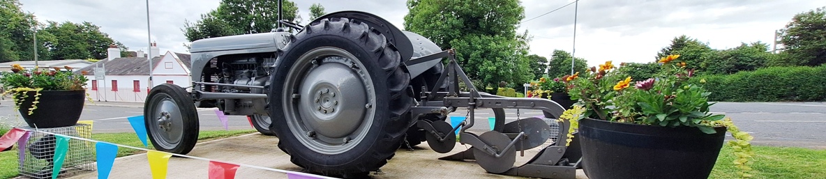
The starting point is shown in the map below.
(c) 2023 – the term ‘Whodunit Hunt’, associated logo, website content, and all Hunt routes, ideas, images and photos, are protected by copyright. Any copying/distribution of anything embraced by our copyright is intellectual theft and therefore unlawful and illegal. Please respect the law as well as numerous years of our hard work.
Who Killed Ernie In Enniskillen?
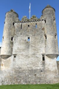 Ernie Travers has been found murdered in the historic city of Enniskillen and we desperately need your help to solve the murder. Although the remains of Ernie’s body were found outside the castle walls, we believe this was not where the murder was committed. However, this would seem to be the best place to start looking for clues to the murder….
- This Whodunit Hunt is a self-guided, linear walking murder mystery trail.
- Discover numerous historic sites along the clue trail in Enniskillen, Ireland’s only island town or city. See the castle and learn about its history, pass the restored Buttermarket, see the impressive French Gothic Revival architecture of St. Michael’s church, visit Forthill park with its memorial… and much more!
- The linear clue route is 1¼ miles / 2 km long, with almost another ¾ mile / 1¼ km return to the starting point.
- Booklet packed with 30 clues as well as several pieces of historical info and trivia.
 Allow at least two hours to solve this murder mystery, excluding refreshment stops.
- Accessibility – some streets have inclines, and there are quite a lot of steps at the end for final clues. Thus we don’t conside it suitable for people with disabilities, but it’s probably ok for most people with prams.
- Refreshments options include coffee shops, cafes, restaurants and stores.
- Email clue help facility if you get stuck.
To purchase this Whodunit Hunt with credit / debit / Amex card please click here.
To pay using Paypal click here to order this trail.
The starting point is at the free Wellington Place car park beside the castle, as shown below:
(c) 2023 – the term ‘Whodunit Hunt’, associated logo, website content, and all Hunt routes, ideas, images and photos, are protected by copyright. Any copying/distribution of anything embraced by our copyright is intellectual theft and therefore unlawful and illegal. Please respect the law as well as numerous years of our hard work.
Who Murdered Tanya Magee From Tandragee?
Shy Tanya Magee from Tandragee was never one to steal the limelight… but having been found brutally murdered her name is big local news. Her body was found in the Newry Canal near Tandragee, but the initial post mortem ruled out drowning so foul play is suspected. The clue trail starts on the outskirts of Newry, where her best friend lives.
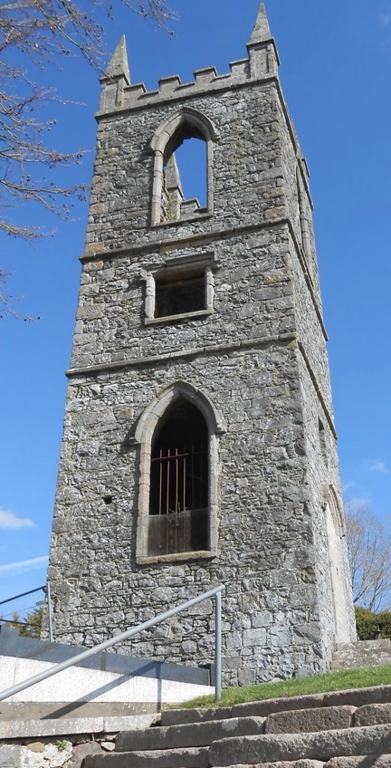 The Newry Canal Trail murder mystery is a self-guided, driving Whodunit Hunt. It starts at Newry and ends near Gilford.
- The route progresses along and across the Newry canal as far as Gilford, with some clues beside its waters. En route visit several villages dating back hundreds of years and find out about characters in their history. In Gilford you’ll see the remains of a magnificent mill and find out about the history of the area’s linen industry.
- The clue route is only 25 miles / 40 km! There is generally moderate walking, about 2 ½ miles / 4 km in total.
- Allow 3 – 4 hours hours to solve this Whodunit Hunt, excluding refreshment stops.
- Accessibility – the walking terrain is generally quite flat, with only occasional moderate slopes and no steps.
- For refreshments, you will pass stores, coffee shops, cafes and restaurants en-route.
- Email clue help facility if you get stuck.
To purchase this Whodunit Hunt with credit / debit / Amex card please click here.
To pay using Paypal click here to order this trail.
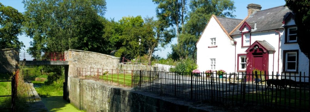
The starting point is the Fiveways roundabout, Newry:
(c) 2023 – the term ‘Whodunit Hunt’, associated logo, website content, and all Hunt routes, ideas, photos, are all protected by copyright. Any copying, impersonation or distribution of anything embraced by our copyright is intellectual theft and therefore unlawful and illegal. Please respect the law as well as all of our hard work.
Who Nailed Natalie In Navan?
Local lady Natalie Murphy has alas been found murdered in the floral town of Navan. The murder trail starts at Athlumney Graveyard where her body, and evidence, was found there. However, detectives think the murder was carried out elsewhere.
 The Navan Whodunit Hunt is a self-guided, walking murder mystery trail.
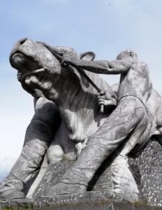
- On the clue route you will discover numerous historic sights, including Athlumney Castle and graveyard, an old fountain, see the canal and read about its construction, learn about the history of this town which spans hundreds of years, see modern giant sculptures… and more!
- The clue route is 4 km / 2 ½ miles.
- The Whodunit Hunt booklet has 29 clues to solve and masses of extra historical information squeezed into it.
- Allow two full hours, excluding any stops for refreshment.
- Accessibility – the route is generally fairly flat, with only moderate inclines.
- Refreshments – there are a number of bars, cafes, coffee shops, restaurants, takeaways, and shops.
- Email clue help facility if you get stuck.
To purchase this Whodunit Hunt with credit / debit / Amex card please click here and type Navan in the ‘Special Requests’ field on the purchase page.
To pay using Paypal click here to order this trail.
The starting point is on Convent Road as it turns into a pedestrian zone just below Athlumney Castle, shown in the map below; you can also park here… for free!
(c) 2023 – the term ‘Whodunit Hunt’, associated logo, website content, and all Hunt routes, ideas, images and photos, are protected by copyright. Any copying/distribution of anything embraced by our copyright is intellectual theft and therefore unlawful and illegal. Please respect the law as well as numerous years of our hard work.
Who Killed Katherine In Kells?
Katherine Lynch has been killed in historic Kells and we need your help to confirm suspicions about the murder. Although her body was found at the round tower, we wonder if the murder was committed elsewhere and so the evidence trail starts at the Market Cross.
 The Kells Whodunit Hunt is a self-guided, walking murder mystery trail.
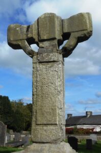
- On the clue route discover numerous historic sites including the round tower and old Irish crosses, learn of the legendary Irish version of the Olympic Games, read about a mischievous pilot and an MP of the previous century with connections here… and more!
- The clue route is about 3 km / 2 miles.
- Whodunit Hunt booklet packed with 30 clues and LOADS of extra historical info and trivia.
- Allow at least two hours to solve this murder mystery, excluding stops for refreshment.
- Accessibility – the route is generally fairly flat, with only moderate inclines.
- Refreshments – there are a number of cafes, coffee shops, bars and convenience stores here.
- Email clue help facility if you get stuck.
To purchase this Whodunit Hunt with credit / debit / Amex card please click here and type Kells in the ‘Special Requests’ field on the purchase page.
To pay using Paypal click here to order.
The starting point is at the Market Cross, shown in the map below.
(c) 2023 – the term ‘Whodunit Hunt’, associated logo, website content, and all Hunt routes, ideas, images and photos, are protected by copyright. Any copying/distribution of anything embraced by our copyright is intellectual theft and therefore unlawful and illegal. Please respect the law as well as numerous years of our hard work.
Who Negated Ned’s Life In Newcastle?
 Local man Ned McKenzie has alas been found murdered in Northern Ireland’s seaside town of Newcastle. Clues start at the Donard Car Park as his body was found dumped at the entrance, though detectives think the murder was carried out elsewhere.
- The Newcastle Whodunit Hunt is a self-guided, walking murder mystery trail.
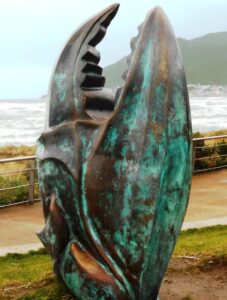
- On our route you’ll discover both historic sites and modern sculptures of this town, dating back 600 years! Find out about past brandy smuggling, the old granite mining industry, an historic flight on the beach, the town’s railway connections, read stories of ghosts, local myths & legends… and more!
- The clue route is about 2 miles / 3 km.
- Whodunit Hunt booklet packed with 28 clues to solve and LOADS of historical and tourist trivia to read.
- Allow two hours to solve this murder mystery, excluding any refreshment stops.
- Accessibility – the route is generally flat.
- Refreshments – you’re spoilt for choice here with many bars, cafes, coffee shops, restaurants, takeaways, and shops.
- Email clue help facility if you get stuck.
To purchase this Whodunit Hunt with credit / debit / Amex card please click here.
To pay using Paypal click here to order this trail.
The starting point is the coast road entrance of the Donard Park car park shown in the map below:
(c) 2023 – the term ‘Whodunit Hunt’, associated logo, website content, and all Hunt routes, ideas, images and photos, are protected by copyright. Any copying/distribution of anything embraced by our copyright is intellectual theft and therefore unlawful and illegal. Please respect the law as well as numerous years of our hard work.
