Who Liquidated Laura In The Lower Lough Erne Area?
Laura Irvine’s body has been found at the shore of Lower Lough Erne but a post mortem confirmed that drowning wasn’t the cause of death. Our investigators have uncovered much evidence but are struggling to tie it all together and thus need your help to solve the murder.
RECENT LAUNCH (23rd September)!
 The Lower Lough Erne Whodunit Hunt starts at Trory Jetty and ends at the outskirts of Enniskillen. It is a self-guided, driving murder mystery trail with a near-circular route.
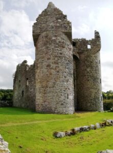
- Enjoy beautiful lakeside scenery while visiting a plethora of historic places! You’ll see neolithic sites including a stone circle and strange carved figures, numerous castles, a famine grave, historic sites related to World War II… and more!
- Almost 30 clues to solve!
- The driving route is 77 miles / 123 km, with clues spread all around the Lough area; 13 miles of this route is along Lough Shore Road between clue stops at Belleek and Tully Castle. There is about 2¼ miles / 3¾ km of walking in total.
- The recommended time for this murder mystery, excluding refreshment stops and return journey, is about 5 hours.
- Accessibility – it is generally flat where the clues are to be found, with no steps that must be navigated.
To pay using Paypal click here (or in the menu) to order this, or any other, Whodunit Hunt.
To purchase this Whodunit Hunt with credit / debit / Amex card please click here.

The starting point is at Trory Jetty on the lower east shore of the Lough, shown in the map below:

(c) 2023 – the term ‘Whodunit Hunt’, associated logo, website content, and all Hunt routes, ideas, photos, are all protected by copyright. Any copying, impersonation or distribution of anything embraced by our copyright is intellectual theft and therefore unlawful and illegal. Please respect the law as well as all of our hard work.
Who Eliminated Neil In The Lough Neagh Area?
Neil Casey from Ardboe has been murdered and our detectives need your help to solve the mystery around his death. Although his body was found floating at the lakeside near Oxford Island the post-mortem confirms he wasn’t drowned and so detectives believe his body was thrown in the lake.
 The Lough Neagh Whodunit Hunt starts at Oxford Island and ends at Cranfield Church east of Toome. It is a self-guided, linear driving murder mystery trail.
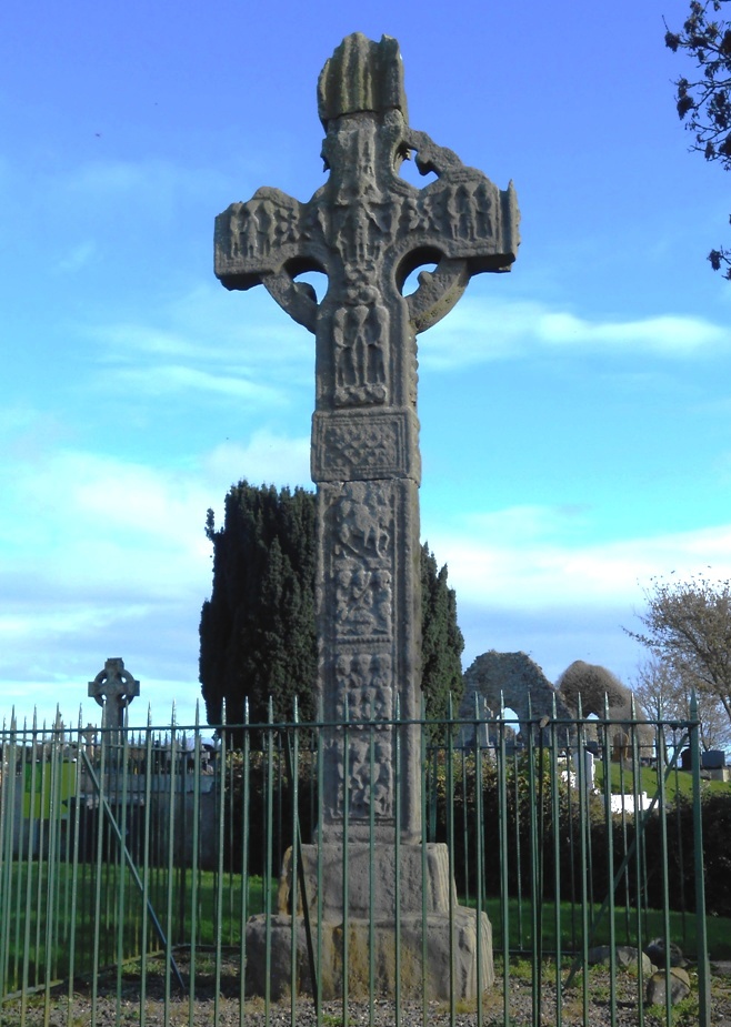
- Visit lovely lakeside villages and see beautiful scenery. You’ll see the finest Irish Cross in Northern Ireland dating back over 1,000 years, a castle, a ruined church and holy well, visit Oxford Island nature reserve… and much more. If you’re a Game Of Thrones fan, there’s a filming location that you’ll stop at along the clue hunt too!
- Over 30 clues to solve!
- The driving route is 52 miles, or 83 km, with clues all around the western side of Lough Neagh. There is about 2 ½ miles / 4 km of walking in total during this Whodunit Hunt, spread across all of the clue stops.
- The recommended time for this murder mystery, excluding refreshment stops and return journey, is about 5 hours – a great day out!
- Accessibility – it is generally flat where the clues are to be found, with no steps that must be navigated.
To pay using Paypal click here (or in the menu) to order this, or any other, Whodunit Hunt.
To purchase this Whodunit Hunt with credit / debit / Amex card please click here.

The starting point is at the Oxford Island nature reserve, off the M1 motorway:

(c) 2023 – the term ‘Whodunit Hunt’, associated logo, website content, and all Hunt routes, ideas, photos, are all protected by copyright. Any copying, impersonation or distribution of anything embraced by our copyright is intellectual theft and therefore unlawful and illegal. Please respect the law as well as all of our hard work.
 The Lower Lough Erne Whodunit Hunt starts at Trory Jetty and ends at the outskirts of Enniskillen. It is a self-guided, driving murder mystery trail with a near-circular route.


 The Lough Neagh Whodunit Hunt starts at Oxford Island and ends at Cranfield Church east of Toome. It is a self-guided, linear driving murder mystery trail.