Who Struck Down Sean From Skerries?
Sean Black has been found murdered at the windmill in Skerries, close to the visitor centre, and our best but overworked investigator needs your help to solve the case. We believe he was killed elsewhere so your search for clues starts at Drogheda, where he worked.
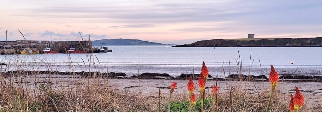
 The Meath-Fingal Coast Trail is a self-guided, driving murder mystery trail. This Whodunit Hunt starts at Drogheda and ends at Rush.
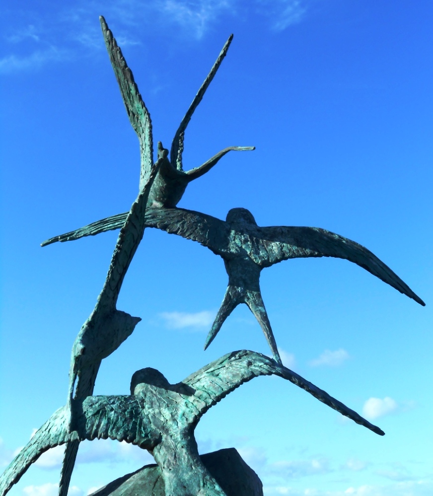
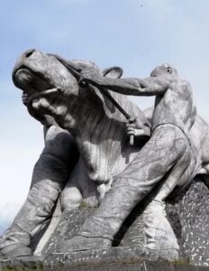
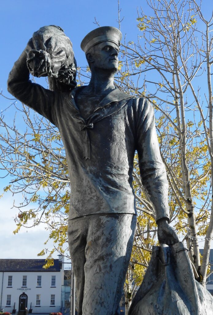
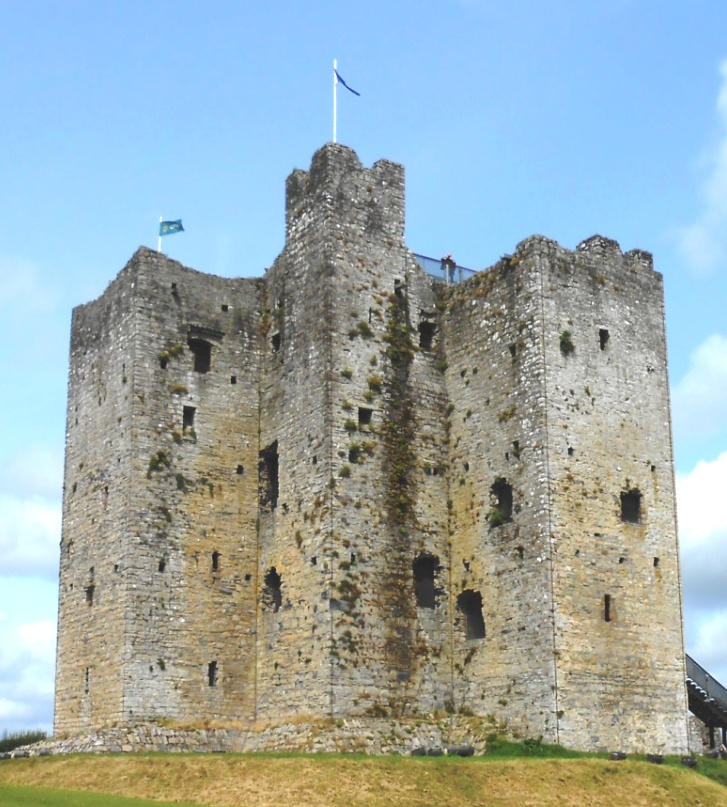
- The clue route includes numerous historic sites and beautiful coastal scenery. You’ll see castles, seaside towns, assorted modern sculptures, windmills, a ruined church, an unusual ‘structure’… and more! Learn about the history and evolution of the area as you go and find out where St Patrick landed here too!
- We’ve squeezed 30 clues into this trail with lots of historical information added to the Whodunit booklet.
- The linear clue route is only 49 km (or about 31 miles). The total walking distance spread across all of the clues is up to 5 ½ km / 3.4 miles but you can reduce this by 1 km / 0.6 miles if you drive your vehicle down Ardgillan Castle’s driveway from its car park to solve one clue.
- We suggest allowing at least four hours to complete this Whodunit Hunt, excluding extended refreshment stops.
- Accessibility – once out of the car the terrain is generally quite flat, with only occasional moderate slopes; there are no steps.
- For refreshments, you will pass coffee shops, a number of bars and restaurants, and stores along the route.
To pay using Paypal click here (or in the menu) to order this, or any other, Whodunit Hunt.
To purchase this Whodunit Hunt with credit / debit / Amex card please click here and type Meath-Fingal Coast in the ‘Special Requests’ field at the start of the purchase page.
The starting point is at the Scotch Hall bus stop at Drogheda, shown below, with the route then heading along the R150 out of the town:

(c) 2023 – the term ‘Whodunit Hunt’, associated logo, website content, and all Hunt routes, ideas, images and photos, are protected by copyright. Any copying/distribution of anything embraced by our copyright is intellectual theft and therefore unlawful and illegal. Please respect the law as well as numerous years of our hard work.
Who Archived Cath From Athboy?
Cath Borgogne from Athboy has been found murdered and our best team of investigators are struggling to conclude the case and thus need your help to solve the murder. Although her body was found in the Fair Green at Athboy it is believed that she was murdered elsewhere – the hunt for clues starts at nearby Rathmore.
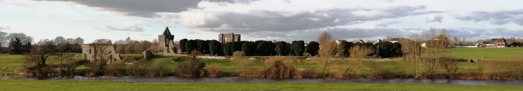
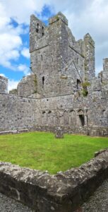 Discover magnificent Fore Abbey (over 1,300 years old), an impressive hilltop neolithic tomb, castles… and more as you try and solve over 30 clues! You will also explore the historical small town of Athboy which has several old sites that form a part of its long history.
- The linear clue route of this murder mystery trail is 42 miles, or about 68 km, from the starting point near Athboy to the end point on the outskirts of Kells.
- We suggest allowing four hours to solve this Whodunit Hunt, excluding any refreshment stops.
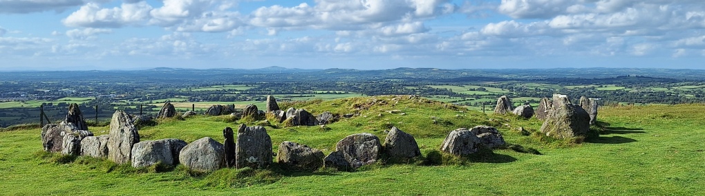
- There is a moderate amount of walking at a small number of locations, totalling 3 km or nearly 2 miles. You can also do a longer walk for pleasure up to the amazing Loughcrew Cairn and nearby stone circle – we highly recommend this for the reward of amazing panaromic views too (such as that shown below) if you have time and energy.
- Accessibility – the walking portions of the Whodunit Hunt are generally fairly flat.
- For refreshments, Athboy is your best bet with quite a number of options, or Kells once you have finished.
To pay using Paypal click here (or in the menu) to order this, or any other, Whodunit Hunt.
To purchase this Whodunit Hunt with credit / debit / Amex card please click here and type Meath in the ‘Special Requests’ field at the start of the purchase page.
The starting point is shown in the map below:
(c) 2023 – the term ‘Whodunit Hunt’, associated logo, website content, and all Hunt routes, ideas, photos, are all protected by copyright. Any copying, impersonation or distribution of anything embraced by our copyright is intellectual theft and therefore unlawful and illegal. Please respect the law as well as all of our hard work.
Who Nailed Natalie In Navan?
Local lady Natalie Murphy has alas been found murdered in the floral town of Navan. The murder trail starts at Athlumney Graveyard where her body, and evidence, was found there. However, detectives think the murder was carried out elsewhere.
 The Navan Whodunit Hunt is a self-guided, walking murder mystery trail.
- On the clue route you will discover numerous historic sights, including Athlumney Castle and graveyard, an old fountain, see the canal and read about its construction, learn about the history of this town which spans hundreds of years, see modern giant sculptures… and more!
- The clue route is 2 ½ miles / 4 km.
- The Whodunit Hunt booklet has 29 clues to solve and masses of extra historical information squeezed into it.
- The recommended time for this murder mystery is between two and three hours, excluding any stops for refreshment.
- Accessibility – the route is generally fairly flat, with only moderate inclines.
- Refreshments – there are a number of bars, cafes, coffee shops, restaurants, takeaways, and shops.
The starting point is at on Convent Road where it turns into a pedestrian zone just below Athlumney Castle, shown in the map below; you can also park here… for free!
To pay using Paypal click here (or in the menu) to order this, or any other, Whodunit Hunt.
To purchase this Whodunit Hunt with credit / debit / Amex card please click here and type Navan in the ‘Special Requests’ field at the start of the purchase page.
(c) 2023 – the term ‘Whodunit Hunt’, associated logo, website content, and all Hunt routes, ideas, images and photos, are protected by copyright. Any copying/distribution of anything embraced by our copyright is intellectual theft and therefore unlawful and illegal. Please respect the law as well as numerous years of our hard work.
Who Killed Katherine In Kells?
Katherine Lynch has been killed in historic Kells and we need your help to confirm suspicions about the murder. Although her body was found at the round tower, we wonder if the murder was committed elsewhere and so the evidence trail starts at the Market Cross.
 The Kells Whodunit Hunt is a self-guided, walking murder mystery trail.
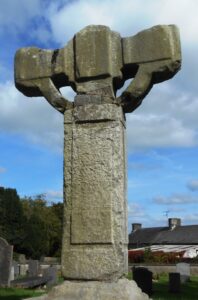
- On the clue route you will discover numerous historic sites, including the round tower and old Irish crosses, discover the legendary Irish version of the Olympic Games, read about a mischievous pilot and an MP of the previous century with connections here… and more!
- The clue route is approximately 2 miles, or about 3 km.
- This Whodunit Hunt is jam packed with 30 clues in a booklet with LOADS of extra historical information and detail.
- The recommended time for this murder mystery is between two and three hours, excluding any stops for refreshment.
- Accessibility – the route is generally fairly flat, with only moderate inclines.
- Refreshments – there are a number of cafes, coffee shops, bars and convenience stores here.
The starting point is at the Market Cross, at the fork junction of the R163 & R147 shown in the map below.
To pay using Paypal click here (or in the menu) to order this, or any other, Whodunit Hunt.
To purchase this Whodunit Hunt with credit / debit / Amex card please click here and type Kells in the ‘Special Requests’ field at the start of the purchase page.
(c) 2023 – the term ‘Whodunit Hunt’, associated logo, website content, and all Hunt routes, ideas, images and photos, are protected by copyright. Any copying/distribution of anything embraced by our copyright is intellectual theft and therefore unlawful and illegal. Please respect the law as well as numerous years of our hard work.
Who Topped Trisha In Trim?
Poor Trisha McDermott has been found murdered in the historic town of Trim and even our best investigators are struggling to tie leads together and thus need your help to solve the murder. Trisha’s body was found on Navan Gate and although detectives suspect she was murdered elsewhere they consider this is a good place to start looking for clues.
 The Trim Whodunit Hunt is a self-guided, walking murder mystery trail.
- Trim is a very historic place, in fact it has more medieval buildings than any other place in Ireland! Along the clue trail you’ll see the impressive Trim Castle, ruins of abbeys and a cathedral, learn about the Tomb Of The Jealous Man & Woman, and find out much more about this fascinating town!
- The route is almost 3.7 miles, or about 6 km, and starts/ends on Navan Gate, as shown in the map below. This is a longer walk than almost all of our Whodunits, as the ruined cathedral is along the pleasant river walk away from the town centre, so we have provided instructions in the murder mystery booklet to reduce the walking distance if required.
- The Whodunit Hunt booklet is packed with 30 clues to solve and nine pieces of extra historical information about the town and the sights you come across!
- The recommended time for this murder mystery is at least three hours, excluding refreshment stops.
- Accessibility – this is a generally quite flat route, but there are a small number of steps to navigate at/near the old cathedral site.
- Refreshments – there are assorted places available, including coffee shops and bars.
To pay using Paypal click here (or in the menu) to order this, or any other, Whodunit Hunt.
To purchase this Whodunit Hunt with credit / debit / Amex card please click here and type Trim in the ‘Special Requests’ field at the start of the purchase page.
The starting point is shown in the map below, with free parking nearby on this street.
(c) 2023 – the term ‘Whodunit Hunt’, associated logo, website content, and all Hunt routes, ideas, images and photos, are protected by copyright. Any copying/distribution of anything embraced by our copyright is intellectual theft and therefore unlawful and illegal. Please respect the law as well as numerous years of our hard work.
 Walking Whodunit Hunts are single-location murder mystery trails where you explore a village or an area of a town or city in search of clues to solve a crime. All have much history to uncover, show you some grand and impressive architecture, and many reveal surprising facts linked to both places and the people that shaped them!
The places listed below (by county) all have single-location walking murder mystery trails for you to solve. Click any location link for more detail. Map available at the bottom of the page to locate trails in a particular area too.
 In County Antrim are Ballymena, Ballymoney, Carrickfergus, Lisburn, Randalstown and Whitehead Whodunits… and we now have a brand new one in Glenarm!
- On the North Antrim coast our Ballycastle walking Whodunit has just been launched and one in Portrush is coming soon.
- In Belfast itself are Belfast City Centre and Titanic Quarter trails as well as our new Europa taster trail if you’re short on time. Recently launched, our new, unique concept… an indoor murder mystery at Ulster Museum!
- Armagh City, Loughgall, and Lurgan trails in County Armagh.
- Belturbet and Cavan Town in County Cavan.
- In County Derry are trails at Derry and former market town Moneymore.
- In County Down you’re spoilt for choice! There are walking Whodunits in Banbridge, Castlewellan, Dromore, Moira, Newcastle, Newry as well as nearby Derrymore Estate, Rathfriland and Saintfield … and if you’re short on free time try our new Newry Taster Trail!
- In North Down are trails at Bangor and Holywood.
- In County Fermanagh is the Enniskillen Whodunit Hunt.
- Ardee, Drogheda, Dromiskin and Dundalk trails available in County Louth.
- Kells, Navan and Trim in County Meath.
- Castleblaney, Clones, Glaslough and Monaghan trails in County Monaghan.
- In County Sligo is our new Sligo Town walking trail.
- In County Tyrone you can find walking Whodunits for Caledon and our recent launch at Omagh.
There are more walking Whodunit Hunts in the pipeline too, including Galway City, Kilkenny, and a very unique trail in Dublin!
 The vast majority of Whodunit Hunt clues are accessible by those with prams and wheelchair users, as we’ve determined routes for evidence investigation with as few steps as possible. Check the applicable Whodunit Hunt description page(s) for full details, which give an indication of any access issues.
The map below shows all of our murder mystery trails. Walking Whodunits available are indicated by a black walker/runner symbol and our intriguing indoor one with a green building. Pipeline walking Whodunits are blue – if you’re interested in one of these then please contact us and we’ll tell you when they’re available.
Use the card or Paypal link in the page of whichever Whodunit Hunt you are interested in to purchase it.
(c) 2023 – the term ‘Whodunit Hunt’, associated logo, website content, and all Whodunit Hunt routes, ideas, photos, are all protected by copyright. Any copying, impersonation or distribution of anything embraced by our copyright is intellectual theft and therefore unlawful and illegal. Please respect the law as well as all of our hard work.
