Who Archived Andy At The Ards Peninsula?
Andy Pennant’s body was dumped outside the gates of Mount Stewart, where he worked in the gardens, but we’re sure he was murdered elsewhere. Our best investigator is struggling to process the mountain of evidence and needs your help to solve this murder case.
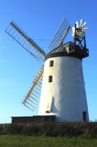 The Ards Peninsula Whodunit Hunt is a self-guided, deluxe driving murder mystery trail… our most popular driving trail!
- The route includes sights as old as 1,300 years! You’ll see the only working windmill and first port in Northern Ireland, old castles, impressive Grey Abbey and a much older well. Also stop at Ireland’s most easterly point, and learn about the evolution of this beautiful area and some of the key figures that shaped it!
- The clue route is 50 miles / 80 km. There is generally moderate walking, just over 3 miles / 5 km in total across all clues.
- This deluxe Whodunit Hunt is jam packed with 42 clues to solve in a booklet containing a dozen extra pieces of historical and/or tourist info! Set aside most of a day (allow six hours) to complete this Whodunit, excluding refreshment stops. What a great value day out for a whole family or group!
- Accessibility – the walking terrain is generally quite flat, with only occasional moderate slopes. Any steps can be avoided using ramps / alternative routes.
- For refreshments, you will pass coffee shops, cafes, bars, restaurants and stores along the route.
- Email clue help facility if you get stuck.
To purchase this Whodunit Hunt with credit / debit / Amex card please click here.
To pay using Paypal click here to order this trail.

The starting point is in the Ballyholme area of East Bangor, shown below; it ends at Greyabbey.

(c) 2023 – the term ‘Whodunit Hunt’, associated logo, website content, and all Hunt routes, ideas, images and photos, are protected by copyright. Any copying/distribution of anything embraced by our copyright is intellectual theft and therefore unlawful and illegal. Please respect the law as well as numerous years of our hard work.
Who Critically Injured Ian From Inniskeen?
Ian O’Mally from Inniskeen was found dumped beside the road outside Carrickmacross and died from his injuries. Our best investigation team are struggling to connect their leads and need your help to solve the murder.
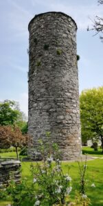 The Patrick Kavanagh Trail is a self-guided, driving murder mystery trail.
- See historic sights over 800 years old, including a round tower, several castles, and an impressive ancient abbey. There are several stops associated with Irish poet Patrick Kavanagh too, both in Inniskeen where you can see his grave and beyond. Also learn about the evolution of the area and some of the historic figures that shaped it.
- The clue route is about 56 km / 35 miles. There is generally moderate walking for most clues, with about 4.5 km / 3 miles in total across all of the clues.
- 30 clues to solve plus extra historical info in our booklet!
- Allow at least four hours to complete this Whodunit Hunt, excluding refreshment stops.
- Accessibility – the walking terrain is generally quite flat, with only occasional moderate slopes and no steps.
- For refreshments, you’ll find bars, coffee shops, restaurants. There is a lovely tearoom at Inniskeen too which we’ve been to!
- Email clue help facility if you get stuck.
To purchase this Whodunit Hunt with credit / debit / Amex card please click here and type Kavanagh in the ‘Special Requests’ field on the purchase page.
To pay using Paypal click here to order this trail.

The starting point is at the Castletown Cemetery in Dundalk, shown below. The clue trail ends nearby.
(c) 2023 – the term ‘Whodunit Hunt’, associated logo, website content, and all Whodunit Hunt routes, ideas, photos, are all protected by copyright. Any copying, impersonation or distribution of anything embraced by our copyright is intellectual theft and therefore unlawful and illegal. Please respect the law as well as all of our hard work.
Who Did Away With Danny Diamond?
Danny Diamond’s body has been ironically found at the Battle Of The Diamond memorial. Our best investigator is struggling to get to the bottom of the mountain of evidence that was collected and thus needs your help to solve the murder.
 The Diamond Trail Whodunit Hunt starts at the Battle Of The Diamond memorial near Loughgall and ends at historic Tynan village.
- This is a self-guided, driving murder mystery trail.
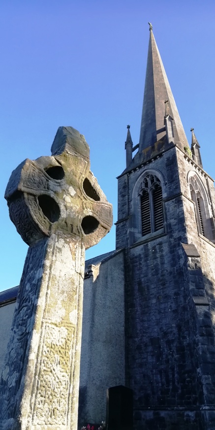
- Visit an old mansion house and gardens, ancient Irish crosses, pretty villages, and learn about key figures in their history. You’ll see a castle, a tiny graveyard, enjoy a pleasant river walk… and more!!
- 27 clues to solve with stacks of extra historical info about various sites squeezed into this Whodunit booklet!
- The driving route is only 26 miles, or 42km, from the start to the end point!!
- There is almost 3 miles / 5 km of walking in total during this Hunt, spread across all of the clues.
- Allow at least four hours to solve this murder mystery, excluding refreshment stops.
- Accessibility – it is generally flat where clues are found.
- Main refreshment options are in Caledon, Moy, and the cafe at Benburb priory.
- Email clue help facility if you get stuck.
To purchase this Whodunit Hunt with credit / debit / Amex card please click here.
To pay using Paypal click here to order this trail.

The starting point is near Dan Winter’s Cottage, shown in the map below:
(c) 2023 – the term ‘Whodunit Hunt’, associated logo, website content, and all Whodunit Hunt routes, ideas, photos, are all protected by copyright. Any copying, impersonation or distribution of anything embraced by our copyright is intellectual theft and therefore unlawful and illegal. Please respect the law as well as all of our hard work.
Who Topped Trisha In Trim?
Poor Trisha McDermott has been found murdered in the historic town of Trim and even our best investigators are struggling to tie leads together and thus need your help to solve the murder. Trisha’s body was found on Navan Gate and although detectives suspect she was murdered elsewhere they consider this is a good place to start looking for clues.
 The Trim Whodunit Hunt is a self-guided, walking murder mystery trail.
- Trim is a very historic place, in fact it has more medieval buildings than any other place in Ireland! Along the clue trail you’ll see the impressive Trim Castle, ruins of abbeys and a cathedral, learn about the Tomb Of The Jealous Man & Woman, and find out much more about this fascinating town!
- The route is almost 6 km / 3.7 miles. This is a longer walk than almost all of our murder mystery trails, as the ruined cathedral is along the pleasant river walk away from the town centre, so we have provided instructions in the Whodunit Hunt booklet to reduce the walking distance if required.
- The Whodunit Hunt booklet is packed with 30 clues to solve and nine pieces of extra historical information about the town and the sights you come across!
- The recommended time for this murder mystery is at least three hours, excluding refreshment stops.
- Accessibility – this is a generally quite flat route, but there are a small number of steps to navigate at/near the old cathedral site.
- Email clue help facility if you get stuck.
To purchase this Whodunit Hunt with credit / debit / Amex card please click here and type Trim in the ‘Special Requests’ field on the purchase page.
To pay using Paypal click here to order this trail.

The starting point is shown in the map below, with free parking nearby on this street.
(c) 2023 – the term ‘Whodunit Hunt’, associated logo, website content, and all Hunt routes, ideas, images and photos, are protected by copyright. Any copying/distribution of anything embraced by our copyright is intellectual theft and therefore unlawful and illegal. Please respect the law as well as numerous years of our hard work.
Who Dispatched Donal In Dromiskin?
Donal Rafferty has been found murdered in the lovely village of Dromiskin. We need your help to solve the murder as detectives are struggling to tie up the loose ends of the case. Although Donal’s body was found at the petrol station, this is not where the murder was committed and so the murder trail starts at the old monastic and round tower site.
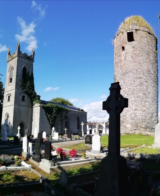 The Dromiskin Whodunit Hunt is a self-guided, walking murder mystery trail.
- Dromiskin is a pretty little village with much history to discover! The historic focal point is the monastic site, over 1,200 years old, with its tall round tower, ruined church, and old Irish Cross. Along the clue trail you’ll see numerous historical references, learn about the village’s railway heritage and the famous people who have come from here, and much more!
- The route is about 3 km / 1.9 miles.
- This Whodunit trail is packed with over 30 clues as well as several pieces of historical trivia.
- Allow 1 ½ – 2 hours to solve this murder mystery, excluding refreshment stops.
- Accessibility – this is a generally quite flat route, with no steps.
- Email clue help facility if you get stuck.
To purchase this Whodunit Hunt with credit / debit / Amex card please click here and type Dromiskin in the ‘Special Requests’ field on the purchase page.
To pay using Paypal click here to order this trail.
The starting point is beside the monastic site shown in the map below, with free car parking there.
(c) 2023 – the term ‘Whodunit Hunt’, associated logo, website content, and all Hunt routes, ideas, images and photos, are protected by copyright. Any copying/distribution of anything embraced by our copyright is intellectual theft and therefore unlawful and illegal. Please respect the law as well as numerous years of our hard work.
Who Got Lochlan In Glaslough?
Local lad Loughlan has alas been murdered in the lovely little historic village of Glaslough. We recommend you start your murder trail at the Castle Leslie exit as his body was found there, however detectives think the murder may have been carried out elsewhere.
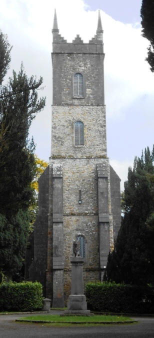 The Glaslough Whodunit Hunt is a self-guided, walking murder mystery trail.
- Glaslough is a pretty little village with a LOT of history, dominated by that of the Castle Leslie estate! Along the clue trail you’ll see a number of historical sites, learn about the village’s railway history, find out about the many famous people who have visited the castle, and much more!
- The route is almost 2 ¼ km / 1½ miles, and starts/ends at the exit to the Castle Leslie estate.
- Whodunit Hunt booklet packed with 27 clues as well as several pieces of historical trivia… and ghost stories too!
- Allow about two hours to solve this murder mystery, excluding refreshment stops.
- Accessibility – this is a generally fairly flat route, with no steps and only moderate inclines.
- Refreshments – there is a good coffee shop on the main street, while more upmarket fare (including delicious afternoon tea, which should be booked the day before) can be found at Castle Leslie.
To purchase this Whodunit Hunt with credit / debit / Amex card please click here and type Glaslough in the ‘Special Requests’ field on the purchase page.
To pay using Paypal click here to order this trail.
The starting point is on the main street beside the marker shown below:
(c) 2023 – the term ‘Whodunit Hunt’, associated logo, website content, and all Hunt routes, ideas, images and photos, are protected by copyright. Any copying/distribution of anything embraced by our copyright is intellectual theft and therefore unlawful and illegal. Please respect the law as well as numerous years of our hard work.
Who Bumped Off Barry In Bangor?
Poor Barry Mulholland has been found murdered in Bangor! Our detective is struggling to tie up the loose ends of the case and needs your help to solve the murder. Barry’s body was found outside the castle, where he often walked his dog, but we’re undecided as to whether the murder was committed there; we’ve ruled out the dog as a suspect though!
30/06/26: new version available!
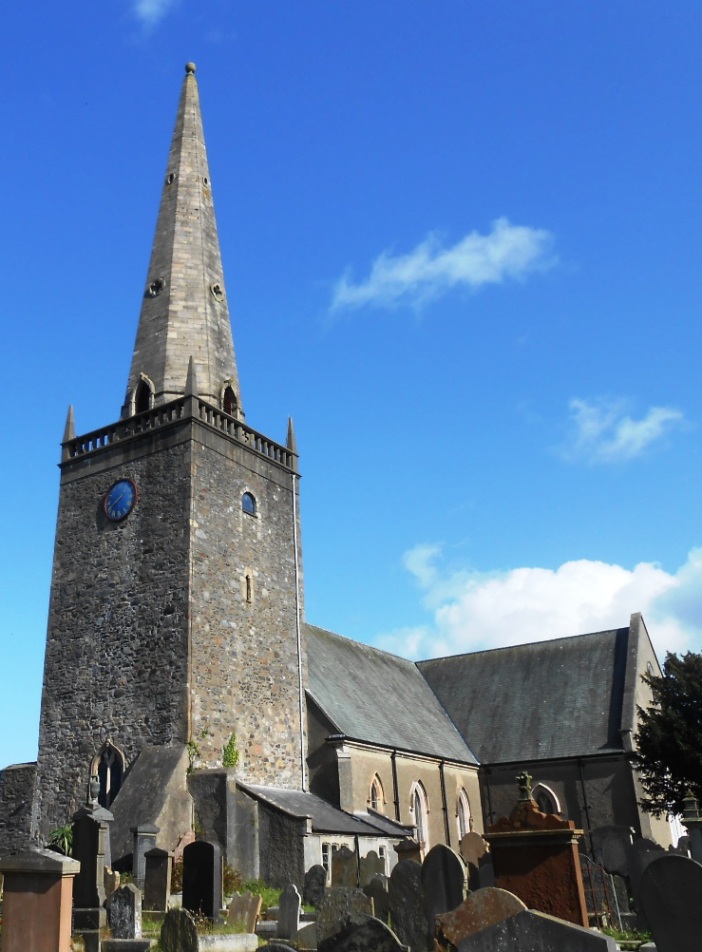 The Bangor Whodunit Hunt is our most popular self-guided, walking murder mystery trail.
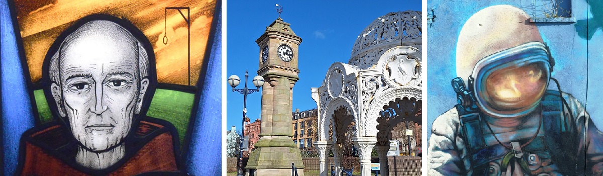
- Bangor may be known as a touristy seaside town, but it has a lot of historical sites with the town’s origins dating back over 1400 years! Along the clue trail you’ll see Bangor Castle, learn of the saints responsible for the early settlement of Bangor, see vibrant street murals and a gun from a World War II U-boat… and much more!
- The route is about 2 ½ miles / 4 km, and starts/ends at the railway station’s park & ride car park (see map below).
- Whodunit Hunt booklet packed with over 30 clues to solve and lots of extra historical trivia not found en-route.
- Allow 2 ½ hours to solve this murder mystery, excluding refreshment stops.
- Accessibility – the route is generally quite flat, although some streets have moderate inclines. There are no steps that must be navigated.
- Refreshments – there are coffee shops, cafes, restaurants, and stores along the route.
- Email clue help facility if you get stuck.
To purchase this Whodunit Hunt with credit / debit / Amex card please click here.
To pay using Paypal click here to order this trail.
(c) 2023 – the term ‘Whodunit Hunt’, associated logo, website content, and all Hunt routes, ideas, images and photos, are protected by copyright. Any copying/distribution of anything embraced by our copyright is intellectual theft and therefore unlawful and illegal. Please respect the law as well as numerous years of our hard work.
Who Destroyed Darian In Drogheda?
Darian Darcey has been found murdered in Drogheda! Although his body was found at the railway station we believe this was not where the murder was committed. Our best investigators have uncovered few leads and need your help to solve the murder – follow the clue trail to determine the circumstances behind the crime!
 This Whodunit Hunt is a self-guided, walking murder mystery trail.
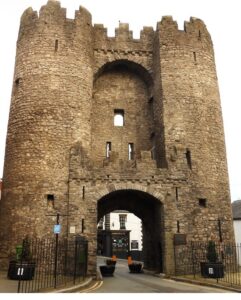
- Drogheda has been a busy town for hundreds of years as a port. But take a closer look and discover a significant amount of history, some dating back over 800 years! On your clue hunt see many historic buildings and ruins including a tower on the site of a 13th Century priory, the old Corn Exchange, Laurence Gate (see photo) and impressive churches including one housing the head of Oliver Plunkett! Much more to discover on the trail route which has 30 clues in a booklet packed with additional historical facts!
- Accessibility: the clue route is a mixture of flat parts with a few moderate inclines but no steps. However, there is quite a steep hill (Barrack Street) near the start / end – this would not be suitable for wheelchair users, but okay for prams.
 The clue route is 2 miles, or about 3km.
- For refreshments, you will pass cafes, coffee shops, a supermarket, bars and restaurants.
- Email clue help facility if you get stuck.
To purchase this Whodunit Hunt with credit / debit / Amex card please click here and type Drogheda in the ‘Special Requests’ field on the purchase page.
To pay using Paypal click here to order this trail.
The starting point is at Millmount Cultural Quarter, where Darian worked, near the museum shown in the map below.
(c) 2023 – the term ‘Whodunit Hunt’, associated logo, website content, and all Hunt routes, ideas, images and photos, are protected by copyright. Any copying/distribution of anything embraced by our copyright is intellectual theft and therefore unlawful and illegal. Please respect the law as well as numerous years of our hard work.
Who Bludgeoned Ben From Blackrock?
Poor Ben O’Sullivan from Blackrock has been sadly found murdered and our stretched investigative team are struggling to close the case. His body was found dumped on the street below the ruined windmill, and the clue hunt starts here although it is considered he was murdered elsewhere.
 The Blackrock Coastal Trail Whodunit Hunt is a self-guided, driving murder mystery trail. It starts beside the ruined windmill at Dundalk and ends at the village of Baltry, near Drogheda.
- The route includes sites spanning a broad period of history, from the invasion of the Vikings over 1100 years ago to tales from the second world war. You’ll see an old castle and ruined churches, an ancient Irish Cross on the site of a 7th Century monastery, learn about the development of tourism in Blackrock and a shipwreck further south, see some very large eggs… and more! En route is lovely coastal scenery.
- The clue route is about 46km / 26 miles, before your return to the starting point (or home). There is generally moderate walking, about 2 miles / 3 km in total (not including an optional walk at the end to the shipwreck if you wish to do this).
- Allow at least four hours to solve the case, excluding refreshment stops.
- Accessibility – walking terrain is generally quite flat, with only occasional moderate slopes and no steps.
- For refreshments, you will pass coffee shops, bars, restaurants and stores.
- Email clue help facility if you get stuck.
To purchase this Whodunit Hunt with credit / debit / Amex card please click here and type Blackrock Coast in the ‘Special Requests’ field on the purchase page.
To pay using Paypal click here to order this trail.

The starting point is on Quay Street beside the old windmill at Dundalk, shown below:
(c) 2023 – the term ‘Whodunit Hunt’, associated logo, website content, and all Hunt routes, ideas, images and photos, are protected by copyright. Any copying/distribution of anything embraced by our copyright is intellectual theft and therefore unlawful and illegal. Please respect the law as well as numerous years of our hard work.
Who Culled Catherine In Cavan?
Catherine O’Mahony has been found murdered in Cavan and our overworked detective needs your help to confirm suspicions about the case. Catherine’s body was found at the bus depot although we’re sure this was not where the murder was committed. But we suggest you start your clue hunt at the nearby roundabout and see where the evidence leads you.
 The Cavan Town Whodunit Hunt is a self-guided, walking murder mystery trail. It starts at the roundabout next to the bus station and ends nearby.
- Cavan has a medieval history dating back well over 800 years! There is much to discover on the clue trail including the remains of an old abbey, an impressive cathedral and church, the house where a famous entertainer lived, and more! Along the way the trail booklet tells you about the town’s history with some amusing tales too.
- The route is about 2 miles, or just over 3km.
- Allow two hours to solve this murder mystery hunt, excluding refreshment stops.
- Accessibility: this is generally a flat route, with no steps, thus suitable for nearly all.
- Email clue help facility if you get stuck.
To purchase this Whodunit Hunt with credit / debit / Amex card please click here and type Cavan in the ‘Special Requests’ field on the purchase page.
To pay using Paypal click here to order this trail.
The starting point of this Whodunit Hunt is at the roundabout beside the Bus Eireann depot, shown in the map below.
(c) 2023 – the term ‘Whodunit Hunt’, associated logo, website content, and all Hunt routes, ideas, images and photos, are protected by copyright. Any copying/distribution of anything embraced by our copyright is intellectual theft and therefore unlawful and illegal. Please respect the law as well as numerous years of our hard work.
