Who Killed Clara From Cushendun?
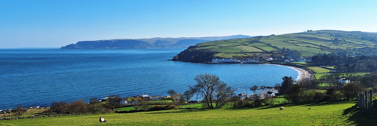
Clara Baxter has alas been found murdered – her body was found dumped at Murlough Bay but evidence suggests the murder was committed elsewhere. Start your hunt for clues at Cushendun and see where they take you…
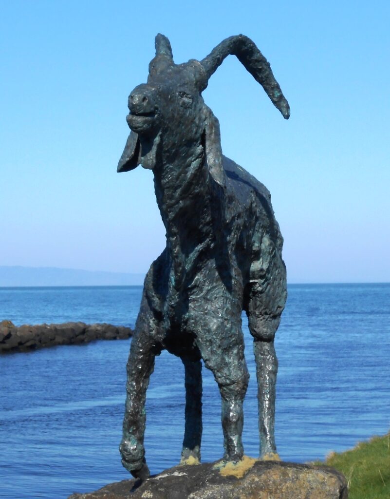 This is a self-guided, driving murder mystery ‘taster trail’, for if you’re short on time or want to try a mini driving Whodunit Hunt to see if you’ll like them. We hope you do!
- Explore the stunning coastline between the quaint village of Cushendun and Ballycastle. You’ll discover a number of historic spots as you go including Ballycastle Friary, standing stones, Carra Castle, and also learn about the history of Cushendun! There’s also a Game Of Thrones location near the starting point!
- The little Whodunit Hunt booklet for this murder mystery is still packed with 14 clues, full directions, and a couple of snippets of history and trivia. It costs only £3.99!
- The recommended time for this murder mystery is 1 ½ – 2 hours; any walking to be done is completely flat, unless you wish to do the short climb up Torr Head for beautiful views.
- The driving route is 16 miles / 26 km and there is a total of one mile (1 ½ km) of walking across all of the clues.
To purchase this Whodunit Hunt with credit / debit / Amex card please click here.
To pay using Paypal click here (or in the menu) to order this, or any other, Whodunit Hunt.
The starting point is at Cushendun, shown in the map below:

(c) 2023 – the term ‘Whodunit Hunt’, associated logo, website content, and all Hunt routes, ideas, images and photos, are protected by copyright. Any copying/distribution of anything embraced by our copyright is intellectual theft and therefore unlawful and illegal. Please respect the law as well as numerous years of our hard work.
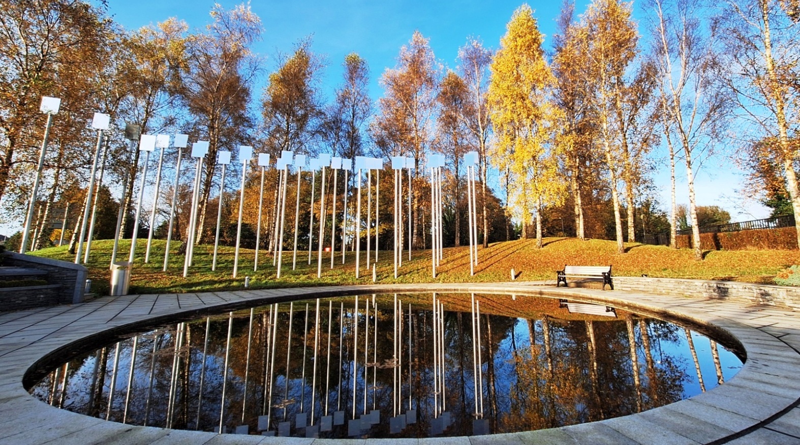
Who Obliterated Oliver In Omagh?
Oliver O’Neill has been found murdered in the historic city of Omagh and we desperately need your help to solve the murder. Although the bloody remains of Oliver’s body were found outside the old Wesleyan Chapel on James Street, we believe this was not where the murder was committed; however, clues to this murder mystery start here.
 The Omagh Whodunit Hunt is a self-guided, walking murder mystery trail.
- Omagh is alas remembered for the 1998 bombing that has resulted in a beautiful memorial garden being created to remember the victims. As well as visiting this garden, you’ll see quite a number of historic buildings on the clue route including beautiful churches, an old stone bridge, and the impressive courthouse. There is a musical interest too at more than one stop!
- There are 26 clues to solve, including quite a few picture clues to spot in order to narrow down the case evidence.
- The route is only 1 ½ miles / 2 ½ km.
- The recommended time for this murder mystery, excluding refreshment stops, is two hours.
- Accessibility – this is a mostly fairly flat route, with no steps, but there are some inclines near the start and end points.
To purchase this Whodunit Hunt with credit / debit / Amex card, please click here.
To pay using Paypal instead, click here.
The start / end point is shown below:
(c) 2023 – the term ‘Whodunit Hunt’, associated logo, website content, and all Hunt routes, ideas, images and photos, are protected by copyright. Any copying/distribution of anything embraced by our copyright is intellectual theft and therefore unlawful and illegal. Please respect the law as well as numerous years of our hard work.
Short On Time? Try A Taster Trail!
 Ever thought of trying a Whodunit Hunt but always short on time or weren’t sure how much you’d enjoy it? Or wondered if you’d be ‘good enough’ to solve a case (which really doesn’t matter)? Then try one of our new taster trails! We’ve specifically designed them to take around 90 minutes to complete with walking routes of less than a mile. We’ll give you help with two clues if you get stuck.
We’ve recently launched two walking taster trails, our Europa Trail in Belfast and the Newry Taster Trail. There’s still 17-18 clues to solve (rather less than the 30+ clues in our standard length trails in these cities) and you’ll get to see interesting places, learn about historic sites and people encountered along the routes, and discover something new!
We’ve just launched our first driving taster trail too, the Torr Road Taster Trail which starts at the quaint village of Cushendun.
So try one of these taster trails and see if you’d like more of our kind of fun… definitely something different to do, for sure! They are at a bargain price of only £3.99!!
(c) 2023 – the term ‘Whodunit Hunt’, associated logo, website content, and all Whodunit Hunt routes, ideas, photos, are all protected by copyright. Any copying, impersonation or distribution of anything embraced by our copyright is intellectual theft and therefore unlawful and illegal. Please respect the law as well as all of our hard work.
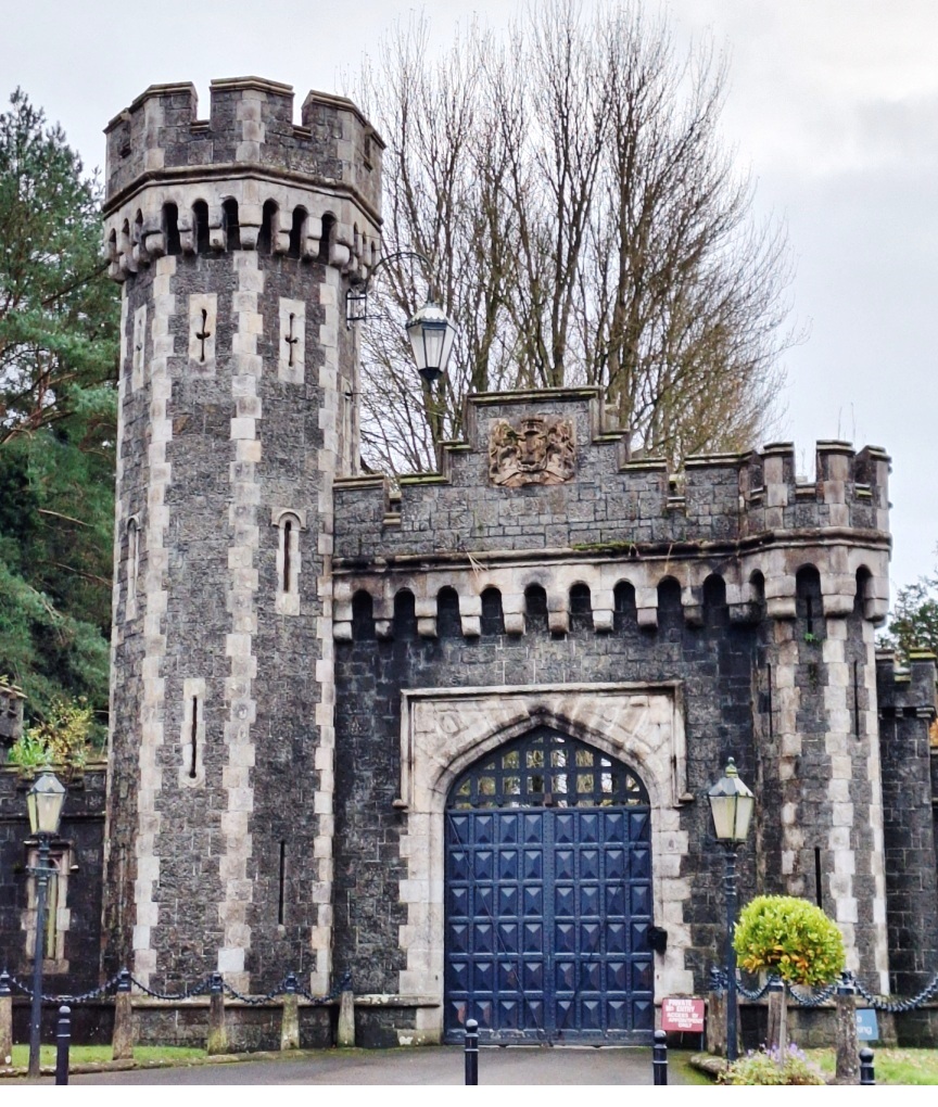
Who Wrecked Randalstown Ray’s Life?
Ray Campbell has been found dead at the base of the old railway viaduct, but the autopsy suggests that he was killed before being thrown off the bridge. However, with a large number of cases to solve, detectives need your help to conclude this case.
New launch for March 2025!
 This Whodunit Hunt is a self-guided murder mystery trail on foot.
- Randalstown is a small town with a huge amount of heritage so you’ll see loads of historic sites on our figure-of-eight walk here that takes you over the railway viaduct! See an unusually shaped church, the viaduct of course and the ancient road bridge, the gate lodge to Shane’s Castle, learn about the history of its buildings and the mill here, nearby Game Of Thrones filming locations… and more!
- The clue route is almost 1 ½ miles, or about 2 ½ km.
- This Whodunit booklet is packed with 33 clues to solve (the most we’ve ever squeezed into a walking Whodunit) and several pieces of extra historical information and trivia not seen en route.
- Allow a full two hours to solve this murder mystery, excluding refreshment stops.
- Accessibility – the route is generally fairly flat, with only moderate inclines and no steps.

To pay using Paypal click here (or in the menu) to order this, or any other, Whodunit Hunt.
To purchase this Whodunit Hunt with credit / debit / Amex card please click here.
The starting point and car park is shown in the map below:
(c) 2023 – the term ‘Whodunit Hunt’, associated logo, website content, and all Hunt routes, ideas, photos, are all protected by copyright. Any copying, impersonation or distribution of anything embraced by our copyright is intellectual theft and therefore unlawful and illegal. Please respect the law as well as all of our hard work.
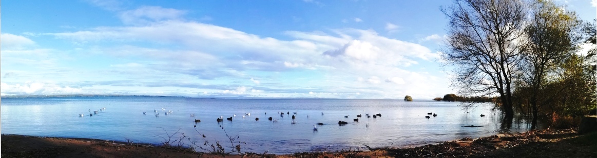
Who Eliminated Neil In The Lough Neagh Area?
Neil Casey from Ardboe has been murdered and our detectives need your help to solve the mystery around his death. Although his body was found floating at the lakeside near Oxford Island the post-mortem confirms he wasn’t drowned and so detectives believe his body was thrown in the lake.
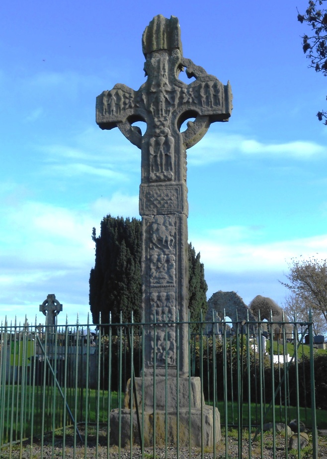 The Lough Neagh Whodunit Hunt starts at Oxford Island and ends at Cranfield Church east of Toome. It is a self-guided, linear driving murder mystery trail.
- Visit lovely lakeside villages and see beautiful scenery. You’ll see the finest Irish Cross in Northern Ireland dating back over 1,000 years, a castle, a ruined church and holy well, visit Oxford Island nature reserve… and much more. If you’re a Game Of Thrones fan, there’s a filming location that you’ll stop at along the clue hunt too!
- Over 30 clues to solve!
- The driving route is 52 miles, or 83 km, with clues all around the western side of Lough Neagh. There is about 2 ½ miles / 4 km of walking in total during this Whodunit Hunt, spread across all of the clue stops.
- The recommended time for this murder mystery, excluding refreshment stops and return journey, is about 5 hours – a great day out!
- Accessibility – it is generally flat where the clues are to be found, with no steps that must be navigated.
To pay using Paypal click here (or in the menu) to order this, or any other, Whodunit Hunt.
To purchase this Whodunit Hunt with credit / debit / Amex card please click here.
The starting point is at the Oxford Island nature reserve, off the M1 motorway:
(c) 2023 – the term ‘Whodunit Hunt’, associated logo, website content, and all Hunt routes, ideas, photos, are all protected by copyright. Any copying, impersonation or distribution of anything embraced by our copyright is intellectual theft and therefore unlawful and illegal. Please respect the law as well as all of our hard work.
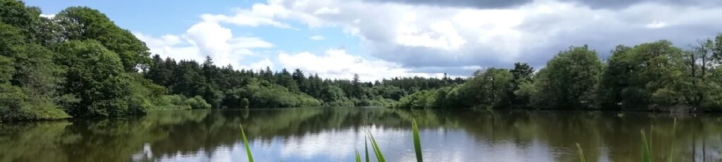
Who Buried Henrietta In Hillsborough?
The body of poor Henrietta Holmes was unearthed by a curious dog beside Hillsborough Lake, but detectives believe she was murdered elsewhere and possibly outside the village of Royal Hillsborough. With a big case load, our chief detective is stressed and desperately needs your help to conclude the case.
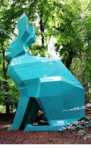 This is a self-guided driving Whodunit Hunt, starting in Royal Hillsborough and ending a few miles away.
- On your clue hunt you’ll see historic buildings, strange creatures in the forest, and select sites associated with famous inventor and pioneer Harry Ferguson who was born in the area. You’ll learn about the history of Hillsborough too, spanning hundreds of years, see an ancient fort site dating back over 1000 years… and more! All this packed into a driving route of only 23 miles / 37 km long!!
- There is nearly 2 ¾ / 4 ¼ km of walking in total, 2/3 of this in Royal Hillsborough and its forest with the rest spread across the remaining clues. Sensible shoes are suggested.
- It is recommended to allow 3-4 hours to solve this murder mystery, excluding refreshment stops.
- Accessibility – there are no steps to navigate, but some slopes, especially a steepish hill in Royal Hillsborough.
- There are assorted places for refreshment; our recommendations would be in the many delicious offerings at Royal Hillsborough.
To pay using Paypal click here (or in the menu) to order this, or any other, Whodunit Hunt.
To purchase this Whodunit Hunt with credit / debit / Amex card please click here.
The starting point is shown in the map below.
(c) 2023 – the term ‘Whodunit Hunt’, associated logo, website content, and all Hunt routes, ideas, images and photos, are protected by copyright. Any copying/distribution of anything embraced by our copyright is intellectual theft and therefore unlawful and illegal. Please respect the law as well as numerous years of our hard work.
Who Bumped Off Brigid in the Boyne Valley?
Brigid O’Hare has been found murdered in the village of Slane in the Boyne Valley. Few leads have been uncovered and detectives need your help to solve the murder. Although her body was found in the Square of Slane, it is believed this was not where she was killed and thus suggest the clue trail starts at the Monasterboice Crosses car park.
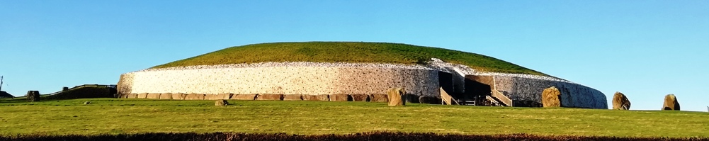
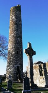 Discover huge ancient monuments, a historic battle site, an old abbey, round towers dating back over 1000 years, ancient burial sites over 5000 years old… and more! You will also explore the historical small town of Slane which has many old buildings as well as a connection to a famous poet.
- The clue route is only 25 miles, or about 40km, to the end point at Donaghmore Tower near Navan.
- We suggest allowing four hours to solve this Whodunit Hunt, excluding any refreshment stops.
- There is a moderate amount of walking at quite a number of locations.
- Accessibility – most clues are generally flat apart from some clues in Slane on inclined roads.
- For refreshments, Slane is your best bet with quite a number of options.
To pay using Paypal click here (or in the menu) to order this, or any other, Whodunit Hunt.
To purchase this Whodunit Hunt with credit / debit / Amex card please click here and type Boyne Valley in the ‘Special Requests’ field at the start of the purchase page.
The start of the Whodunit Hunt is shown in the map below:
(c) 2023 – the term ‘Whodunit Hunt’, associated logo, website content, and all Hunt routes, ideas, photos, are all protected by copyright. Any copying, impersonation or distribution of anything embraced by our copyright is intellectual theft and therefore unlawful and illegal. Please respect the law as well as all of our hard work.
