Short On Time? Try A Taster Trail!
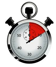 Ever thought of trying a Whodunit Hunt but always short on time or weren’t sure how much you’d enjoy it? Or wondered if you’d be ‘good enough’ to solve a case (which really doesn’t matter)? Then try one of our new taster trails! We’ve specifically designed them to take around 90 minutes to complete with walking routes of less than a mile. We’ll give you help with two clues if you get stuck.
There are now four walking taster trails available: our Belfast Europa Trail, a Newry Taster Trail, recently launched Newtownards taster trail, and now an indoor one at Down County Museum in Downpatrick. There are still 16-18 clues to solve (rather less than the 30+ clues in our standard length trails in these cities) but you’ll still get to see interesting places, learn about historic sites and notable people from these areas, and discover something new!
There are also two driving taster trails too, the Torr Road Taster Trail that starts at the quaint village of Cushendun and the Harry Ferguson Trail which follows in the footsteps of the famous inventor.
So try one of these taster trails and see if you’d like more of our kind of fun… definitely something different to do, for sure! They are at a bargain price of only £3.99!!

(c) 2023 – the term ‘Whodunit Hunt’, associated logo, website content, and all Whodunit Hunt routes, ideas, photos, are all protected by copyright. Any copying, impersonation or distribution of anything embraced by our copyright is intellectual theft and therefore unlawful and illegal. Please respect the law as well as all of our hard work.
Who Annihilated Ned In Newry?
Ned Black has alas been found murdered outside Café Krem on Hill Street but evidence suggests this was not where the murder was committed. Your help is needed to wrap up the case.
 This is a self-guided, walking murder mystery ‘taster trail’ in Newry, for if you’re short on time or want to try a mini Whodunit Hunt to see if you’ll like them. We hope you do!
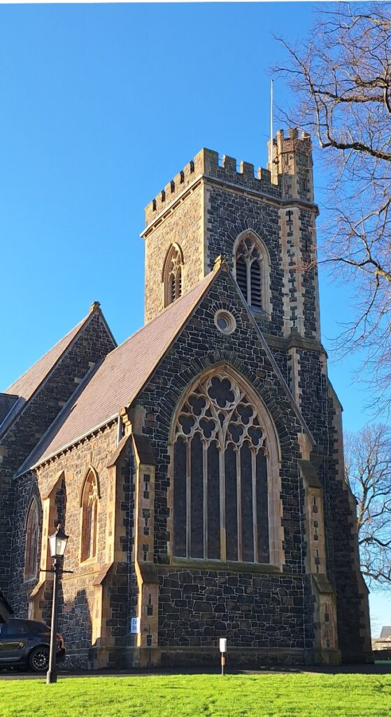
- Did you know that Newry has a history stretching back around 1,000 years! It’s certainly not all about shops, and on this mini trail you’ll visit several historic stops, the canal, beautiful Newry Cathedral, and find out about several people remembered en-route as well as tragic maritime disasters.
- This may be a mini murder mystery but is still packed with 17 clues to solve. Despite sharing some of the route of our standard trail, we’ve come up with lots of different clues for this taster trail! It costs only £3.99!
- Allow 60-90 minutes to solve the clues.
- Accessibility – this is a totally flat route of less than a mile with one small set of steps to the cathedral entrance.
To purchase this Whodunit Hunt with credit / debit / Amex card please click here.
To pay using Paypal click here (or in the menu) to order this, or any other, Whodunit Hunt.
The clue hunt starts at the Market Place, shown below:
(c) 2023 – the term ‘Whodunit Hunt’, associated logo, website content, and all Hunt routes, ideas, images and photos, are protected by copyright. Any copying/distribution of anything embraced by our copyright is intellectual theft and therefore unlawful and illegal. Please respect the law as well as numerous years of our hard work.
Who Bludgeoned Bea In Belfast?
Bea White has been found murdered outside City Hall, where she often had her lunch, but evidence suggests the murder occurred elsewhere. Start your clue hunt at the Europa Hotel Entrance.
 This is a self-guided, walking murder mystery ‘taster trail’, for if you’re short on time or want to try a mini Whodunit Hunt to see if you’ll like them. We hope you do!
- On your clue hunt you’ll discover quite a number of historic spots and beautiful buildings on a trail less than a mile long. You’ll see the Grand Opera House, Belfast’s most famous bar and a much older drinking place, the beautiful Presbyterian Assembly Buildings, and much more. You’ll also learn about some interesting historical characters!
- The little Whodunit Hunt booklet for this murder mystery is still packed with 18 clues and extra historical information … and we’ve recently added a couple of Super Sleuth clues for you spot as well! Note: all of the clues are brand new for this Whodunit Hunt and separate from our main Belfast City trail.
- The recommended time for this murder mystery is 60-90 minutes and the route is completely flat. It costs only £3.99!
To purchase this Whodunit Hunt with credit / debit / Amex card please click here.
To pay using Paypal click here (or in the menu) to order this, or any other, Whodunit Hunt.
The starting point is at the Europa Hotel, shown in the map below:
(c) 2023 – the term ‘Whodunit Hunt’, associated logo, website content, and all Hunt routes, ideas, images and photos, are protected by copyright. Any copying/distribution of anything embraced by our copyright is intellectual theft and therefore unlawful and illegal. Please respect the law as well as numerous years of our hard work.
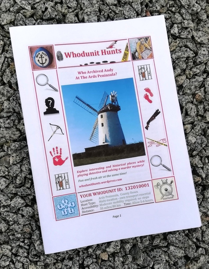
Who Killed Kerry At Derrymore?
Kerry Moore has been found murdered in Derrymore House estate and, with our big case load, we need your help to solve the murder. Although Kerry’s body was found at the entrance to the house, the absence of blood around the body suggests this was not where the murder was committed and she may have even been murdered beyond the estate walls!
 The Derrymore Whodunit Hunt is a self-guided, walking murder mystery trail.
- Derrymore Estate near Newry is a lovely spot for woodland walks in landscaped grounds with a view of the Mournes, but it’s also rich in history with an elegant old cottage, a Quaker Meeting House, an old rath, and attractive gate lodges. In spring and summer the flowers are lovely!
- This murder mystery is jam packed with over 30 clues to solve in a booklet containing several pieces of extra historical information about the estate and nearby Bessbrook.
- The clue route is 1.9 miles, or about 3 km. The recommended time for completing it, excluding refreshment stops, is about two hours.
- Accessibility – the route has no steps and paths generally are either flat or with moderate inclines.

To purchase this Whodunit Hunt with credit / debit / Amex card please click here.
To pay using Paypal click here (or in the menu) to order this, or any other, Whodunit Hunt.
The trail of clues is confined to the Derrymore Estate, which is shown in the map below. Access to the estate, and parking at it, are free.
(c) 2023 – the term ‘Whodunit Hunt’, associated logo, website content, and all Hunt routes, ideas, images and photos, are protected by copyright. Any copying/distribution of anything embraced by our copyright is intellectual theft and therefore unlawful and illegal. Please respect the law as well as numerous years of our hard work.
 Tired of having the same old team-building events at pubs / restaurants? Looking for a new, fun, and very affordable idea for hen & stag days or a college / uni event? Then why not have a murder mystery themed event with one of our Whodunit Hunt trails!
The cost per booklet of our walking Whodunit Hunts is £6.99 and (standard length) driving Whodunit Hunts is £7.99 if sent by email (or Euro equivalents)… so very affordable! Taster trails cost only £3.99!
 We give a discount for buying multiple Whodunit Hunt booklets, depending on the number of copies needed. If you want us to print (on premium quality paper) and post your booklets then the discount will, at the least, give you free printing and postage.
For a team event we advise teams of 2-3 people (although four is doable too) with one booklet per team. Booklets provided will each have a unique case id for each team to submit an answer (and get clue help). After purchase, we supply guidance on running your event and indicate the best place(s) for your teams to meet near the starting point.
The photo shows an example booklet. If printing the booklets yourself, click this printing link for guidance.
Payment is by either card or Paypal – we’ll supply payment instructions when you’ve concluded the details of your event with us.
To make an enquiry just fill in the form below and we’ll get back to you with a quote and any queries that we may have about your event.
(c) 2023 – the term ‘Whodunit Hunt’, associated logo, website content, and all Hunt routes, ideas, images and photos, are protected by copyright. Any copying/distribution of anything embraced by our copyright is intellectual theft and therefore unlawful and illegal. Please respect the law as well as numerous years of our hard work.
Who Bumped Off Brian In Ballymena?
Brian McCarthy has alas been found murdered in Ballymena. Our chief detective is struggling to conclude the case and needs your help to solve this murder mystery. The evidence trail starts near the Museum/Arts Centre building, on Bridge Street, where Brian used to work.
 The Ballymena Whodunit Hunt is a self-guided murder mystery trail on foot.
- Investigate Ballymena closely and one finds quite a number of historic places, even if the original Ballymena castle is no more, as it began life as a town around 400 years ago. You’ll see many historic buildings (especially ones with beautiful Georgian architecture on Ballymoney Road), old churches, Ballymena’s very own Pentagon, learn about the history of its shops and markets, read ghost stories… and more!
- The clue route is almost 1 ½ miles, or about 2 ½ km. It starts/ends at the Mid-Ulster Museum/Arts Centre.
- This Whodunit booklet is packed with 28 clues to solve and several pieces of extra historical information not seen en route.
- The recommended time for this murder mystery is about 2 hours, excluding refreshment stops.
- Accessibility – the route is generally fairly flat, with only moderate inclines.
To purchase this Whodunit Hunt with credit / debit / Amex card please click here.
To pay using Paypal click here to order this, or any other, Whodunit Hunt.
(c) 2023 – the term ‘Whodunit Hunt’, associated logo, website content, and all Whodunit Hunt routes, ideas, photos, are all protected by copyright. Any copying, impersonation or distribution of anything embraced by our copyright is intellectual theft and therefore unlawful and illegal. Please respect the law as well as all of our hard work.
 For an absolutely unique gift, treat someone to a Whodunit Hunts Gift Voucher! Or treat yourself to a multi-trail discount voucher!
Multi-trail e-vouchers are like a mini-subscription – choose five Whodunit Hunts as and when you want them with a voucher price offering a 10% discount compared to individual trails. Or you can buy an e-voucher for just a single trail.
The cost of e-vouchers with booklets emailed to the recipient is:
- Walking Whodunit Voucher: £6.99,
- Driving Whodunit Voucher: £7.99,
- Multi-Trail (5) Walking Voucher: £31.50,
- Multi-Trail (5) Mixed Voucher: £34.00 – choose a mix of up to 3 driving Whodunit Hunts and the remainder walking ones.
If you prefer the gift recipient to get their booklet(s) in the post then the e-voucher prices are:
- Single-trail Walking/Driving Whodunit E-voucher: £1.95 additional cost if living in UK or £3.60 for ROI addresses,
- Multi-Trail (5) Walking E-voucher: £41.00 (NI addresses only),
- Multi-Trail (5) Mixed E-voucher: £43.50 (NI addresses only).
To pay for vouchers by credit / debit / AMEX card click here instead of using the form below. It gives a more seamless order / checkout experience – set the date to when you want the voucher to be sent and in ‘Special Requests’ put the email of the recipient (if not you), their address if having booklets posted, and any message to be sent with the e-voucher.
To pay by Paypal use the form below and we’ll email an invoice with the amount to send. You can pick however many trails you want on a walking or driving voucher with Paypal. If your card isn’t in GBP, Paypal converts from your home-currency to GBP so you know you’re sending the right amount.
Please check your junk/spam folder if you haven’t heard back from us in a while – invoices are usually sent in 10-15 minutes.
Please Contact Us for any queries about voucher purchases or your order.
(c) 2023 – the term ‘Whodunit Hunt’, associated logo, website content, and all Hunt routes, ideas, images and photos, are all protected by copyright. Any copying/distribution of anything embraced by our copyright is intellectual theft and therefore unlawful and illegal. Please respect the law as well as all of our hard work.
Who Culled Cathy In Caledon?
Evidence suggests that courageous Cathy put up a brave fight for her life, but alas she has been found murdered in the beautiful village of Caledon. We recommend you start your hunt for evidence at the car park on Mill Street as her body was found there, however we think it was likely that the crime was carried out elsewhere.
 The Caledon Whodunit Hunt is a self-guided murder mystery trail on foot.
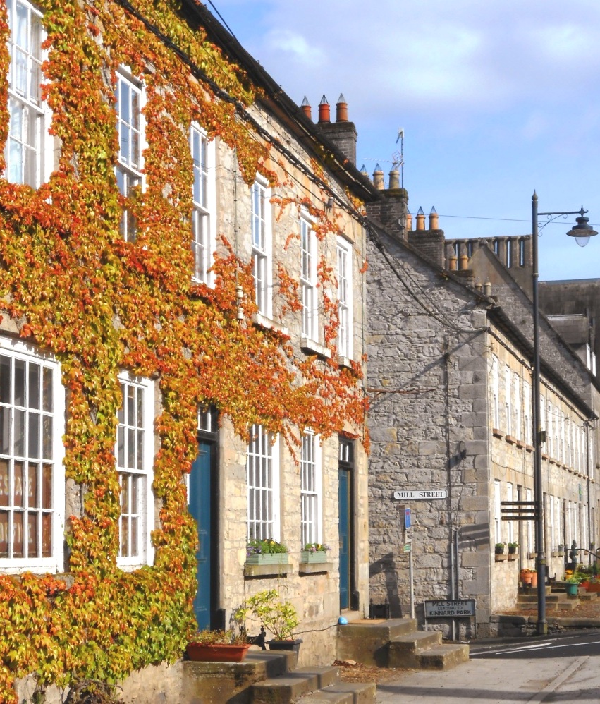
- Caledon, County Tyrone, is a pretty, quaint village with much grand Georgian architecture dating back over 200 years. You’ll see the mill ruins, numerous historic buildings, pretty floral displays… and more! Learn about the mills that were built here, the origins of the village before that, and the development of Caledon and the Alexander family that helped create it.
- The clue route is almost 1 ½ miles, or about 2 ¼ km. It starts/ends at the car park on Mill Street, shown in the map below.
- This Whodunit booklet is packed with 28 clues to solve and lots of pieces of historical information.
- The recommended time for this murder mystery is 1 ½ hours, excluding any stops for refreshment. You can extend your stay in the village with a walk along the river… or a delicious scone at the coffee shop on the main street!
- Accessibility – the route is generally fairly flat, with only moderate inclines… though the Mill Street hill is a bit steeper.
To pay using Paypal click here (or in the menu) to order this, or any other, Whodunit Hunt.
To purchase this Whodunit Hunt with credit / debit / Amex card please click here.

(c) 2023 – the term ‘Whodunit Hunt’, associated logo, website content, and all Hunt routes, ideas, images and photos, are protected by copyright. Any copying/distribution of anything embraced by our copyright is intellectual theft and therefore unlawful and illegal. Please respect the law as well as numerous years of our hard work.
Who Fatally Assaulted Alan From Antrim?
Alan Meekin has been found murdered at Belfast Castle and our best but overworked investigator needs your help to solve the case. It is believed that Alan was likely murdered elsewhere and so the hunt for clues starts at Waterworks Park in Belfast.
 The Antrim Castles Whodunit Hunt starts in North Belfast and ends at Antrim.
- This is a self-guided, driving murder mystery trail.
- Visit historic sites and beautiful gardens as you try and nail the criminal for this case. See Belfast and Antrim castles and pass another castle en-route (hence the trail name), beautiful gardens, Northern Ireland’s very own White House, mills, various historic sites in Antrim… and more!
- Over 30 clues to solve squeezed into a Whodunit booklet that has extra historical and tourist pointers!
- The driving route is only 26 miles, or 42km! There is about 2¾ miles / 4½ km of walking in total across all of the clues.
- The recommended time for this murder mystery, excluding extened refreshment stops, is 4-5 hours.
- Accessibility – it is generally fairly flat where all of the clues are to be found.
To purchase this Whodunit Hunt with credit / debit / Amex card please click here.
To pay using Paypal click here (or in the menu) to order this, or any other, Whodunit Hunt.

The starting point is at the playground entrance to Waterworks Park, North Belfast, close to the point we’ve marked on the map below:
(c) 2023 – the term ‘Whodunit Hunt’, associated logo, website content, and all Whodunit Hunt routes, ideas, photos, are all protected by copyright. Any copying, impersonation or distribution of anything embraced by our copyright is intellectual theft and therefore unlawful and illegal. Please respect the law as well as all of our hard work.
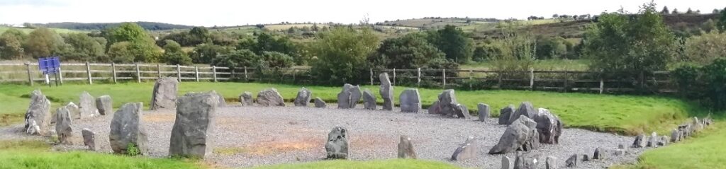
Who Liquidated Laura In The Lower Lough Erne Area?
Laura Irvine’s body has been found at the shore of Lower Lough Erne but a post mortem confirmed that drowning wasn’t the cause of death. Our investigators have uncovered much evidence but are struggling to tie it all together and thus need your help to solve the murder.
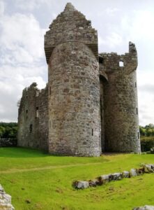 The Lower Lough Erne Whodunit Hunt starts at Trory Jetty and ends at the outskirts of Enniskillen. It is a self-guided, driving murder mystery trail with a near-circular route.
- Enjoy beautiful lakeside scenery while visiting a plethora of historic places! You’ll see neolithic sites including a stone circle and strange carved figures, numerous castles, a famine grave, historic sites related to World War II… and more!
- Almost 30 clues to solve!
- The driving route is 77 miles / 123 km, with clues spread all around the Lough area; 13 miles of this route is along Lough Shore Road between clue stops at Belleek and Tully Castle. There is about 2¼ miles / 3¾ km of walking in total.
- The recommended time for this murder mystery, excluding refreshment stops and return journey, is about 5 hours.
- Accessibility – it is generally flat where the clues are to be found, with no steps that must be navigated.
To purchase this Whodunit Hunt with credit / debit / Amex card please click here.
To pay using Paypal click here (or in the menu) to order this, or any other, Whodunit Hunt.
The starting point is at Trory Jetty on the lower east shore of the Lough, shown in the map below:
(c) 2023 – the term ‘Whodunit Hunt’, associated logo, website content, and all Hunt routes, ideas, photos, are all protected by copyright. Any copying, impersonation or distribution of anything embraced by our copyright is intellectual theft and therefore unlawful and illegal. Please respect the law as well as all of our hard work.
