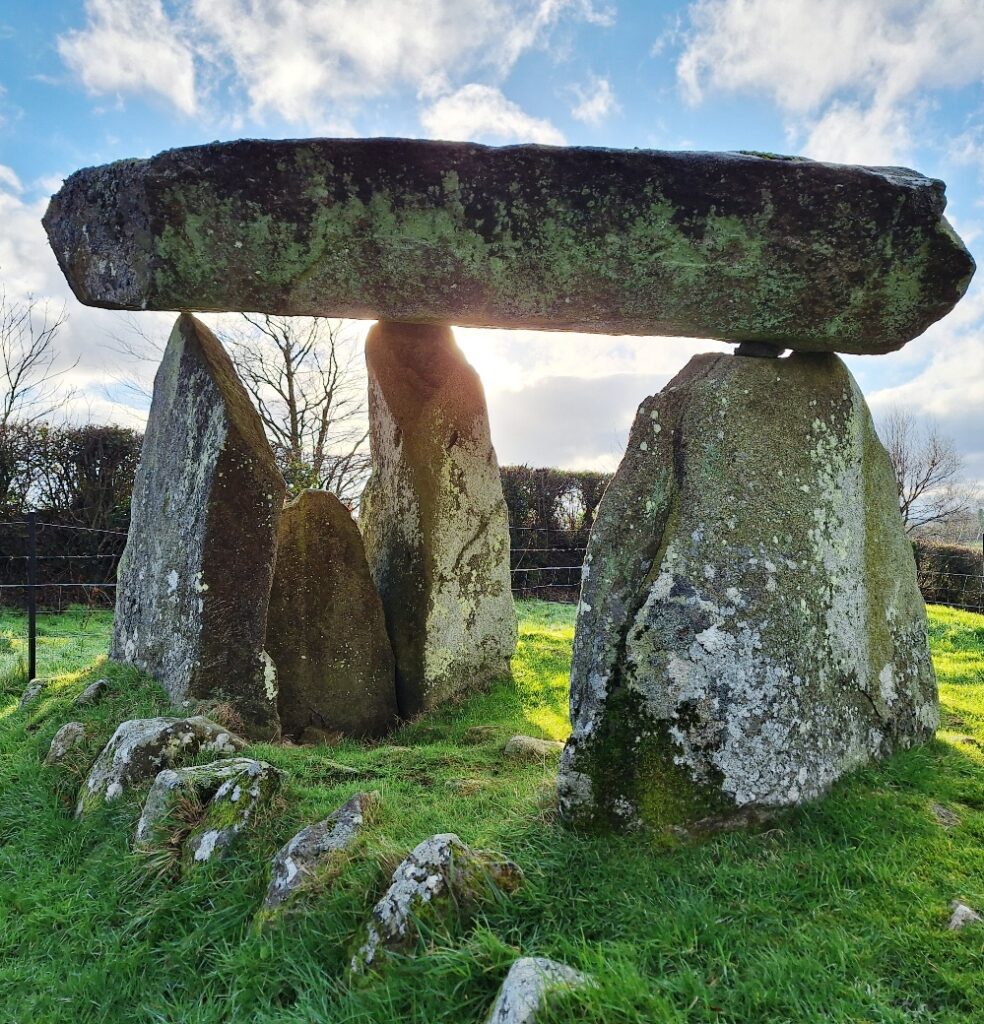
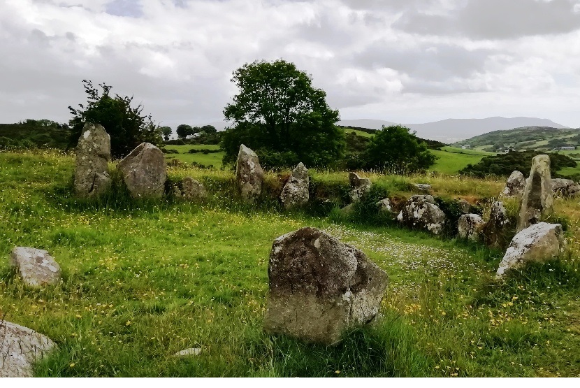
 Ballykeel dolmen dates back around 5,500 years to 3,500 BC! It’s a great example of a tripod dolmen (or portal tomb) and is of the same type as the Legananny Dolmen (that can be seen on our Slieve Croob Whodunit Hunt in County Down) which is only a mile or two from Slieve Croob mountain.
Ballykeel Dolmen was only excavated in 1965 and had to be partially re-erected during excavations in 1965 that had begun two years earlier because the large capstone on top had fallen. Those investigations indicated that the tomb had been previously disturbed and, likely, some items taken – however, it still unearthed three highly decorated ‘Ballyalton’ bowls, hundreds of shards of pottery and some flint tools including a javelin head. High levels of phosphates found on the chamber floor confirm it was used for ancient burials.
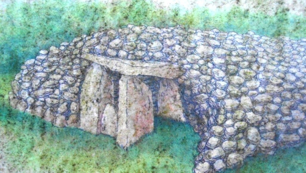
This dolmen was at the southern end of a large cairn that measured approximately 10 * 30 metres. Most of this cairn has, with age, unsurprisingly disappeared but two parallel lines of stones can still clearly be seen. When it was originally built it would have had the appearance of that shown in the reconstruction photo below:
Known locally as ‘The Hag’s Chair’, the cairn is associated with the Cailleach, the mythical goddess of Winter. Legend has it that she would fly down from her home on Slieve Gullion to sit on the dolmen at Ballykeel, which served as her throne. Sacred rituals and ceremonies were likely performed here in ancient times.

(c) 2023 – the term ‘Whodunit Hunt’, associated logo, website content, and all Hunt routes, ideas, photos, are all protected by copyright. Any copying, impersonation or distribution of anything embraced by our copyright is intellectual theft and therefore unlawful and illegal. Please respect the law as well as all of our hard work.
Who Slayed Steve Crook In The Slieve Croob Area?
Steve Crook has been found murdered in the Slieve Croob area, and although we know his surname is quite appropriate his petty crimes didn’t deserve such a gruesome end. Although his body was found dumped at the Slieve Croob car park it’s not clear that he was murdered here and the clue trail starts on the Castlewellan Road east of Rathfriland.
 The Slieve Croob Trail is a self-guided driving Whodunit Hunt that starts between Rathfriland and Castlewellan and ends at the old market town of Ballynahinch.
- You will discover quite a number of historical places on this murder mystery trail as well as see beautiful scenery. En route you’ll visit one of the most photographed neolithic sites in Ireland, two early-Christian souterrains, stop at a village where the remains of a flax mill are located, and learn about the evolution of Ballynahinch which dates back hundreds of years with a turbulent history.
- The clue route from start to end is 32 miles, or about 51 km.
- There is generally moderate walking, about 2 ¼ miles / 3 ¼ km in total.
- It is recommended to allow four hours to solve this murder mystery.
 Accessibility – once out of the car the terrain is generally fairly flat, but a few clues require reasonable mobility. We recommend taking sensible shoes… AND a torch if you fancy going on an Indiana Jones type adventure!
To pay using Paypal click here (or in the menu) to order this, or any other, Whodunit Hunt.
To purchase this Whodunit Hunt with credit / debit / Amex card please click here.
The starting point is shown in the map below:
(c) 2023 – the term ‘Whodunit Hunt’, associated logo, website content, and all Hunt routes, ideas, photos, are all protected by copyright. Any copying, impersonation or distribution of anything embraced by our copyright is intellectual theft and therefore unlawful and illegal. Please respect the law as well as all of our hard work.
Who Slaughtered Steven Gray In The Slieve Gullion Area?
Steven Gray has been found murdered at Meigh, near Newry, but it is believed he was killed elsewhere. Even our best team of investigators have uncovered very few leads and thus need your help to solve the murder.
New standard-length version now available!!
 The Slieve Gullion Whodunit Hunt starts at Derrymore House, near Newry.
- This is a self-guided, circular driving murder mystery trail.
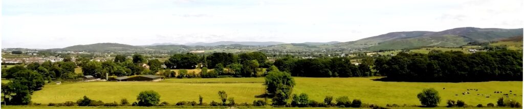
- You’ll see super mountain scenery as you drive around the Ring Of Gullion area. Also learn about the area’s past linen industry, visit a National Trust woodland house, an ancient church and significant monastic site, a nelithic tomb dating back thousands of years… and more!
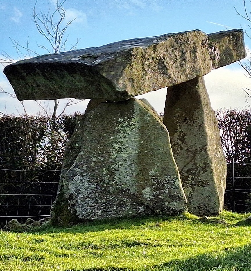
- Having created the new standard trail version we’ve even squeezed in an extra optional site to see en-route in both versions of this murder mystery, the tripod dolmen shown in the top photo! You can read about this tomb here.
- The standard version of this trail has a route of only 19 miles, or 31 km! The recommended time to solve the case is 3-4 hours.
- There is about 2½ miles / 4 km of walking in total, spread across numerous clue stops along the route.
 The deluxe version of this trail also visits a graveyard where the brother of Robert The Bruce is buried, a ruined castle, and a holy shrine – it has 39 clues in a bumper-sized booklet that we suggest allowing at least five hours to solve. The deluxe route is about 40 miles / 64 km with an extra ½ mile of walking.
- Accessibility – it is mostly fairly flat where the clues are to be found.
- There are several bars, cafes, coffee shops, and convenience stores along the route.
- Note: in April 2024 a parking charge of £5 was introduced by Slieve Gullion Forest Park. It is possible to avoid this with additional walking (and we’ve given instructions in the booklet if necessary), but for all this investigative fun we think that this fee on top of the price of the Whodunit booklet is still incredible value!
To pay using Paypal click here (or in the menu) to order this, or any other, Whodunit Hunt.
To purchase this Whodunit Hunt with credit / debit / Amex card please click here.
The starting point is shown in the map below:
(c) 2023 – the term ‘Whodunit Hunt’, associated logo, website content, and all Hunt routes, ideas, photos, are all protected by copyright. Any copying, impersonation or distribution of anything embraced by our copyright is intellectual theft and therefore unlawful and illegal. Please respect the law as well as all of our hard work.
