Who Nailed Natalie In Navan?
Local lady Natalie Murphy has alas been found murdered in the floral town of Navan. The murder trail starts at Athlumney Graveyard where her body, and evidence, was found there. However, detectives think the murder was carried out elsewhere.
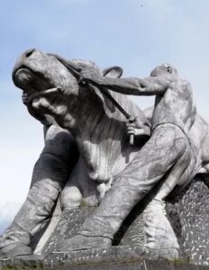 The Navan Whodunit Hunt is a self-guided, walking murder mystery trail.
- On the clue route you will discover numerous historic sights, including Athlumney Castle and graveyard, an old fountain, see the canal and read about its construction, learn about the history of this town which spans hundreds of years, see modern giant sculptures… and more!
- The clue route is 4 km / 2 ½ miles.
- The Whodunit Hunt booklet has 29 clues to solve and masses of extra historical information squeezed into it.
- Allow two full hours, excluding any stops for refreshment.
- Accessibility – the route is generally fairly flat, with only moderate inclines.
- Refreshments – there are a number of bars, cafes, coffee shops, restaurants, takeaways, and shops.
- Email clue help facility if you get stuck.
To purchase this Whodunit Hunt with credit / debit / Amex card please click here and type Navan in the ‘Special Requests’ field on the purchase page.
To pay using Paypal click here to order this trail.
The starting point is on Convent Road as it turns into a pedestrian zone just below Athlumney Castle, shown in the map below; you can also park here… for free!

(c) 2023 – the term ‘Whodunit Hunt’, associated logo, website content, and all Hunt routes, ideas, images and photos, are protected by copyright. Any copying/distribution of anything embraced by our copyright is intellectual theft and therefore unlawful and illegal. Please respect the law as well as numerous years of our hard work.
Who Killed Katherine In Kells?
Katherine Lynch has been killed in historic Kells and we need your help to confirm suspicions about the murder. Although her body was found at the round tower, we wonder if the murder was committed elsewhere and so the evidence trail starts at the Market Cross.
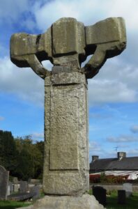 The Kells Whodunit Hunt is a self-guided, walking murder mystery trail.
- On the clue route discover numerous historic sites including the round tower and old Irish crosses, learn of the legendary Irish version of the Olympic Games, read about a mischievous pilot and an MP of the previous century with connections here… and more!
- The clue route is about 3 km / 2 miles.
- Whodunit Hunt booklet packed with 30 clues and LOADS of extra historical info and trivia.
- Allow at least two hours to solve this murder mystery, excluding stops for refreshment.
- Accessibility – the route is generally fairly flat, with only moderate inclines.
- Refreshments – there are a number of cafes, coffee shops, bars and convenience stores here.
- Email clue help facility if you get stuck.
To purchase this Whodunit Hunt with credit / debit / Amex card please click here and type Kells in the ‘Special Requests’ field on the purchase page.
To pay using Paypal click here to order.
The starting point is at the Market Cross, shown in the map below.
(c) 2023 – the term ‘Whodunit Hunt’, associated logo, website content, and all Hunt routes, ideas, images and photos, are protected by copyright. Any copying/distribution of anything embraced by our copyright is intellectual theft and therefore unlawful and illegal. Please respect the law as well as numerous years of our hard work.
Who Negated Ned’s Life In Newcastle?
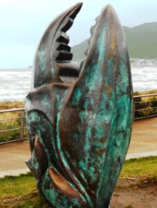 Local man Ned McKenzie has alas been found murdered in Northern Ireland’s seaside town of Newcastle. Clues start at the Donard Car Park as his body was found dumped at the entrance, though detectives think the murder was carried out elsewhere.
- The Newcastle Whodunit Hunt is a self-guided, walking murder mystery trail.
- On our route you’ll discover both historic sites and modern sculptures of this town, dating back 600 years! Find out about past brandy smuggling, the old granite mining industry, an historic flight on the beach, the town’s railway connections, read stories of ghosts, local myths & legends… and more!
- The clue route is about 2 miles / 3 km.
- Whodunit Hunt booklet packed with 28 clues to solve and LOADS of historical and tourist trivia to read.
- Allow two hours to solve this murder mystery, excluding any refreshment stops.
- Accessibility – the route is generally flat.
- Refreshments – you’re spoilt for choice here with many bars, cafes, coffee shops, restaurants, takeaways, and shops.
- Email clue help facility if you get stuck.
To purchase this Whodunit Hunt with credit / debit / Amex card please click here.
To pay using Paypal click here to order this trail.
The starting point is the coast road entrance of the Donard Park car park shown in the map below:
(c) 2023 – the term ‘Whodunit Hunt’, associated logo, website content, and all Hunt routes, ideas, images and photos, are protected by copyright. Any copying/distribution of anything embraced by our copyright is intellectual theft and therefore unlawful and illegal. Please respect the law as well as numerous years of our hard work.
Who Killed Cathy In Castlewellan?
Cathy O’Reilly from Castlewellan has been murdered and detectives need your help to solve the mystery around her death. Her body was found in Castlewellan lake but evidence tells us the murder was committed elsewhere… but where?
New and improved booklet now available, with more clues in Castlewellan Forest Park!
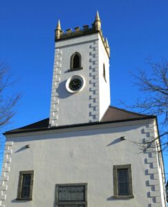 This Whodunit Hunt is a self-guided, walking murder mystery trail.
- On the clue route you’ll learn about the village’s history and characters who were part of it, especially the Annesley family who designed the village and created what is now Castlewellan’s Forest Park. See historic buildings, read about Castlewellan’s past railway history, enjoy the beauty of the forest park, even get a ghost story thrown in for good measure!
- The clue route is 2 ¼ miles / 3 ¾ km. The starting point is shown in the map below and the route ends in Castlewellan Forest Park near the lake.
- Nearly 30 clues to solve in a booklet packed with lots of extra historical and tourist trivia.
- Allow about two hours to solve this murder mystery, excluding any stops for refreshment.
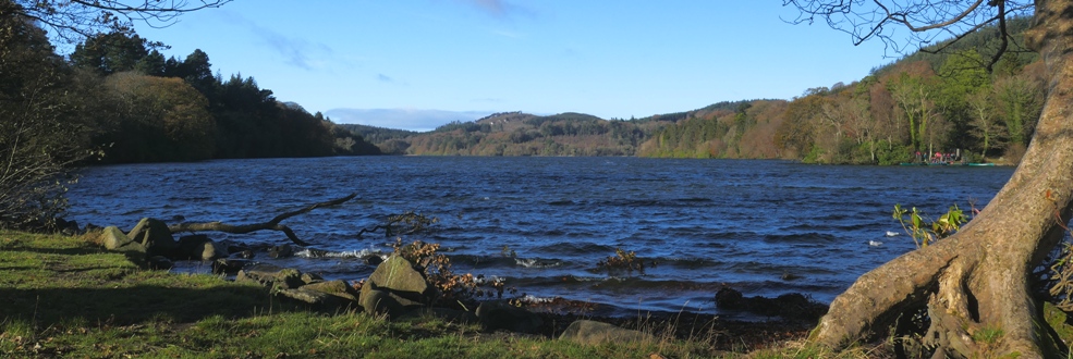
- You can extend your day here by spending time in the forest park (see below photo). There are many lovely walks in the park, as well as pretty gardens.
- Accessibility – the route is generally fairly flat, but with one hill to partly descend and climb back up.
- Refreshments – cafes, coffee shops, and restaurants are available here.
- Email clue help facility if you get stuck.
To purchase this Whodunit Hunt with credit / debit / Amex card please click here.
To pay using Paypal click here to order this trail.
The starting point is at the car park beside the King’s Inn at Lower Square, shown in the map below.
(c) 2023 – the term ‘Whodunit Hunt’, associated logo, website content, and all Hunt routes, ideas, images and photos, are protected by copyright. Any copying/distribution of anything embraced by our copyright is intellectual theft and therefore unlawful and illegal. Please respect the law as well as numerous years of our hard work.
Who Slaughtered Sean in Saintfield?
Sean Magill has been sadly slain in the historical small town of Saintfield and our best investigators need your help to confirm their suspicions about the murder. Although his body was found at the ruins of the old windmill, we believe this was not where the murder was committed.
New version now available with several improvements and an extra clue added!
 The Saintfield Whodunit Hunt is a self-guided, walking murder mystery trail.
- Along the clue route you’ll see quite a number of historic buildings in this quaint village, including the old coaching inn and several churches, as well as pretty flower displays. Learn about Saintfield’s turbulent history too – especially in the memorial garden – spanning hundreds of years.
- The clue route is 1 ¾ miles / 2 ¾ km.
- This Whodunit Hunt has 28 clues in a booklet with extra information not seen elsewhere in the village.
- Allow 1½ – 2 hours to solve this murder mystery, excluding any stops for refreshment. The National Trust’s Rowallane Gardens is at the village outskirts nearby if you have time to extend your visit.
- Accessibility – the route is generally fairly flat, with only moderate inclines.
 Refreshments – there are a number of cafes, coffee shops, convenience stores in Saintfield as well as the old White Horse Inn.
- Email clue help facility if you get stuck.
To purchase this Whodunit Hunt with credit / debit / Amex card please click here.
To pay using Paypal click here to order this trail.
The starting point is the car park beyond the Masonic Hall on Downpatrick Street, shown in the map below.
(c) 2023 – the term ‘Whodunit Hunt’, associated logo, website content, and all Hunt routes, ideas, images and photos, are protected by copyright. Any copying/distribution of anything embraced by our copyright is intellectual theft and therefore unlawful and illegal. Please respect the law as well as numerous years of our hard work.
Who Killed Laura in Loughgall?
Laura Masterton has been found murdered in the historic village of Loughgall. Our best team of investigators are struggling to conclude the case and thus need your help to solve the murder. Although Laura’s body was found at the football club, it’s obvious to detectives that she was murdered elsewhere.
 The Loughgall Whodunit Hunt is a self-guided, there-and-back murder mystery trail on foot.
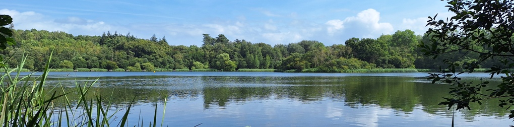
- Loughgall is a lovely, quaint village in Northern Ireland’s apple growing area. Learn about the apple industry as the evidence trail takes you into Loughgall Country Park, and see numerous historical sites along the main street including a ruined church and the old schools.
- The clue route is 1 ½ miles / about 2 ½ km.
- Whodunit booklet packed with 28 clues and lots of pieces of historical information.
- Allow about two hours, excluding refreshment stop. You can extend your stay in the village with a walk in the country park.
- Accessibility – the route is generally fairly flat, with only moderate inclines.
- Refreshments – there’s a nice coffee shop but it’s open only some days of the week. In warmer months there are snack options in the country park.
- Email clue help facility if you get stuck.
To pay using Paypal click here to order this trail.
To purchase this Whodunit Hunt with credit / debit / Amex card please click here.
The starting point is shown in the map below, with parking on the side road just opposite:
(c) 2023 – the term ‘Whodunit Hunt’, associated logo, website content, and all Hunt routes, ideas, images and photos, are protected by copyright. Any copying/distribution of anything embraced by our copyright is intellectual theft and therefore unlawful and illegal. Please respect the law as well as numerous years of our hard work.
Who Whacked William in Whitehead?
William White has been found murdered in the old coastal town of Whitehead and our investigators have uncovered very few leads. Therefore, we desperately need your help to solve the murder. Although William’s body was found on the beach, our detective team believe this was not where the murder was committed.
 The Whitehead Whodunit Hunt is a self-guided, walking murder mystery trail.
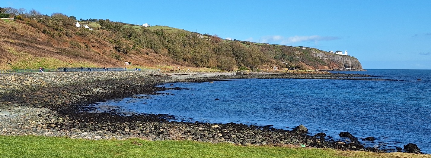
- Discover many interesting sights, both historic and modern, in this quaint seaside village. Learn about its railway history, the evolution of its tourism industry, and several of the characters who shaped it. See a castle, read about a pop star who used to live here… and someone who made their home in a cave!
- The clue route is almost 2 ½ miles / 4 km. Previous sleuths attempting this trail report that it is ‘dog-friendly’!
- The Whodunit Hunt booklet is packed with 30 clues as well as several pieces of historical and tourism trivia.
- Allow two hours to solve the case, excluding refreshment stops.
- Accessibility – the route is generally fairly flat, with only moderate inclines.
- Refreshments – there are a number of cafes, coffee shops, and convenience stores in Whitehead.
- Email clue help facility if you get stuck.
To purchase this Whodunit Hunt with credit / debit / Amex card please click here.
To pay using Paypal click here to order this trail.
The starting point is in the car park at the end of the Old Castle Road, shown in the map below:
(c) 2023 – the term ‘Whodunit Hunt’, associated logo, website content, and all Whodunit Hunt routes, ideas, photos, are all protected by copyright. Any copying, impersonation or distribution of anything embraced by our copyright is intellectual theft and therefore unlawful and illegal. Please respect the law as well as all of our hard work.
Who Topped Trisha In Trim?
Poor Trisha McDermott has been found murdered in the historic town of Trim and even our best investigators are struggling to tie leads together and thus need your help to solve the murder. Trisha’s body was found on Navan Gate and although detectives suspect she was murdered elsewhere they consider this is a good place to start looking for clues.
 The Trim Whodunit Hunt is a self-guided, walking murder mystery trail.
- Trim is a very historic place, in fact it has more medieval buildings than any other place in Ireland! Along the clue trail you’ll see the impressive Trim Castle, ruins of abbeys and a cathedral, learn about the Tomb Of The Jealous Man & Woman, and find out much more about this fascinating town!
- The route is almost 6 km / 3.7 miles. This is a longer walk than almost all of our murder mystery trails, as the ruined cathedral is along the pleasant river walk away from the town centre, so we have provided instructions in the Whodunit Hunt booklet to reduce the walking distance if required.
- The Whodunit Hunt booklet is packed with 30 clues to solve and nine pieces of extra historical information about the town and the sights you come across!
- The recommended time for this murder mystery is at least three hours, excluding refreshment stops.
- Accessibility – this is a generally quite flat route, but there are a small number of steps to navigate at/near the old cathedral site.
- Email clue help facility if you get stuck.
To purchase this Whodunit Hunt with credit / debit / Amex card please click here and type Trim in the ‘Special Requests’ field on the purchase page.
To pay using Paypal click here to order this trail.

The starting point is shown in the map below, with free parking nearby on this street.
(c) 2023 – the term ‘Whodunit Hunt’, associated logo, website content, and all Hunt routes, ideas, images and photos, are protected by copyright. Any copying/distribution of anything embraced by our copyright is intellectual theft and therefore unlawful and illegal. Please respect the law as well as numerous years of our hard work.
Who Dispatched Donal In Dromiskin?
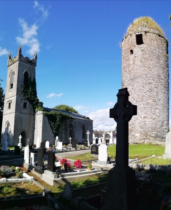
Donal Rafferty has been found murdered in the lovely village of Dromiskin. We need your help to solve the murder as detectives are struggling to tie up the loose ends of the case. Although Donal’s body was found at the petrol station, this is not where the murder was committed and so the murder trail starts at the old monastic and round tower site.
 The Dromiskin Whodunit Hunt is a self-guided, walking murder mystery trail.
- Dromiskin is a pretty little village with much history to discover! The historic focal point is the monastic site, over 1,200 years old, with its tall round tower, ruined church, and old Irish Cross. Along the clue trail you’ll see numerous historical references, learn about the village’s railway heritage and the famous people who have come from here, and much more!
- The route is about 3 km / 1.9 miles.
- This Whodunit trail is packed with over 30 clues as well as several pieces of historical trivia.
- Allow 1 ½ – 2 hours to solve this murder mystery, excluding refreshment stops.
- Accessibility – this is a generally quite flat route, with no steps.
- Email clue help facility if you get stuck.
To purchase this Whodunit Hunt with credit / debit / Amex card please click here and type Dromiskin in the ‘Special Requests’ field on the purchase page.
To pay using Paypal click here to order this trail.
The starting point is beside the monastic site shown in the map below, with free car parking there.
(c) 2023 – the term ‘Whodunit Hunt’, associated logo, website content, and all Hunt routes, ideas, images and photos, are protected by copyright. Any copying/distribution of anything embraced by our copyright is intellectual theft and therefore unlawful and illegal. Please respect the law as well as numerous years of our hard work.
Who Culled Carrie In Carrickfergus?
The body of Carrie Musgrave has been found in Carrickfergus and we need your help to confirm our suspicions about the murder. Although Carrie’s body was found at the base of the castle walls, she didn’t fall and we don’t believe this was where the murder was committed either. Only by following the clue trail can the circumstances of her death be revealed…
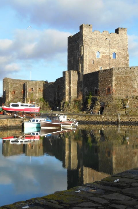 This is a self-guided, circular walking Whodunit Hunt murder mystery trail.
- Carrickfergus has a long history, having been inhabited as a town for around 850 years! The shoreline is dominated by the impressive castle, but there is much more to see. Along the clue trail you’ll learn about the town’s rise as a port, how it was surrounded by over a kilometre of walls (which you’ll see the remains of), learn about the part Edward & Robert The Bruce played in its history, see an historic church… and more!
- The route is approx 2 miles / 3 km.
- This Whodunit trail is crammed with 32 clues as well as several pieces of historical information and ghost stories too!
- Allow two hours to solve the case, excluding refreshment stops.
- Accessibility – this is generally a fairly flat route, with only occasional moderate inclines and no steps to navigate.
- Email clue help facility if you get stuck.
To purchase this Whodunit Hunt with credit / debit / Amex card please click here.
To pay using Paypal click here to order this trail.
The starting point is beside Carrickfergus Castle:
(c) 2023 – the term ‘Whodunit Hunt’, associated logo, website content, and all Whodunit Hunt routes, ideas, photos, are all protected by copyright. Any copying, impersonation or distribution of anything embraced by our copyright is intellectual theft and therefore unlawful and illegal. Please respect the law as well as all of our hard work.
