Belfast Europa

Who Bludgeoned Bea In Belfast?

Bea White has alas been found murdered outside City Hall but evidence suggests this was not where the murder was committed. The trail for clues starts at the Europa Hotel, where her boyfriend used to work.
  • This is a self-guided, walking murder mystery ‘taster trail’, for if you’ve not got much time or want to try a mini Whodunit Hunt to see if you’ll like them. We hope you do!
  • On your clue hunt you’ll discover quite a number of historic spots and beautiful buildings on a trail less than a mile long. You’ll see the Grand Opera House, Belfast’s most famous bar and a much older drinking place, the beautiful Presbyterian Assembly Buildings, and much more. You’ll also learn about some interesting historical characters!
  • The little Whodunit Hunt booklet for this murder mystery is still packed with 18 clues and some extra historical information too. Note: all of the clues are brand new for this Whodunit Hunt and separate from our main Belfast City trail.
  • The recommended time for this murder mystery is 60-90 minutes and the route is completely flat. It costs only £3.50!

To purchase this Whodunit Hunt with credit / debit / Amex card please click here.

To pay using Paypal click here (or in the menu) to order this, or any other, Whodunit Hunt.

The starting point is at the Europa Hotel, shown in the map below:

crime scene tape on white

(c) 2023 – the term ‘Whodunit Hunt’, associated logo, website content, and all Hunt routes, ideas, images and photos, are protected by copyright. Any copying/distribution of anything embraced by our copyright is intellectual theft and therefore unlawful and illegal. Please respect the law as well as numerous years of our hard work.

Belturbet

Who Bludgeoned Bert In Belturbet?

Bert O’Brien has been found murdered in the historic town of Belturbet. Our investigator on the case is struggling to make sense of the evidence and needs your help to solve the murder. Although Bert’s body was found in the river, the coroner soon ruled out drowning during his examinations. The starting point is the Mill Walk car park where spots of blood were first found – see where the evidence leads you…

  • This Whodunit Hunt is a self-guided, walking murder mystery trail.
  • There is much to discover on the clue trail at Belturbet, pleasantly situated overlooking the River Erne. Visit the site of an old castle, the former railway station, enjoy a river walk, learn about the numerous historic spots in the town which dates back to the 12th Century, read ghost stories… and more!
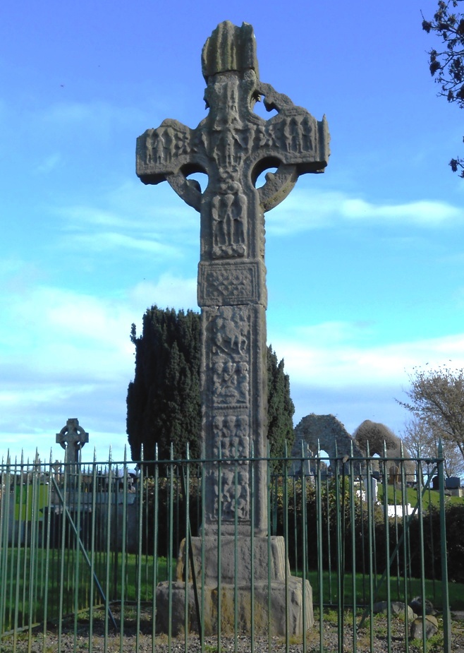
  • Over 30 clues to solve in a booklet packed with extra historical details not found en-route!
  • The route is 2½ miles, or about 4km.
  • The recommended time to solve this Whodunit Hunt, excluding refreshment stops, is 2-3 hours.
  • Accessibility: this is generally quite a flat route, with no steps, but there are a couple of hills to navigate.
  • For refreshments you will pass local stores, takeaways, bars and a restaurant.

The starting point is at the Mill Walk car park at the bottom of the hill near Kilconny Bridge, shown below.

To pay using Paypal click here (or in the menu) to order this, or any other, Whodunit Hunt.

To purchase this Whodunit Hunt with credit / debit / Amex card please click here and type Belturbet in the ‘Special Requests’ field at the start of the purchase page.

crime scene tape on white

(c) 2023 – the term ‘Whodunit Hunt’, associated logo, website content, and all Hunt routes, ideas, photos, are all protected by copyright. Any copying, impersonation or distribution of anything embraced by our copyright is intellectual theft and therefore unlawful and illegal. Please respect the law as well as all of our hard work.

Sperrins Trail

Who Slaughtered Perry In The Sperrins?

Poor Perry Inghams disappeared after a late night out. Weeks later, his partially decomposed body was found at Reuben’s Glen, a spot where he liked to stop for a picnic. Luckily you don’t need to see the body, but what we really need your help with is to piece together the clues and determine the circumstances behind his death.
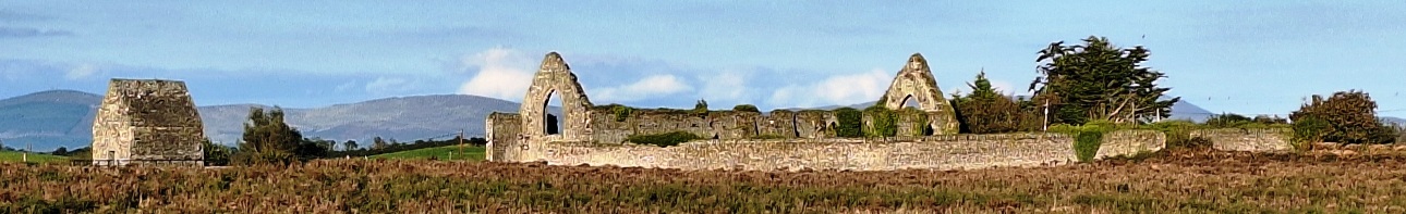
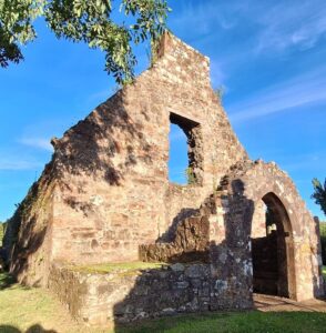
  • The Sperrins Whodunit Hunt starts near Moneymore and ends at Tullaghoge Fort just south of Cookstown.
  • This is a self-guided, near-circular driving murder mystery trail.
  • The clues take you to a mixture of historic sites while showing you much lovely mountain and river valley scenery too. This area has many neolithic sites, and you’ll visit some of the best and most accessible ones, including Beaghmore where there are seven stone circles! You’ll also visit historic ruined churches, forests and lakes, an ancient and significant fort… and much more!
  • Almost 30 clues to solve!
  • There is about 2¼ miles / 3¾ km of walking in total during this Whodunit, spread across all of the clues.
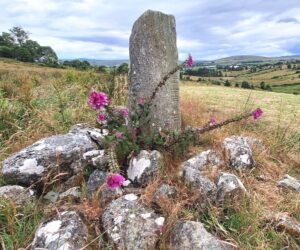
  • The driving route is almost 73 miles / 116 km. This is our longest-distance Whodunit – we always try and pack as many top sites into our driving trails as possible to make them varied, interesting, and fun… but alas we don’t have the power to move them closer together 🙂 There is much scenery to enjoy in between stops here!
  • We think this trail is ideal for those who really want to get off the beaten track. There are opportunities for extra walks en-route, if desired.
  • For this murder mystery we suggest allowing at least 5 hours, excluding extended refreshment stops.
  • Accessibility – it is generally flat where the clues are to be found, though one clue has a slope down to it; sensible shoes are recommended.

To pay using Paypal click here (or in the menu) to order this, or any other, Whodunit Hunt.

To purchase this Whodunit Hunt with credit / debit / Amex card please click here.

The starting point is at Reuben’s Glen car park 3 miles north of Moneymore, as shown in the map below:

crime scene tape on white

(c) 2023 – the term ‘Whodunit Hunt’, associated logo, website content, and all Hunt routes, ideas, photos, are all protected by copyright. Any copying, impersonation or distribution of anything embraced by our copyright is intellectual theft and therefore unlawful and illegal. Please respect the law as well as all of our hard work.

Lough Neagh

Who Eliminated Neil In The Lough Neagh Area?

Neil Casey from Ardboe has been murdered and our detectives need your help to solve the mystery around his death. Although his body was found floating at the lakeside near Oxford Island the post-mortem confirms he wasn’t drowned and so detectives believe his body was thrown in the lake.
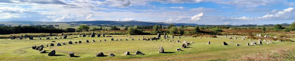
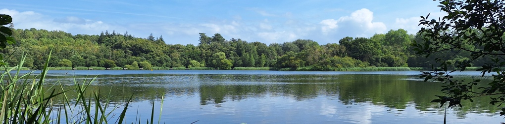
  • The Lough Neagh Whodunit Hunt starts at Oxford Island and ends at Cranfield Church east of Toome. It is a self-guided, linear driving murder mystery trail.
  • Visit lovely lakeside villages while taking in beautiful lakeside scenery. You’ll see the finest Irish Cross in Northern Ireland dating back over 1,000 years, a castle, a ruined church and holy well, visit Oxford Island nature reserve… and much more. If you’re a Game Of Thrones fan, there’s a filming location that you’ll stop at along the clue hunt too!
  • Over 30 clues to solve!
  • The driving route is 52 miles, or 83 km, with clues all around the western side of Lough Neagh. There is about 2 ½ miles / 4 km of walking in total during this Whodunit Hunt, spread across all of the clue stops.
  • The recommended time for this murder mystery, excluding refreshment stops and return journey, is about 5 hours.
  • Accessibility – it is generally flat where the clues are to be found, with no steps that must be navigated.

To pay using Paypal click here (or in the menu) to order this, or any other, Whodunit Hunt.

To purchase this Whodunit Hunt with credit / debit / Amex card please click here.

The starting point is at the Oxford Island nature reserve, off the M1 motorway:

crime scene tape on white

(c) 2023 – the term ‘Whodunit Hunt’, associated logo, website content, and all Hunt routes, ideas, photos, are all protected by copyright. Any copying, impersonation or distribution of anything embraced by our copyright is intellectual theft and therefore unlawful and illegal. Please respect the law as well as all of our hard work.

Printing

If printing your own Whodunit Hunt booklet for the first time, please follow this guide for best results. Your PDF file prints with two pages next to each other on each side of the paper so that, when folded in half, it is a booklet of manageable size as per the example photo.

Firstly, always print in colour (if possible), in Landscape orientation, and choose the Fit To Page / Shrink To Fit option so that it prints the correct size on A4 paper.

The booklet looks best if two paper sheets (three for deluxe Whodunits) are used, printed on both sides.

If you (or your hotel/B&B) have a duplex printer that can automatically print on both sides of the paper then in your printer properties select ‘2-sided printing’ with ‘Binding Location’ set to ‘Short Edge (Left)’ (or ‘Flip On Short Edge’ under the ‘Print on both sides’ option… or similar)… and print!

If you can only print single-sided pages then print one page at a time and follow these steps for the best looking result for a nice-looking booklet printed on both sides:

  • Print the first page of the PDF file.
  • Return the sheet to the printer tray with the blank side facing the way that your printing device prints. If this means that you have to flip the page over then hold it with the longer paper edge in each hand, and flip over lengthways towards you (so that if the top side of the paper had printing on it then you are now looking at the blank side… and vice versa) as directed in the diagram below:

  • Print the second page of the PDF.
  • Repeat the above steps for the remaining PDF pages and sheet(s)

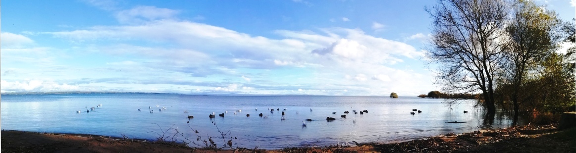
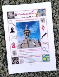
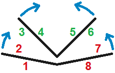
Once you’ve finished printing, fold the sheets lengthways so that the pages 1 and 3 are on the outside of the folded sheets so that your booklet has the same general appearanced and page numbering (for a standard Whodunit) as the one shown in the example photo. Hopefully this is an easy task… but see diagram right for guidance if needed.

If you are getting your booklet printed at a busy hotel/B&B, you’re in a rush, or if the above just sounds too complicated, printing single-sided absolutely won’t mean you can’t do your Whodunit Hunt correctly – just follow the clues and directions in number order and you’ll be able to follow the evidence trail just fine!

crime scene tape on white

(c) 2023 – the term ‘Whodunit Hunt’, associated logo, website content, and all Hunt routes, ideas, photos, are all protected by copyright. Any copying/distribution of anything embraced by our copyright is intellectual theft and therefore unlawful and illegal. Please respect the law as well as all of our hard work.

Loughgall

Who Killed Laura in Loughgall?

Laura Masterton has been found murdered in the historic village of Loughgall. Our best team of investigators are struggling to conclude the case and thus need your help to solve the murder. Although Laura’s body was found at the football club, it’s obvious to detectives that she was murdered elsewhere.
  • The Loughgall Whodunit Hunt is a self-guided, there-and-back murder mystery trail on foot.
  • Loughgall is a lovely, quaint village in Northern Ireland’s apple growing area. You’ll learn about the apple industry as the evidence trail takes you into Loughgall Country Park, and will see numerous historical buildings along the main street including a ruined church and the old schools.
  • The clue route is approximately 1 ½ miles, or about 2 ½ km. It starts/ends at St Luke’s Church.
  • This Whodunit trail is packed with 28 clues and lots of pieces of historical information.
  • The recommended time for this murder mystery is around two hours, excluding any stops for refreshment. You can extend your stay in the village with a walk in the country park.
  • Accessibility – the route is generally fairly flat, with only moderate inclines.
  • Refreshments – there is a convenience store, also a coffee shop but it is open only some days of the week. In warmer months there are snack options in the country park too.

To pay using Paypal click here (or in the menu) to order this, or any other, Whodunit Hunt.

To purchase this Whodunit Hunt with credit / debit / Amex card please click here.

The starting point is shown in the map below, with parking on the side road just opposite:

crime scene tape on white

(c) 2023 – the term ‘Whodunit Hunt’, associated logo, website content, and all Hunt routes, ideas, images and photos, are protected by copyright. Any copying/distribution of anything embraced by our copyright is intellectual theft and therefore unlawful and illegal. Please respect the law as well as numerous years of our hard work.

Patrick Kavanagh Trail

Who Critically Injured Ian From Inniskeen?

Ian O’Mally from Inniskeen was found dumped beside the road outside Carrickmacross and died from his injuries. Our best investigation team are struggling to connect their leads and need your help to solve the murder.
  • The Patrick Kavanagh Trail is a self-guided, driving murder mystery trail. This Whodunit Hunt starts on the outskirts of Dundalk and ends nearby.
  • You’ll see historic sights over 800 years old, including a round tower, several castles, and an impressive ancient abbey. There are several stops associated with famous Irish poet Patrick Kavanagh too, both in Inniskeen where he is buried and beyond. Also learn about the evolution of the area and some of the historic figures that shaped it.
  • The clue route is 35 miles, or about 56 km. There is generally moderate walking for most clues, with approximately 3.0 miles / 4.5 km in total.
  • There are 30 clues to solve and we suggest allowing at least four hours to complete this Whodunit Hunt, excluding prolonged refreshment stops.
  • Accessibility – once out of the car the terrain is generally quite flat, with only occasional moderate slopes; there are no steps.
  • For refreshments, you will pass a number of bars, coffee shops, restaurants and a tearoom along the route as well as shops.

To pay using Paypal click here (or in the menu) to order this, or any other, Whodunit Hunt.

To purchase this Whodunit Hunt with credit / debit / Amex card please click here and type Kavanagh in the ‘Special Requests’ field at the start of the purchase page.

The starting point is at the Castletown Cemetery in Dundalk, shown below:


crime scene tape on white

(c) 2023 – the term ‘Whodunit Hunt’, associated logo, website content, and all Hunt routes, ideas, photos, are all protected by copyright. Any copying, impersonation or distribution of anything embraced by our copyright is intellectual theft and therefore unlawful and illegal. Please respect the law as well as all of our hard work.

Feedback Comments

See below for just some of the positive and real feedback we’ve received:

Good length, not too difficult and dog friendly!” Julieanne (Whitehead WH, Mar 25)

Bought as a gift for my Mum… she absolutely loved it. So well thought out we highly recommend.” Anna (Castlewellan WH, Mar 25)

Loved doing this trail and shall definitely do more. It’s great to see these trails all over Ireland… thank you for creating these trails.” Margi. D. (Bangor WH, Feb 25)

We enjoyed our trail immensely! Great way to visit places and learn a bit more about the history of our little country.” – Karen D. (Tassagh Trail WH)

Thoroughly enjoyed it, learned and saw things we would not have otherwise. Looking forward to doing more trails.” – Lynne H. (Bangor WH)

This was out second Whodunit in a few weeks and can’t wait to try out more. Fun way to spend our day.” – Simon R. (Holywood WH)

We really enjoyed your trail. Thank you!” – Cat (Bangor WH)

Enjoyed being made to engage with locations and signage, being made to look at things that would have (otherwise) just passed by” – Karen S. (Deluxe Ards Peninsula WH)

Really enjoyed the route… we were introduced to a number of new locations. Clues were fun and interesting, both for young and old” – Michelle (Lough Neagh)

Really, really fun! Very enjoyable way to spend a Saturday afternoon, a nice walk too.” – Rose & Chris (Newry WH)

“Very fun and challenging!”Helen S. (Belfast City WH)

“Very fun and clues are great”Sheryl C. (Newcastle WH)

“…loved to discover so many things about Ardee, it would encourage me to go back and explore more. Difficulty finding the place to park at the start.” – Wee. M

Brilliant! Something different… discovered interesting places on our search.” – Rose & Chris (Tandragee Trail)

Great way to spend the afternoon. Certainly tests the powers of observation!” – Detective Simerjan (Japanese Division) – 3 trails!

“…an entertaining few hours exploring a new town, especially with a purpose. Far more engaging than aimless wandering…” – Caoilfhinn (Belfast WH)

“Great fun!” Lornah (Castlewellan WH)

Fantastic!!! There is obviously a lot of work that has gone into this!” – Margaret

Very good. Enjoyed it.” – Detective TS (Lurgan)

See map below of available Whodunit Hunts, and an indication of more coming soon. Use the ‘Buy & Explore’ menu options for more details and to buy a Whodunit Hunt.

crime scene tape on white

(c) 2023 – the term ‘Whodunit Hunt’, associated logo, website content, and all Whodunit Hunt routes, ideas, photos, are all protected by copyright. Any copying, impersonation or distribution of anything embraced by our copyright is intellectual theft and therefore unlawful and illegal. Please respect the law as well as all of our hard work.

Boyne Valley

Who Bumped Off Brigid in the Boyne Valley?

Brigid O’Hare has been found murdered in the village of Slane in the Boyne Valley. Few leads have been uncovered and detectives need your help to solve the murder. Although her body was found in the Square of Slane, it is believed this was not where she was killed and thus suggest the clue trail starts at the Monasterboice Crosses car park.
  • Discover huge ancient monuments, a historic battle site, an old abbey, round towers dating back over 1000 years, ancient burial sites over 5000 years old… and more! You will also explore the historical small town of Slane which has many old buildings as well as a connection to a famous poet.
  • The clue route is only 25 miles, or about 40km, to the end point at Donaghmore Tower near Navan.
  • We suggest allowing four hours to solve this  Whodunit Hunt, excluding any refreshment stops.
  • There is a moderate amount of walking at quite a number of locations.
  • Accessibility – most clues are generally flat apart from some clues in Slane on inclined roads.
  • For refreshments, Slane is your best bet with quite a number of options.

To pay using Paypal click here (or in the menu) to order this, or any other, Whodunit Hunt.

To purchase this Whodunit Hunt with credit / debit / Amex card please click here and type Boyne Valley in the ‘Special Requests’ field at the start of the purchase page.

The start of the Whodunit Hunt is shown in the map below:

crime scene tape on white

(c) 2023 – the term ‘Whodunit Hunt’, associated logo, website content, and all Hunt routes, ideas, photos, are all protected by copyright. Any copying, impersonation or distribution of anything embraced by our copyright is intellectual theft and therefore unlawful and illegal. Please respect the law as well as all of our hard work.

Game Of Thrones

Audleys Castle (C) 2023 Andrea MIf you’re a Game Of Thrones fan, then on some of our Whodunit Hunts you’ll see locations where some of the filming for this multi-series epic actually took place and/or be able to visit other filming locations nearby. Keep a keen eye out for signs erected for the long-running series!

You’ll pass two filming locations on our Antrim Coast clue route and one on each of our Lough Neagh and St Patrick’s trails. We have at least two other Whodunit Hunts in the pipeline which also pass, and come close to, filming locations – one coming soon, watch this space!


crime scene tape on white

(c) 2023 – the term ‘Whodunit Hunt’, associated logo, website content, and all Whodunit Hunt routes, ideas, photos, are all protected by copyright. Any copying, impersonation or distribution of anything embraced by our copyright is intellectual theft and therefore unlawful and illegal. Please respect the law as well as all of our hard work.