Who Got Graham At Glenarm?
Graham Whelan has been found murdered in the village of Glenarm. Our chief detective has a heavy case load and needs your help to solve this murder mystery. Although Graham’s body was found in the harbour he certainly didn’t drown, says the coroner. So was he pushed… or murdered elsewhere? Only by following the evidence trail will all be revealed.
 The Glenarm Whodunit Hunt is a self-guided murder mystery trail on foot.
- Explore the beautiful village of Glenarm, a conservation area with much history and quaint streets with preserved old shop fronts. Learn about the castle, characters who shaped the history of Glenarm, see historic buildings and beautiful coastal views.
- The clue route is almost 2 miles / 3 ¼ km long. It starts between the marina building and the nearby car park at the southern end of town.
- The Whodunit Hunt booklet is packed with over 30 clues to solve as well as several pieces of extra historical info and trivia not seen en route… and a folklore tale of heartbreak too!
- The recommended time for this murder mystery is a good two hours, excluding refreshment stops.
- Accessibility – most of the route is fairly flat, but towards the end there is a steep hill to ascend and then a shallower one to descend… but the climb is worth it for fabulous views!
To purchase this Whodunit Hunt with credit / debit / Amex card please click here.
To pay using Paypal click here (or in the menu) to order this, or any other, Whodunit Hunt.

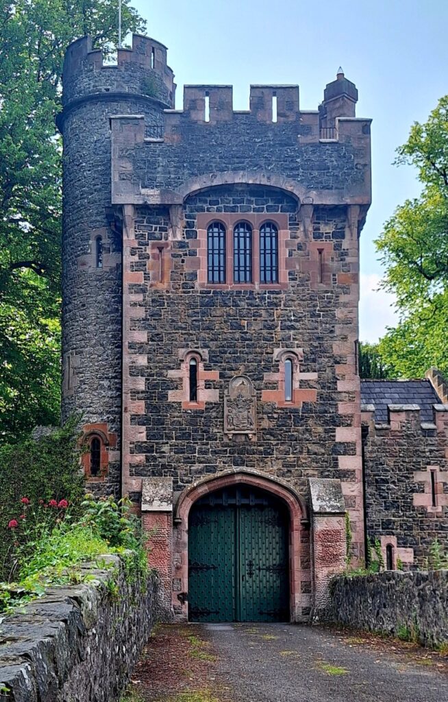
The starting point is close to the red blob in the map below, with parking between it and the main road:

(c) 2023 – the term ‘Whodunit Hunt’, associated logo, website content, and all Whodunit Hunt routes, ideas, photos, are all protected by copyright. Any copying, impersonation or distribution of anything embraced by our copyright is intellectual theft and therefore unlawful and illegal. Please respect the law as well as all of our hard work.
Who Killed Kevin From Kingscourt?
Kevin King from Kingscourt has been found murdered and our chief investigator needs your help to solve the crime. Although his body was found at Bailieborough square, we think he may have been murdered elsewhere. So the trail for clues starts at Kingscourt, where he lived.
 This Whodunit Hunt is a self-guided, driving murder mystery trail. It starts at Kingscourt and ends at the unique tin church of Laragh.
- The Ancient East Churches trail visits a variety of historic spots in Counties Cavan and Monaghan. See beautiful churches, enjoy a lovely forest walk, explore the main street of Ballybay, learn about historic Bailieborough town and an ancient fair, see beautiful lakes, an unusual statue of an elk… and more!
- We’ve squeezed nearly 30 clues into this trail with lots of historical information added to the Whodunit booklet so that you get to know just a little more about the places you’re visiting.
- The route is 78 km (almost 49 miles).
- The total walking distance spread across all of the clue stops is 5 ¾ km / 3 ½ miles. This includes a lovely woodland walk of 2 ½ km / 1 ½ miles at Bailieborough Demesne – if you wanted to use up two of your clue helps instead of walking this distance you could do this if you wished… though in the spring the bluebells are beautiful here.
- We suggest allowing 4-5 hours to complete this Whodunit Hunt, excluding extended refreshment stops…. so it’s great for a wee day out.
- Accessibility – once out of the car the terrain is fairly flat, with mostly moderate slopes. Reasonable mobility is required to do the forest walk. Alternative routes can be found around steps.

To purchase this Whodunit Hunt with credit / debit / Amex card please click here and type AE Churches in the ‘Special Requests’ field at the start of the purchase page.
To pay using Paypal click here (or in the menu) to order this, or any other, Whodunit Hunt.
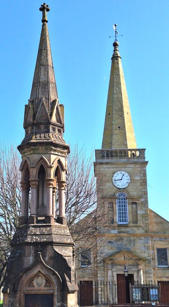
The starting point is at the church in Kingscourt shown below:
(c) 2023 – the term ‘Whodunit Hunt’, associated logo, website content, and all Hunt routes, ideas, images and photos, are protected by copyright. Any copying/distribution of anything embraced by our copyright is intellectual theft and therefore unlawful and illegal. Please respect the law as well as numerous years of our hard work.
Who Bashed Brian In Ballycastle?
Brian Duffy has been found murdered at Ballycastle and, with a mounting caseload, we need your help to solve the case. Brian’s body was found at the ferry terminal but no evidence was found near the body so we think he was killed elsewhere and left here to confuse detectives. Start searching for evidence at the harbour car park and see where the clues take you…
New launch for June 2025!
 The Ballycastle Whodunit Hunt is a self-guided murder mystery trail on foot.
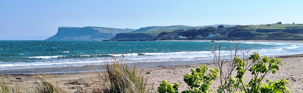
- Explore Ballycastle and you’ll find it is so much more than a seaside town! Did you know that it used to have a glass factory and a big coal mining industry? Or that Ireland’s first railway was built nearby? You can discover so much about the history of the town on this murder mystery trail, see a number of historic buildings, enjoy a river walk… and more!
- The clue route is almost 1 ½ miles / 2 ½ km. It starts at the harbour car park beside the visitor centre and ends near the Diamond – see map below.
- This Whodunit booklet is packed with over 30 clues to solve as well as several pieces of extra historical and tourist information not seen en route.
- The recommended time to complete this murder mystery is at least two hours, excluding refreshment stops.
- Accessibility – the route is generally fairly flat, with only moderate inclines (one short and steeper one) and no steps.
To purchase this Whodunit Hunt with credit / debit / Amex card please click here.
To pay using Paypal click here (or in the menu) to order this, or any other, Whodunit Hunt.
(c) 2023 – the term ‘Whodunit Hunt’, associated logo, website content, and all Whodunit Hunt routes, ideas, photos, are all protected by copyright. Any copying, impersonation or distribution of anything embraced by our copyright is intellectual theft and therefore unlawful and illegal. Please respect the law as well as all of our hard work.
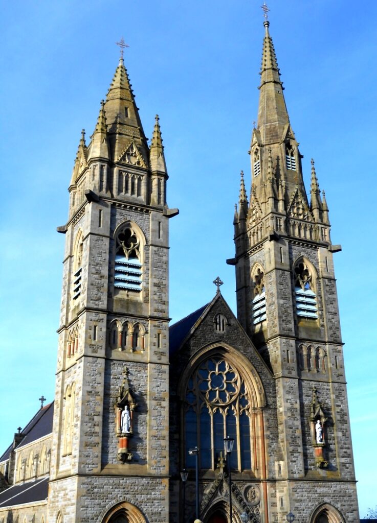
Who Massacred Bill From Ballymoney?
Bill Malarkey from Ballymoney has been found dead in the town and we need your help to confirm suspicions about the murder. Although his body was found at the railway station, we suspect that the murder occurred elsewhere and recommend you start your trail for clues at the Dunlop Memorial Garden.
 The Ballymoney Whodunit Hunt is a self-guided murder mystery trail on foot.
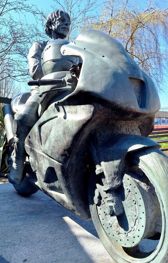
- You’ll especially love our Ballymoney Whodunit Hunt if you’re a biker as this is where the famous Dunlop racing family are from! You’ll start at the Dunlop memorial garden, and also see other sites associated with the family in the town. There are several historic buildings to see along the clue route too, including beautiful churches like the one below and the magnificent town hall. Read extra historical info in our booklet as well as tales of a ghost!
- The short clue route is almost 1 ½ miles / 2 ½ km. It starts at the Dunlop Memorial Garden and ends nearby – see map below.
- This Whodunit booklet is packed with over 25 clues to solve as well as several pieces of extra historical info and trivia not seen en route… including a ghost story!
- The recommended time for this murder mystery is 1 ½ – 2 hours, excluding refreshment stops.
- Accessibility – the route is generally fairly flat, with no steps.

To purchase this Whodunit Hunt with credit / debit / Amex card please click here.
To pay using Paypal click here (or in the menu) to order this, or any other, Whodunit Hunt.
(c) 2023 – the term ‘Whodunit Hunt’, associated logo, website content, and all Whodunit Hunt routes, ideas, photos, are all protected by copyright. Any copying, impersonation or distribution of anything embraced by our copyright is intellectual theft and therefore unlawful and illegal. Please respect the law as well as all of our hard work.
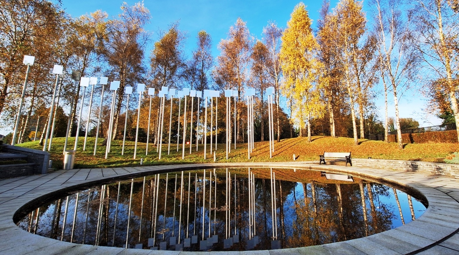
Who Obliterated Oliver In Omagh?
Oliver O’Neill has been found murdered in the historic city of Omagh and we desperately need your help to solve the murder. Although the bloody remains of Oliver’s body were found outside the old Wesleyan Chapel on James Street, we believe this was not where the murder was committed; however, clues to this murder mystery start here.
 The Omagh Whodunit Hunt is a self-guided, walking murder mystery trail.
- Omagh is alas remembered for the 1998 bombing that has resulted in a beautiful memorial garden being created to remember the victims. As well as visiting this garden, you’ll see quite a number of historic buildings on the clue route including beautiful churches, an old stone bridge, and the impressive courthouse. There is a musical interest too at more than one stop!
- There are 26 clues to solve, including quite a few picture clues to spot in order to narrow down the case evidence.
- The route is only 1 ½ miles / 2 ½ km.
- The recommended time for this murder mystery, excluding refreshment stops, is two hours.
- Accessibility – this is a mostly fairly flat route, with no steps, but there are some inclines near the start and end points.
To purchase this Whodunit Hunt with credit / debit / Amex card, please click here.
To pay using Paypal instead, click here.
The start / end point is shown below:
(c) 2023 – the term ‘Whodunit Hunt’, associated logo, website content, and all Hunt routes, ideas, images and photos, are protected by copyright. Any copying/distribution of anything embraced by our copyright is intellectual theft and therefore unlawful and illegal. Please respect the law as well as numerous years of our hard work.
Short On Time? Try A Taster Trail!
 Ever thought of trying a Whodunit Hunt but always short on time or weren’t sure how much you’d enjoy it? Or wondered if you’d be ‘good enough’ to solve a case (which really doesn’t matter)? Then try one of our new taster trails! We’ve specifically designed them to take around 90 minutes to complete with walking routes of less than a mile. We’ll give you help with two clues if you get stuck.
We’ve recently launched two walking taster trails, our Europa Trail in Belfast and the Newry Taster Trail. There’s still 17-18 clues to solve (rather less than the 30+ clues in our standard length trails in these cities) and you’ll get to see interesting places, learn about historic sites and people encountered along the routes, and discover something new!
We’ve just launched our first driving taster trails too – the Torr Road Taster Trail which starts at the quaint village of Cushendun and the Harry Ferguson Trail which follows in the footsteps of the famous inventor.
So try one of these taster trails and see if you’d like more of our kind of fun… definitely something different to do, for sure! They are at a bargain price of only £3.99!!
(c) 2023 – the term ‘Whodunit Hunt’, associated logo, website content, and all Whodunit Hunt routes, ideas, photos, are all protected by copyright. Any copying, impersonation or distribution of anything embraced by our copyright is intellectual theft and therefore unlawful and illegal. Please respect the law as well as all of our hard work.
Who Annihilated Ned In Newry?
Ned Black has alas been found murdered outside Café Krem on Hill Street but evidence suggests this was not where the murder was committed. Your help is needed to wrap up the case.
 This is a self-guided, walking murder mystery ‘taster trail’ in Newry, for if you’re short on time or want to try a mini Whodunit Hunt to see if you’ll like them. We hope you do!
- Did you know that Newry has a history stretching back around 1,000 years! It’s certainly not all about shops, and on this mini trail you’ll visit several historic stops, the canal, beautiful Newry Cathedral, and find out about several people remembered en-route as well as tragic maritime disasters.
- This may be a mini murder mystery but is still packed with 17 clues to solve. Despite sharing some of the route of our standard trail, we’ve come up with lots of different clues for this taster trail! It costs only £3.99!
- Allow 60-90 minutes to solve the clues.
- Accessibility – this is a totally flat route of less than a mile with no steps.
To purchase this Whodunit Hunt with credit / debit / Amex card please click here.
To pay using Paypal click here (or in the menu) to order this, or any other, Whodunit Hunt.
The clue hunt starts at the Market Place, shown below:
(c) 2023 – the term ‘Whodunit Hunt’, associated logo, website content, and all Hunt routes, ideas, images and photos, are protected by copyright. Any copying/distribution of anything embraced by our copyright is intellectual theft and therefore unlawful and illegal. Please respect the law as well as numerous years of our hard work.
Who Bludgeoned Bea In Belfast?
Bea White has alas been found murdered outside City Hall but evidence suggests this was not where the murder was committed. The trail for clues starts at the Europa Hotel, where her boyfriend used to work.
 This is a self-guided, walking murder mystery ‘taster trail’, for if you’re short on time or want to try a mini Whodunit Hunt to see if you’ll like them. We hope you do!
- On your clue hunt you’ll discover quite a number of historic spots and beautiful buildings on a trail less than a mile long. You’ll see the Grand Opera House, Belfast’s most famous bar and a much older drinking place, the beautiful Presbyterian Assembly Buildings, and much more. You’ll also learn about some interesting historical characters!
- The little Whodunit Hunt booklet for this murder mystery is still packed with 18 clues and some extra historical information too. Note: all of the clues are brand new for this Whodunit Hunt and separate from our main Belfast City trail.
- The recommended time for this murder mystery is 60-90 minutes and the route is completely flat. It costs only £3.99!
To purchase this Whodunit Hunt with credit / debit / Amex card please click here.
To pay using Paypal click here (or in the menu) to order this, or any other, Whodunit Hunt.
The starting point is at the Europa Hotel, shown in the map below:
(c) 2023 – the term ‘Whodunit Hunt’, associated logo, website content, and all Hunt routes, ideas, images and photos, are protected by copyright. Any copying/distribution of anything embraced by our copyright is intellectual theft and therefore unlawful and illegal. Please respect the law as well as numerous years of our hard work.
Who Wrecked Randalstown Ray’s Life?
Ray Campbell has been found dead at the base of the old railway viaduct, but the autopsy suggests that he was killed before being thrown off the bridge. However, with a large number of cases to solve, detectives need your help to conclude this case.
 This Whodunit Hunt is a self-guided murder mystery trail on foot.
- Randalstown is a small town with a huge amount of heritage so you’ll see loads of historic sites on our figure-of-eight walk here that takes you over the railway viaduct! See an unusually shaped church, the viaduct of course and the ancient road bridge, the gate lodge to Shane’s Castle, learn about the history of its buildings and the mill here, nearby Game Of Thrones filming locations… and more!
- The clue route is almost 1 ½ miles, or about 2 ½ km.
- This Whodunit booklet is packed with 33 clues to solve (the most we’ve ever squeezed into a walking Whodunit) and several pieces of extra historical information and trivia not seen en route.
- Allow a full two hours to solve this murder mystery, excluding refreshment stops.
- Accessibility – the route is generally fairly flat, with only moderate inclines and no steps.
To purchase this Whodunit Hunt with credit / debit / Amex card please click here.
To pay using Paypal click here (or in the menu) to order this, or any other, Whodunit Hunt.
The starting point and car park is shown in the map below:
(c) 2023 – the term ‘Whodunit Hunt’, associated logo, website content, and all Hunt routes, ideas, photos, are all protected by copyright. Any copying, impersonation or distribution of anything embraced by our copyright is intellectual theft and therefore unlawful and illegal. Please respect the law as well as all of our hard work.
 Tired of having the same old team-building events at pubs / restaurants? Looking for a new, fun, and very affordable idea for hen & stag days or a college / uni event? Then why not have a murder mystery themed event with one of our Whodunit Hunt trails!
The cost per booklet of our walking Whodunit Hunts is £6.99 and (standard length) driving Whodunit Hunts is £7.99 if sent by email only (or Euro equivalent)… so very affordable for a team event! Taster trails cost only £3.99!
 We give a discount for buying multiple copies of a Whodunit Hunt trail, depending on the number of copies needed. If you want us to print (on premium quality paper) and post your booklets then the discount will, at the least, give you free printing and reduced or free postage.
For a team event we advise teams of 2-3 people (although four is okay too) with one booklet per team. Booklets provided will each have a unique case id for each team to submit an answer. After purchase, we supply guidance on running your event and indicate the best place(s) for your teams to meet near the starting point of the chosen trail.
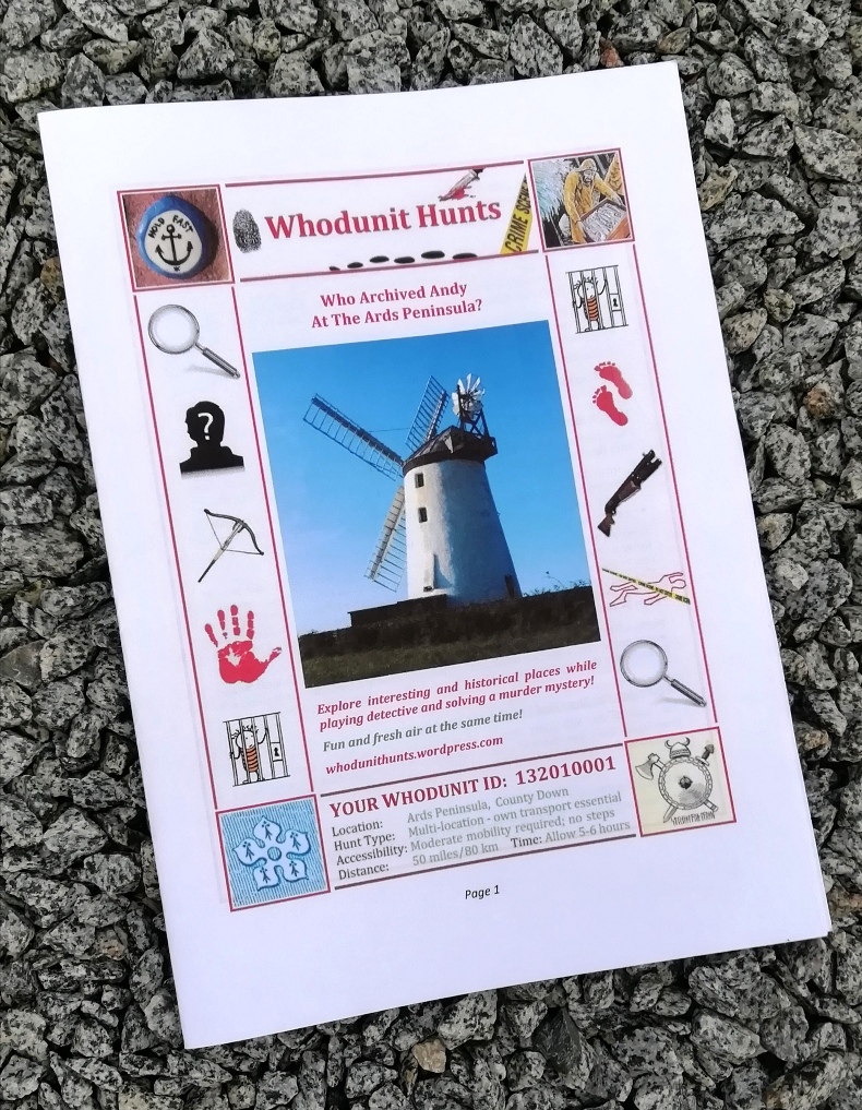
The photo shows an example booklet. If printing the booklets yourself, click this printing link for guidance.
Payment is by either card or Paypal – we’ll supply payment instructions when you’ve concluded the details of your event.
To make an enquiry just fill in the form below and we’ll get back to you with a quote and any queries that we may have about your event.
(c) 2023 – the term ‘Whodunit Hunt’, associated logo, website content, and all Hunt routes, ideas, images and photos, are protected by copyright. Any copying/distribution of anything embraced by our copyright is intellectual theft and therefore unlawful and illegal. Please respect the law as well as numerous years of our hard work.
