Who Struck Down Sean From Skerries?
Sean Black has been found murdered at the windmill in Skerries, close to the visitor centre, and our best but overworked investigator needs your help to solve the case. We believe he was killed elsewhere so your search for clues starts at Drogheda, where he worked.
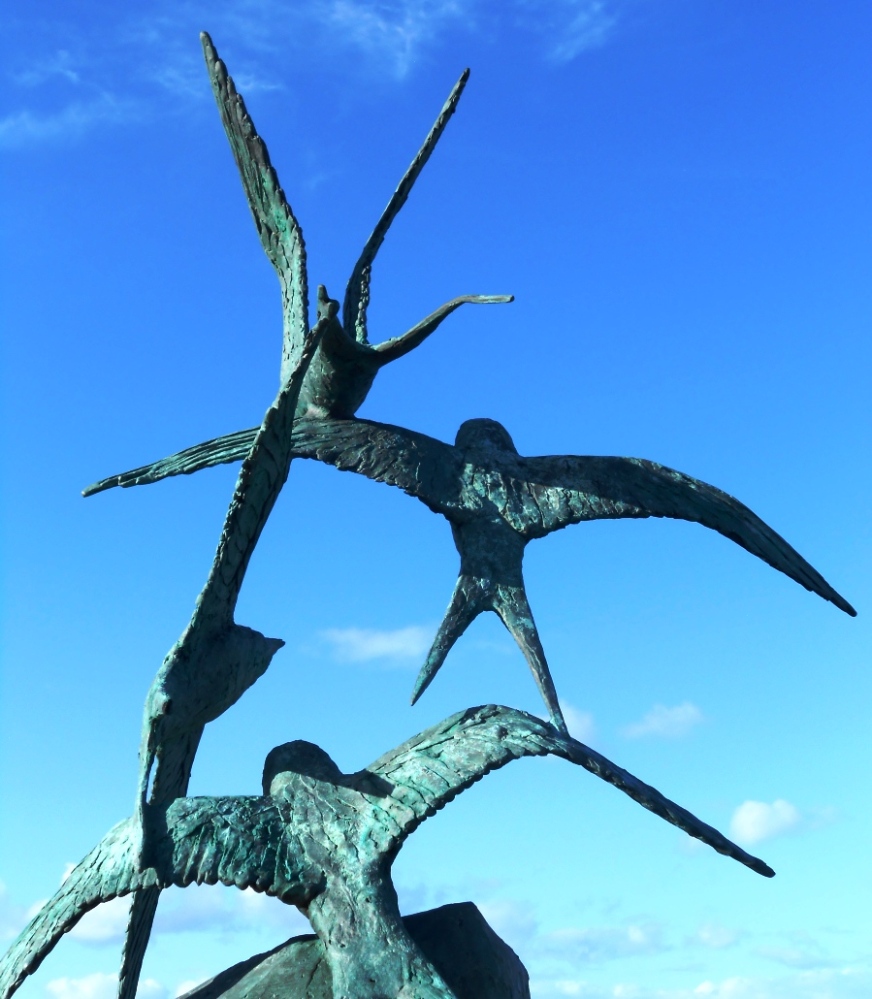 The Meath-Fingal Coast Trail is a self-guided, driving murder mystery trail. This Whodunit Hunt starts at Drogheda and ends at Rush.
- The clue route includes numerous historic sites and beautiful coastal scenery. You’ll see castles, seaside towns, assorted modern sculptures, windmills, a ruined church, an unusual ‘structure’… and more! Learn about the history and evolution of the area as you go and find out where St Patrick landed here too!
- We’ve squeezed 30 clues into this trail with lots of historical information added to the Whodunit booklet.
- The linear clue route is only 49 km (or about 31 miles). The total walking distance spread across all of the clues is up to 5 ½ km / 3.4 miles but you can reduce this by 1 km / 0.6 miles if you drive your vehicle down Ardgillan Castle’s driveway from its car park to solve one clue.
- We suggest allowing at least four hours to complete this Whodunit Hunt, excluding extended refreshment stops.
- Accessibility – once out of the car the terrain is generally quite flat, with only occasional moderate slopes; there are no steps.
- For refreshments, you will pass coffee shops, a number of bars and restaurants, and stores along the route.
To pay using Paypal click here (or in the menu) to order this, or any other, Whodunit Hunt.
To purchase this Whodunit Hunt with credit / debit / Amex card please click here and type Meath-Fingal Coast in the ‘Special Requests’ field at the start of the purchase page.
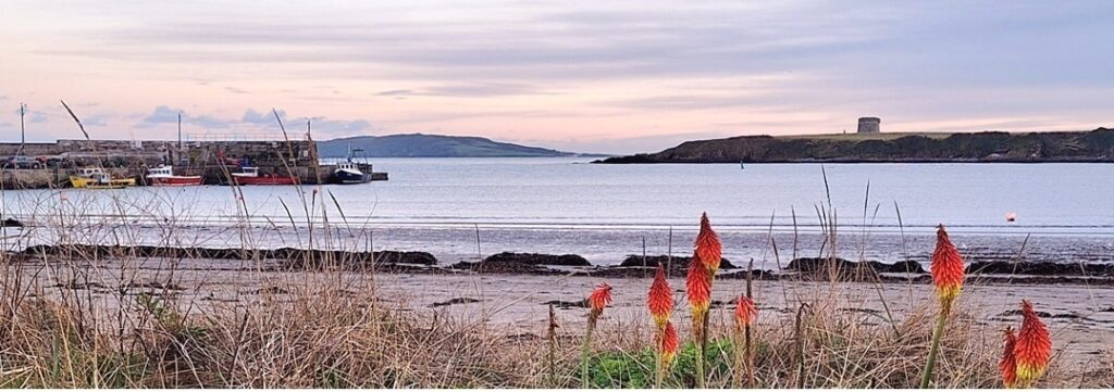
The starting point is at the Scotch Hall bus stop at Drogheda, shown below, with the route then heading along the R150 out of the town:

(c) 2023 – the term ‘Whodunit Hunt’, associated logo, website content, and all Hunt routes, ideas, images and photos, are protected by copyright. Any copying/distribution of anything embraced by our copyright is intellectual theft and therefore unlawful and illegal. Please respect the law as well as numerous years of our hard work.
Who Murdered Cora Rohan Along The Mourne Coastal Route?
Cora Rohan’s body has been found washed up on Cranfield West Beach but our investigators have uncovered very few leads and thus need your help to solve the murder. Although Cora’s body was found on the beach, we don’t believe she drowned or was murdered here and so have advised that the evidence trail starts in Restrevor.
 The Mourne Coast Whodunit Hunt is a self-guided, driving murder mystery trail. It starts beside Restrevor’s Kilbroney river bridge and ends on the outskirts of seaside town Newcastle.
- The route includes sights spanning a broad period of history from as far back as 5,000 years ago!! You’ll come across an old castle, a mill, and a neolithic tomb for starters. You’ll also visit the seaside, read tales of smugglers and ghosts, and learn about the evolution of Kilkeel as a major port. En route you will also see lovely coastal and mountain scenery too.
- The clue route is 33 miles, or about 50 km, before your return to the starting point (or home). There is generally moderate walking at all clue stops, approximately 2 ¼ miles / 3 ¾ km in total.
- We suggest allowing about four hours to complete this Whodunit Hunt, excluding refreshment stops.
 Accessibility – once out of your vehicle the terrain is mostly quite flat, with only occasional moderate slopes; there are no steps.
- For refreshments, you will pass convenience stores, coffee shops, bars and restaurants along the route.
To pay using Paypal click here (or in the menu) to order this, or any other, Whodunit Hunt.
To purchase this Whodunit Hunt with credit / debit / Amex card please click here.
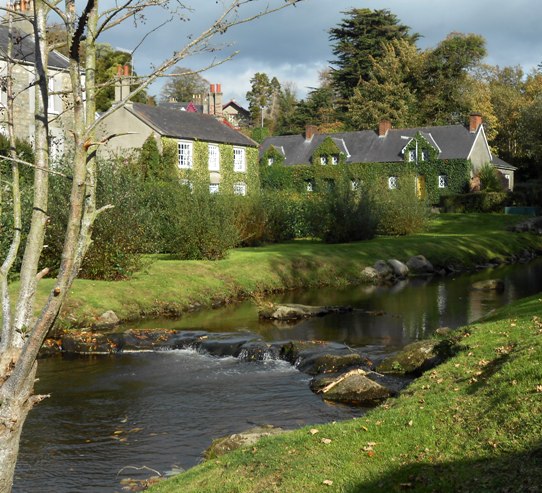
The starting point is beside Restrevor’s Kilbroney river bridge at the entrance to Fairy Glen:

(c) 2023 – the term ‘Whodunit Hunt’, associated logo, website content, and all Hunt routes, ideas, photos, are all protected by copyright. Any copying, impersonation or distribution of anything embraced by our copyright is intellectual theft and therefore unlawful and illegal. Please respect the law as well as all of our hard work.
Who Bludgeoned Ben From Blackrock?
Poor Ben O’Sullivan from Blackrock has been sadly found murdered and our stretched investigative team are struggling to close the case. His body was found dumped on the street below the ruined windmill, and the clue hunt starts here although it is considered he was murdered elsewhere.
 The Blackrock Coastal Trail Whodunit Hunt is a self-guided, driving murder mystery trail. It starts beside the ruined windmill at Dundalk and ends at the village of Baltry, near Drogheda.
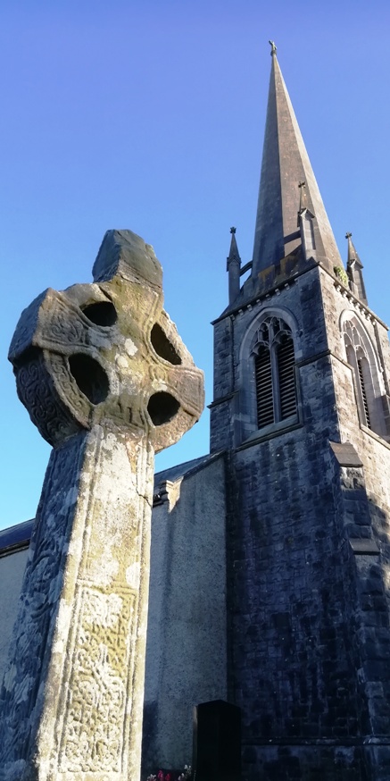
- The route includes sights spanning a broad period of history, from the invasion of the Vikings over 1100 years ago to tales from the second world war. You’ll see an old castle and ruined churches, an old Irish Cross on the site of a 7th Century monastery, learn about the development of tourism in Blackrock and a shipwreck further south, see some very large eggs… and more! En route you will also see lovely coastal scenery as you go.
- The clue route is 26 miles, or about 46km, before your return to the starting point (or home). There is generally moderate walking, approximately 2 miles / 3 km in total (not including a walk at the end to the shipwreck if you wish to do this).
- We suggest allowing at least four hours to complete this Whodunit Hunt, excluding refreshment stops.
- Accessibility – once out of the car the terrain is generally quite flat, with only occasional moderate slopes; there are no steps.
- For refreshments, you will pass coffee shops, a number of bars and restaurants, and stores along the route.
To pay using Paypal click here (or in the menu) to order this, or any other, Whodunit Hunt.
To purchase this Whodunit Hunt with credit / debit / Amex card please click here and type Blackrock Coast in the ‘Special Requests’ field at the start of the purchase page.

The starting point is on Quay Street beside the old windmill at Dundalk, shown below:

(c) 2023 – the term ‘Whodunit Hunt’, associated logo, website content, and all Hunt routes, ideas, photos, are all protected by copyright. Any copying, impersonation or distribution of anything embraced by our copyright is intellectual theft and therefore unlawful and illegal. Please respect the law as well as all of our hard work.
Who Liquidated Colm Along The Lecale Coast?
Colm O’Brien has been found murdered in the village of Rossglass and our best investigator is struggling to narrow down leads. We need your help to confirm their suspicions and crack the case! It is believed that Colm was murdered outside of the village and so the clue trail starts near Newcastle, at the ancient Maghera Church and Round Tower site.
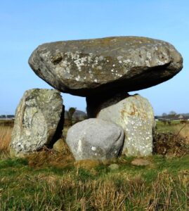 The Lecale Coast Trail is a self-guided, non-circular driving Whodunit Hunt.
- This murder mystery trail is jam-packed with historic sites along a driving route of only 30 miles, or about 50 km. You will visit, or pass, neolithic sites including the portal tomb shown in the photo and a large stone circle, numerous castles with seven in the coastal town of Ardglass alone, and a church over a thousand years old!! You will also see several other sites, beautiful coastal scenery (including the view of the Mourne mountains shown below), and learn about several characters who have helped shaped the area’s history.
- There is generally moderate walking, about 3 miles or 5 km in total, which is spread across all of the clues. Sensible shoes are required (e.g. trainers) for the walk to the stone circle clue.
- It is recommended to allow at least four hours to solve this murder mystery, excluding refreshment stops.
- Accessibility – once out of the car the terrain is generally fairly flat, but a few clues do require reasonable mobility.
- There are assorted places for refreshment along the route in many towns and villages.
To pay using Paypal click here (or in the menu) to order this, or any other, Whodunit Hunt.
To purchase this Whodunit Hunt with credit / debit / Amex card please click here.

The starting point is shown in the map below.

(c) 2023 – the term ‘Whodunit Hunt’, associated logo, website content, and all Hunt routes, ideas, photos, are all protected by copyright. Any copying, impersonation or distribution of anything embraced by our copyright is intellectual theft and therefore unlawful and illegal. Please respect the law as well as all of our hard work.
Who Archived Ann At The Antrim Coast?
Ann Collins has been found murdered on the beach at Ballygally, Northern Ireland, although crime scene technicians concluded that she didn’t drown and was killed elsewhere. Our best investigators have uncovered few leads and thus need your help to solve the crime.
 The Antrim Coast Whodunit Hunt starts at the junction of Tower Road in Larne and ends near Cushendall.
- This is a self-guided, non-circular driving murder mystery trail.
- Visit lovely villages and learn about key figures in the history of the area hundreds of years ago… and its geology tens of millions of years ago. See castles and towers, historic memorials and ruined churches, stunning coastline too… and even the Scottish coast on a clear day!
- Over 30 clues to solve now we’ve squeezed even more fun into this Whodunit trail!
- If you’re a Games Of Thrones fan, then there are two filming locations along the clue route to spot!
- All of the sights to see are on a driving route of only 25 miles, or 40km, from the start to the end point! There is about 2 miles / 3km of walking in total during this Hunt, spread across all of the clues.
- The recommended time for this murder mystery from start to end points, excluding refreshment stops, is 4-5 hours.
- Accessibility – it is generally flat where the clues are to be found, however the last clue has quite a steep slope down to it which can be slippery after wet weather (though it has been recently improved); sensible shoes for this clue are therefore strongly recommended.
- Note: if you live a way along the clue route and it’s inconvenient to drive to the start, simply begin with the clue that is closest to you and, once you get to the end, drive to the start and solve the rest of the clues!

To purchase this Whodunit Hunt with credit / debit / Amex card please click here.
To pay using Paypal click here (or in the menu) to order this, or any other, Whodunit Hunt.
The starting point is at the junction of Tower Road in Larne, County Antrim:

(c) 2023 – the term ‘Whodunit Hunt’, associated logo, website content, and all Whodunit Hunt routes, ideas, photos, are all protected by copyright. Any copying, impersonation or distribution of anything embraced by our copyright is intellectual theft and therefore unlawful and illegal. Please respect the law as well as all of our hard work.
 The Meath-Fingal Coast Trail is a self-guided, driving murder mystery trail. This Whodunit Hunt starts at Drogheda and ends at Rush.


 The Mourne Coast Whodunit Hunt is a self-guided, driving murder mystery trail. It starts beside Restrevor’s Kilbroney river bridge and ends on the outskirts of seaside town Newcastle.
 Accessibility – once out of your vehicle the terrain is mostly quite flat, with only occasional moderate slopes; there are no steps.

 The Lecale Coast Trail is a self-guided, non-circular driving Whodunit Hunt.
 The Antrim Coast Whodunit Hunt starts at the junction of Tower Road in Larne and ends near Cushendall.