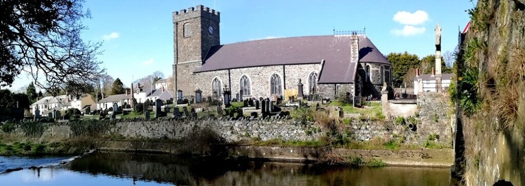
Who Dispatched Dani From Dungiven?
Dani Kelly from Dungiven has been murdered and detectives need your help to solve the mystery around her death. Although her body was found at the Dungiven priory site detectives have strong suspicions that she was murdered elsewhere. The hunt for clues starts at Castledawson, where her boyfriend lives.
RECENT LAUNCH!
 The Glenshane Heaney Trail Whodunit Hunt starts at Castledawson and ends at Portglenone.
- This is a self-guided, driving murder mystery trail.
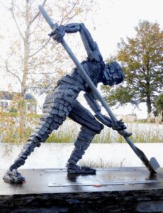
- This trail’s name comes from the spectacular pass that the route traverses, and the famous poet Seamus Heaney who was born near the starting point. As well as beautiful scenery you’ll visit numerous historic sites including the Seamus Heaney Homeplace, Dungiven Priory, a ruined church with a rare structure, visit a forest park, find out about a highwayman from the area… and more!
- Over 30 clues have been squeezed into this Whodunit Hunt in a booklet containing several bits of additional historical information!
- The clue route is 57 miles / 92 km. There is a moderate 2¼ miles / 3½ km of walking, spread across all clue stops.
- The recommended time to solve this murder mystery, excluding refreshment stops, is likely to be about five hours.
- Accessibility – it is generally flat where most of the clues are to be found, though there are some inclines where sensible shoes are recommended.
To pay using Paypal click here (or in the menu) to order this, or any other, Whodunit Hunt.
To purchase this Whodunit Hunt with credit / debit / Amex card please click here.
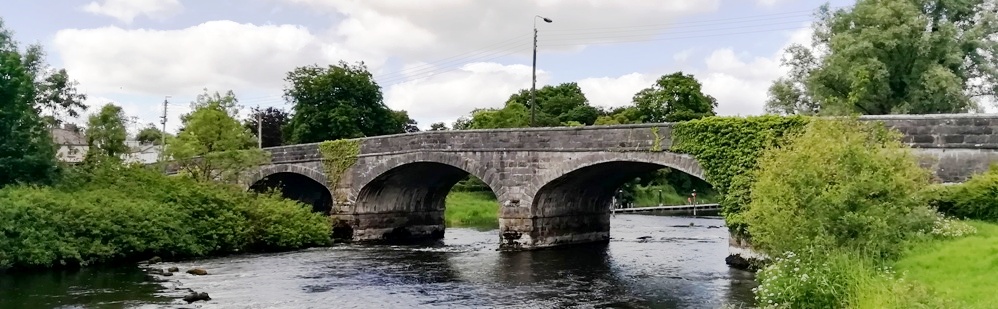
The starting point is in Castledawson, at the roadside car park beside the Moyola river bridge:

(c) 2023 – the term ‘Whodunit Hunt’, associated logo, website content, and all Hunt routes, ideas, photos, are all protected by copyright. Any copying, impersonation or distribution of anything embraced by our copyright is intellectual theft and therefore unlawful and illegal. Please respect the law as well as all of our hard work.
Who Destroyed Deirdre In Derry?
Deirdre Moore has been found murdered in the historic walled city of Derry and we desperately need your help to solve the murder. Although the remains of Deirdre’s body were found near the Guildhall, we believe this was not where the murder was committed. The trail starts on the other side of the Peace Bridge, near where Deirdre lived.
 The Derry City Whodunit Hunt is a self-guided, walking murder mystery trail.
- Discover a wealth of history in this unique place, one of the best preserved walled cities in all of Europe! You’ll cross the Peace Bridge, visit the Guildhall with its impressive pipe organ, and then explore much of the city walls (and beyond) to see numerous historic and varied sites. You’ll see the cathedral, huge cannons, grand architecture, read ghost stories… and more!
- This Whodunit Hunt is jam-packed with over 30 clues to solve! The booklet also contains several pieces of extra historical and tourist information.
- There are a number of guided tours around Derry (usually in groups with a guide), and all have their merits. However, if you want a really affordable self-guided tour with a murder mystery theme that you can do at your own pace then we think ours is hard to beat! Our Whodunit trail even takes you to historic places beyond the city walls and packs in a plethora of varied sights in the city! We don’t dwell on the history of ‘The Troubles’, though – we wanted to keep our trail a bit more light-hearted.
- The recommended time for this murder mystery is about 3 hours, excluding refreshment stops.
- Accessibility – we don’t feel this particular Whodunit Hunt is suitable for people with mobility issues owing to steps to navigate and inclines for some clues.
To pay using Paypal click here (or in the menu) to order this, or any other, Whodunit Hunt.
To purchase this Whodunit Hunt with credit / debit / Amex card please click here.

The starting point is on the south side of the river beside the Bakery Ebrington, shown in the map below, with free parking nearby. The route ends near the Guildhall.
(c) 2023 – the term ‘Whodunit Hunt’, associated logo, website content, and all Hunt routes, ideas, images and photos, are protected by copyright. Any copying/distribution of anything embraced by our copyright is intellectual theft and therefore unlawful and illegal. Please respect the law as well as numerous years of our hard work.
Who Decimated Dolly in Dromore?
Dolly Moore has been found murdered in the historic market town Dromore and our best team of investigators are struggling to conclude the case and thus need your help to solve the murder.
 The Dromore Whodunit Hunt is a self-guided, walking murder mystery trail.
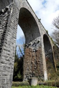
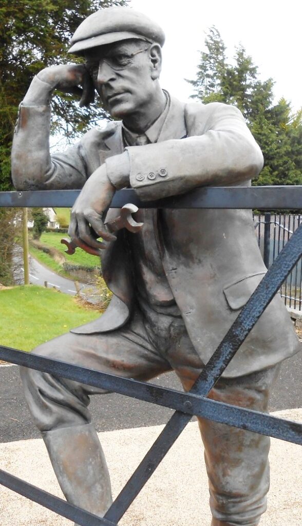
- Learn about the surprising amount of history that this former market town has to offer, which dates back over 800 years! You’ll learn about its railway history and see the impressive railway viaduct up close, read about famous inventor Harry Ferguson who was born nearby, see the cathedral and remains of an ancient Irish cross… and much more.
- The route is a moderate 1 ¾ miles, or about 2 ¾ km.
- The recommended time for this murder mystery, excluding refreshment stops, is around two hours.
- Accessibility – this is a mostly quite flat route, with just 2-3 steps to one clue.
- Refreshments – there are restaurants, cafes, and convenience stores along the clue trail.
To pay using Paypal click here (or in the menu) to order this, or any other, Whodunit Hunt.
To purchase this Whodunit Hunt with credit / debit / Amex card please click here.
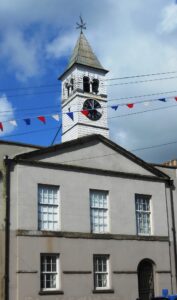
The hunt for clues starts/ends at Dromore Park, shown below:
(c) 2023 – the term ‘Whodunit Hunt’, associated logo, website content, and all Hunt routes, ideas, images and photos, are protected by copyright. Any copying/distribution of anything embraced by our copyright is intellectual theft and therefore unlawful and illegal. Please respect the law as well as numerous years of our hard work.
Who Bludgeoned Oisin From Belfast?
Oisin White has been found murdered at Shaw’s Bridge in Outer Belfast and our best but overworked investigator needs your help to solve the case. Oisin’s body was found at Shaw’s Bridge, but we believe he was killed elsewhere. The clue trail starts at Drum Bridge car park, see where the evidence trail leads you…
 This is a self-guided, linear driving Whodunit Hunt, starting near Drumbeg and ending in Belfast.
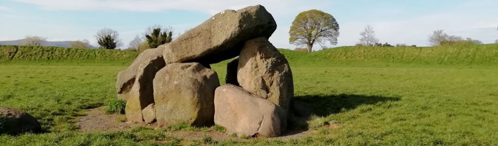
- On your clue hunt you’ll see historic houses and gardens, an ancient burial tomb, the site of an American military cemetery, visit a historic waterway and the land of Narnia… and more!
- The driving route is only 20 miles / 31 km long with nearly 30 clues to solve! There is nearly 2 ¾ / 4 ¼ km of walking in total.
- It is recommended to allow 4-5 hours to solve this murder mystery, excluding refreshment stops.
- Accessibility – there are no steps to navigate but moderate inclines.
- There are assorted places for refreshment; we like the Lockkeeper’s Cottage, especially in spring/summer for alfresco eats.
To pay using Paypal click here (or in the menu) to order this, or any other, Whodunit Hunt.
To purchase this Whodunit Hunt with credit / debit / Amex card please click here.
The starting point is shown in the map below.
(c) 2023 – the term ‘Whodunit Hunt’, associated logo, website content, and all Hunt routes, ideas, photos, are all protected by copyright. Any copying, impersonation or distribution of anything embraced by our copyright is intellectual theft and therefore unlawful and illegal. Please respect the law as well as all of our hard work.
Who Archived Cath From Athboy?
Cath Borgogne from Athboy has been found murdered and our best team of investigators are struggling to conclude the case and thus need your help to solve the murder. Although her body was found in the Fair Green at Athboy it is believed that she was murdered elsewhere – the hunt for clues starts at nearby Rathmore.
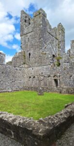 Discover magnificent Fore Abbey (over 1,300 years old), an impressive hilltop neolithic tomb, castles… and more as you try and solve over 30 clues! You will also explore the historical small town of Athboy which has several old sites that form a part of its long history.
- The linear clue route of this murder mystery trail is 42 miles, or about 68 km, from the starting point near Athboy to the end point on the outskirts of Kells.
- We suggest allowing four hours to solve this Whodunit Hunt, excluding any refreshment stops.
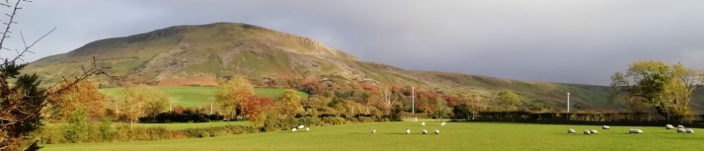
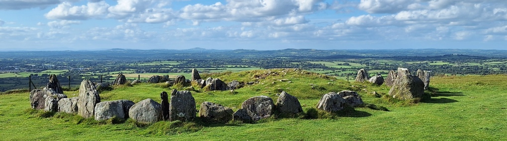
- There is a moderate amount of walking at a small number of locations, totalling 3 km or nearly 2 miles. You can also do a longer walk for pleasure up to the amazing Loughcrew Cairn and nearby stone circle – we highly recommend this for the reward of amazing panaromic views too (such as that shown below) if you have time and energy.
- Accessibility – the walking portions of the Whodunit Hunt are generally fairly flat.
- For refreshments, Athboy is your best bet with quite a number of options, or Kells once you have finished.
To pay using Paypal click here (or in the menu) to order this, or any other, Whodunit Hunt.
To purchase this Whodunit Hunt with credit / debit / Amex card please click here and type Meath in the ‘Special Requests’ field at the start of the purchase page.
The starting point is shown in the map below:
(c) 2023 – the term ‘Whodunit Hunt’, associated logo, website content, and all Hunt routes, ideas, photos, are all protected by copyright. Any copying, impersonation or distribution of anything embraced by our copyright is intellectual theft and therefore unlawful and illegal. Please respect the law as well as all of our hard work.
Who Bludgeoned Bert In Belturbet?
Bert O’Brien has been found murdered in the historic town of Belturbet. Our investigator on the case is struggling to make sense of the evidence and needs your help to solve the murder. Although Bert’s body was found in the river, the coroner soon ruled out drowning during his examinations. The starting point is the Mill Walk car park where spots of blood were first found – see where the evidence leads you…
- This Whodunit Hunt is a self-guided, walking murder mystery trail.
- There is much to discover on the clue trail at Belturbet, pleasantly situated overlooking the River Erne. Visit the site of an old castle, the former railway station, enjoy a river walk, learn about the numerous historic spots in the town which dates back to the 12th Century, read ghost stories… and more!
 Over 30 clues to solve in a booklet packed with extra historical details not found en-route!
- The route is 2½ miles, or about 4km.
- The recommended time to solve this Whodunit Hunt, excluding refreshment stops, is 2-3 hours.
- Accessibility: this is generally quite a flat route, with no steps, but there are a couple of hills to navigate.
- For refreshments you will pass local stores, takeaways, bars and a restaurant.
The starting point is at the Mill Walk car park at the bottom of the hill near Kilconny Bridge, shown below.
To pay using Paypal click here (or in the menu) to order this, or any other, Whodunit Hunt.
To purchase this Whodunit Hunt with credit / debit / Amex card please click here and type Belturbet in the ‘Special Requests’ field at the start of the purchase page.
(c) 2023 – the term ‘Whodunit Hunt’, associated logo, website content, and all Hunt routes, ideas, photos, are all protected by copyright. Any copying, impersonation or distribution of anything embraced by our copyright is intellectual theft and therefore unlawful and illegal. Please respect the law as well as all of our hard work.
Who Murdered Mary In Moneymore?
Mary Mahon has alas been found murdered in the historic village of Moneymore. We recommend you start your murder trail at the Manor House beside the roundabout in Moneymore, as her body was found dumped there, however detectives think the murder was carried out elsewhere.
 This Whodunit Hunt is a self-guided, walking murder mystery trail.
- Moneymore used to be a thriving market town 200 years ago. Why not explore the main spots on its heritage trail and solve a murder mystery at the same time! There are numerous historic sites and buildings to see, also learn about the village’s part in the area’s lime industry, its railway history, an ancient battle, even hear of a ghost story!
- The clue route is approximately 1.4 miles, or about 2 ½ km, and starts at the old Manor House building.
- This Whodunit trail has 25 clues in a booklet packed with several pieces of extra historical information.
- The recommended time for this murder mystery is 1½-2 hours, excluding any stops for refreshment.
- Accessibility – some streets are just slightly hilly, but there are no steps to navigate.
- Refreshments – there are takeaways, a cafe, and a tearoom along your clue hunt.
To pay using Paypal click here (or in the menu) to order this, or any other, Whodunit Hunt.
To purchase this Whodunit Hunt with credit / debit / Amex card please click here.
The starting point is shown below:
(c) 2023 – the term ‘Whodunit Hunt’, associated logo, website content, and all Hunt routes, ideas, images and photos, are protected by copyright. Any copying/distribution of anything embraced by our copyright is intellectual theft and therefore unlawful and illegal. Please respect the law as well as numerous years of our hard work.
Who Tortured Terry To His End?
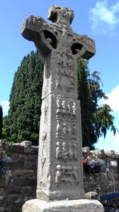
Terry Williams has been found dead at the old cross at Donaghmore. Our detective is struggling to get to the bottom of the evidence collected and needs your help to solve the murder. Crime scene investigators suggest Terry’s body was left here to confuse us and that he was murdered elsewhere… but where? He frequently explored the area that the Torrent River flows, and beyond, and your clue hunt is focussed here.
 The Torrent Trail is a driving Whodunit Hunt that starts at Donaghmore and ends at Aughnacloy. It is a self-guided, murder mystery trail.
- Your 42 mile / 67 km route takes in a wealth of historic sites! You’ll see impressive Irish Crosses and a detailed replica, a castle ruin, an ancient hill fort, visit an old cottage where the parent of a past U.S. president lived… and lots more!
- 26 clues to solve, and loads of little historical info snippets squeezed into our booklet to give you as much value as possible.
- There is only 1 ¼ miles / 2 km of walking in total on this Whodunit Hunt that must be done to solve the clues. However there are optional short walks to do if you wish, along the River Torrent, up to a Neolithic tomb thousands of years old, in a ‘royal’ forest, and to the magical St Patrick’s Chair.
- The recommended time for this murder mystery, excluding refreshment stops or extended walks, is 4-5 hours.
- Accessibility – it is mostly flat where the clues are to be found, apart from a short hill ascent to Clogher Fort.

To purchase this Whodunit Hunt with credit / debit / Amex card please click here.
To pay using Paypal click here (or in the menu) to order this, or any other, Whodunit Hunt.
The starting point is at Donaghmore, near Dungannon as shown in the map below:
(c) 2023 – the term ‘Whodunit Hunt’, associated logo, website content, and all Whodunit Hunt routes, ideas, photos, are all protected by copyright. Any copying, impersonation or distribution of anything embraced by our copyright is intellectual theft and therefore unlawful and illegal. Please respect the law as well as all of our hard work.
Who Murdered Monica In Monaghan?
Monica Keogh has been found murdered in Monaghan and even our best investigator is struggling to tie up the case and thus needs your help to solve the murder. Although Monica’s body was found in the Diamond, we believe this was not where the murder was committed and recommend you start your hunt for clues at the Cathedral gates.
 This Whodunit Hunt is a self-guided, walking murder mystery trail.
- Monaghan is a busy town with many historic spots and along the clue trail you’ll see many of them, including the cathedral, the Market House, and The Diamond with its Rossmore Memorial.
- The clue route is 2 ¾ km / 1 ¾ miles.
- The Whodunit Hunt booklet is packed with 30 clues to solve as well as several extra pieces of historical information and trivia!
- The recommended time for this murder mystery is 2-3 hours, excluding refreshment stops.
- Accessibility – the route is fairly flat, but there are some hilly streets, especially from the cathedral into town; you can avoid the latter by parking at the bottom of the hill after the first three clues if you wish.
- Refreshments – there are a number of options, including coffee shops, cafes, restaurants, and bars.
To pay using Paypal click here (or in the menu) to order this, or any other, Whodunit Hunt.
To purchase this Whodunit Hunt with credit / debit / Amex card please click here and type Monaghan in the ‘Special Requests’ field at the start of the purchase page.
The starting point is at the foot of the cathedral steps, as shown in the map below, with free parking on the side street:
(c) 2023 – the term ‘Whodunit Hunt’, associated logo, website content, and all Hunt routes, ideas, images and photos, are protected by copyright. Any copying/distribution of anything embraced by our copyright is intellectual theft and therefore unlawful and illegal. Please respect the law as well as numerous years of our hard work.
Who Buried Henry In Hillsborough?
The body of Henry Hale was unearthed by a curious dog beside the plane sculpture at Hilsborough Lake! But detectives believe he was murdered elsewhere and quite likely outside the village of Royal Hillsborough. With a big case load, our chief detective needs your help to conclude the case.
 This is a self-guided driving Whodunit Hunt, starting at Hillsborough Lake and ending a few miles away. It’s a mini ‘taster trail’ for if you want to start small with driving Whodunit Hunts or don’t have much time.
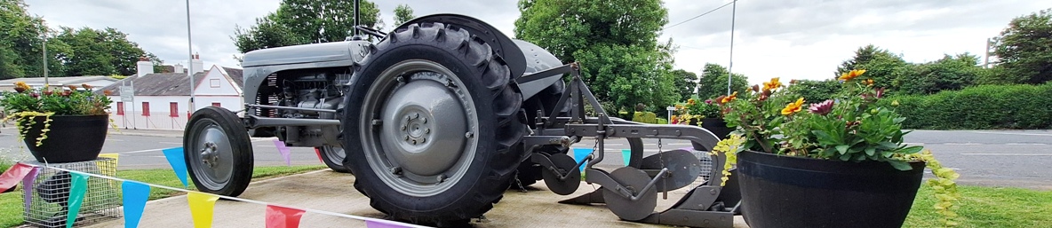
- Starting at Hillsborough Lake the clue trail takes you to several sites associated with famous inventor and extraordinary pioneer Harry Ferguson who was born in the area. You’ll also visit an ancient fort site dating back over 1000 years and an old motte and bailey almost as old! All this packed into a driving route of only 23 miles / 37 km long!!
- There are still 14 clues to solve in the mini Whodunit booklet which also has full directions and several snippets of history and trivia squeezed into it! There is only one mile / 1.6 km of walking in total.
- It is recommended to allow 1 ½ – 2 hours to solve this murder mystery, excluding refreshment stops.
- Accessibility – the route is generally flat.
To pay using Paypal click here (or in the menu) to order this, or any other, Whodunit Hunt.
To purchase this Whodunit Hunt with credit / debit / Amex card please click here.
The starting point is shown in the map below.
(c) 2023 – the term ‘Whodunit Hunt’, associated logo, website content, and all Hunt routes, ideas, images and photos, are protected by copyright. Any copying/distribution of anything embraced by our copyright is intellectual theft and therefore unlawful and illegal. Please respect the law as well as numerous years of our hard work.
