Who Abrogated Artie’s Life in Ardee?
Artie Sullivan has been found murdered in Ardee. His body was found on the Riverway Walk, but we’re sure that he was murdered elsewhere. Our best team of investigators have uncovered few leads and thus need your help to solve the murder.
New improved trail route now available!
 The Ardee Whodunit Hunt is a self-guided, walking murder mystery trail.
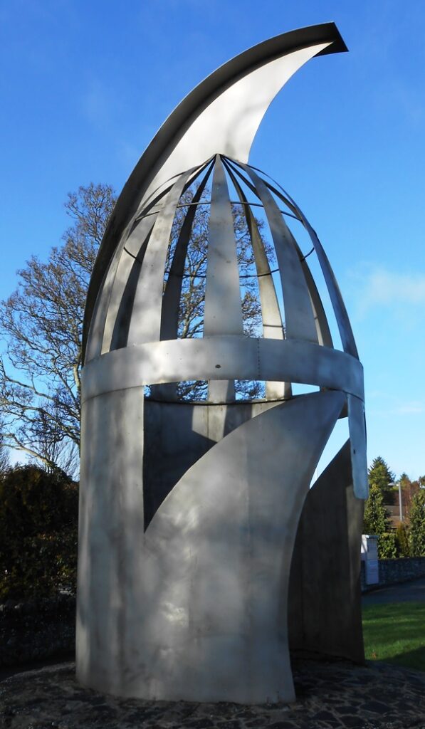
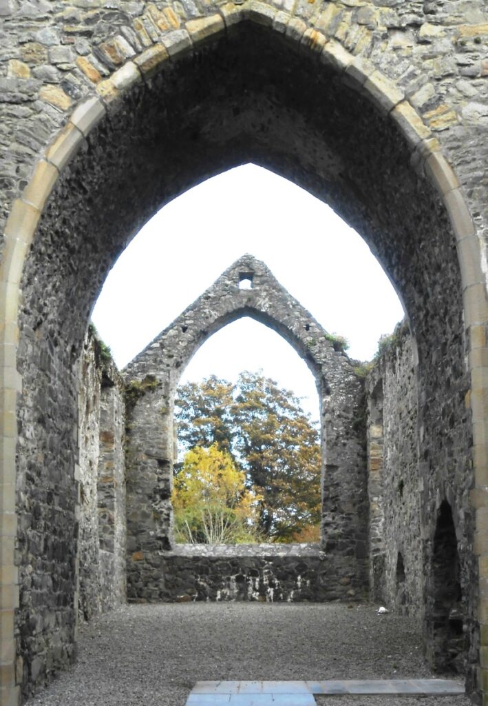
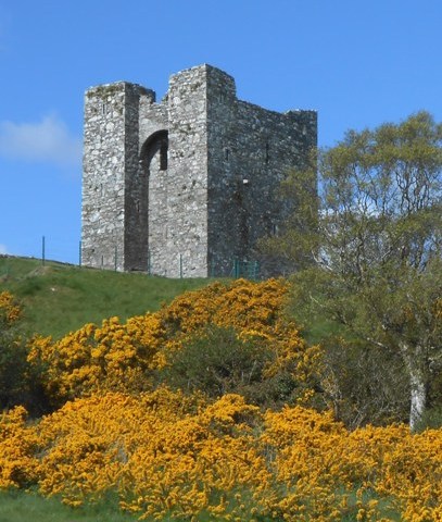
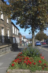
- Ardee is a very historic town dating back to the early 14th Century!! On your hunt for clues discover castles, old churches and several other historic buildings as well as learning about the origins of Ardee town and epic Irish battles. You may see local artworks on the main street too.
- The route is 2 ¼ miles, or about 3 ½ km.
- The recommended time to solve this murder mystery, excluding refreshment stops, is about two hours.
- Accessibility – this is generally a flat route, with occasional moderate inclines but no steps.
To purchase this Whodunit Hunt with credit / debit / Amex card please click here and type Ardee in the ‘Special Requests’ field at the start of the purchase page.
To pay using Paypal click here (or in the menu) to order this, or any other, Whodunit Hunt.
The starting point is shown in the map below.

(c) 2023 – the term ‘Whodunit Hunt’, associated logo, website content, and all Hunt routes, ideas, images and photos, are protected by copyright. Any copying/distribution of anything embraced by our copyright is intellectual theft and therefore unlawful and illegal. Please respect the law as well as numerous years of our hard work.
Who Clobbered Colin At The Cooley Peninsula?
Colin O’Brien has been found murdered in the village car park of Carlingford, though it is believed this was not where the murder was committed. Our best investigators have uncovered few leads and need your help to solve the murder.
 The Cooley Peninsula Whodunit Hunt is a self-guided, driving murder mystery trail. It starts beside Newry’s Quays shopping centre and ends at the village of Lordship near Dundalk.
- The Cooley Peninsula has a wealth of history to discover, including maritime disasters, castles and a priory, and the people (some of royal heritage) that have shaped the area’s history. You will also visit a site of great religious significance, see much wonderful scenery… and more!
- The clue route is only 19 miles, or about 31km, plus return to Newry/home. There is generally moderate walking, mostly in Carlingford where you have 0.9 miles / 1.4 km to cover.
- The recommended time to solve this murder mystery hunt, excluding refreshment stops, is 3-4 hours.
- Accessibility – once out of the car the terrain is generally quite flat, with only occasional moderate slopes and no steps.
- For refreshments, you will pass a lovely tea room with many irresistible cakes, convenience stores, as well as a number of bars and restaurants along the route – our recommendations are in Carlingford.
To pay using Paypal click here (or in the menu) to order this, or any other, Whodunit Hunt.
To purchase this Whodunit Hunt with credit / debit / Amex card please click here.
The starting point is beside the Quays in Newry, as shown below; you start by heading south along Albert Basin.
(c) 2023 – the term ‘Whodunit Hunt’, associated logo, website content, and all Hunt routes, ideas, photos, are all protected by copyright. Any copying, impersonation or distribution of anything embraced by our copyright is intellectual theft and therefore unlawful and illegal. Please respect the law as well as all of our hard work.
Who Dispatched Donald in Dundalk?
Donald McClintock has been found murdered in Dundalk. His body was found at the gates of St Patrick’s Cathedral, but we consider that he was likely murdered elsewhere. Even our best team of investigators are struggling to make sense of the evidence gathered and need your help to solve the case.
 The Dundalk Whodunit Hunt is a self-guided, walking murder mystery trail. It starts at Kelly Memorial beside the cathedral, and ends nearby.
- Dundalk has a huge amount of history that you can discover while hunting for clues, some dating back to the 13th Century! See a ruined windmill, a magnificent cathedral and many other historic buildings, as well as learning about people involved in the town’s history. You’ll also see a peace garden, the distant scenery of the Cooley Mountains… and more!
- The clue route is 2 ¼ miles, or about 3 ½ km.
- The recommended time to solve this murder mystery hunt, excluding refreshment stops, is about three hours.
- Accessibility – this is a flat route, with no steps.
- For refreshments, you will pass coffee shops and convenience stores as well as a number of bars and restaurants along the route.
To pay using Paypal click here (or in the menu) to order this, or any other, Whodunit Hunt.
To purchase this Whodunit Hunt with credit / debit / Amex card please click here and type Dundalk in the ‘Special Requests’ field at the start of the purchase page.
The starting point is Kelly’s Monument near the cathedral, shown in the map below.
(c) 2023 – the term ‘Whodunit Hunt’, associated logo, website content, and all Hunt routes, ideas, images and photos, are protected by copyright. Any copying/distribution of anything embraced by our copyright is intellectual theft and therefore unlawful and illegal. Please respect the law as well as numerous years of our hard work.
 If you’re a Game Of Thrones fan, then on some of our Whodunit Hunts you’ll see locations where some of the filming for this multi-series epic actually took place and/or be able to visit other filming locations nearby. Keep a keen eye out for signs erected for the long-running series!
You’ll pass two filming locations on our Antrim Coast clue route and one on each of our Lough Neagh and St Patrick’s trails. We have at least two other Whodunit Hunts in the pipeline which also pass, and come close to, filming locations – one coming soon, watch this space!
(c) 2023 – the term ‘Whodunit Hunt’, associated logo, website content, and all Whodunit Hunt routes, ideas, photos, are all protected by copyright. Any copying, impersonation or distribution of anything embraced by our copyright is intellectual theft and therefore unlawful and illegal. Please respect the law as well as all of our hard work.
Who Murdered Moira in Moira?
Moira Gorman has been found murdered at the railway station just outside the pretty town of Moira, though there is no sign that this was where the crime was committed. Even our best team of investigators have uncovered few leads and need your help to solve the murder.
 The Moira Whodunit Hunt starts and ends at the car park situated off Main Street, marking one of the entrances to Moira Demesne.
- This is a self-guided, walking murder mystery trail.
- Explore this pretty village as you hunt for clues. Admire seasonal flower displays that have made Moira a frequent winner of Ulster In Bloom, learn about the man who shaped Moira hundreds of years ago into the village you see today, find out about the linen and quarrying industries of the area… and more! Almost 30 clues to solve!
- The route is 2 ½ miles, or about 4 km.
- The recommended time for this murder mystery, excluding refreshment stops, is 2-3 hours.
- Accessibility – this is a generally flat route, with little in the way of gradient and no steps.
- Refreshments – you will be spoilt for choice in Moira, which has an abundance of excellent coffee shops, restaurants, and cafes. We like Fine on the main street for good value lunches
To pay using Paypal click here (or in the menu) to order this, or any other, Whodunit Hunt.
To purchase this Whodunit Hunt with credit / debit / Amex card please click here.
The entrance to the Moira Park Demesne for the starting point is opposite the point shown in the map below:
(c) 2023 – the term ‘Whodunit Hunt’, associated logo, website content, and all Hunt routes, ideas, images and photos, are protected by copyright. Any copying/distribution of anything embraced by our copyright is intellectual theft and therefore unlawful and illegal. Please respect the law as well as numerous years of our hard work.
Who Slaughtered Steven Gray In The Slieve Gullion Area?
Steven Gray has been found murdered at Meigh, near Newry, but it is believed he was killed elsewhere. Even our best team of investigators have uncovered very few leads and thus need your help to solve the murder.
Standard and deluxe length versions now available!!
 The Slieve Gullion Whodunit Hunt starts at Derrymore House, near Newry.
- This is a self-guided, circular driving murder mystery trail.
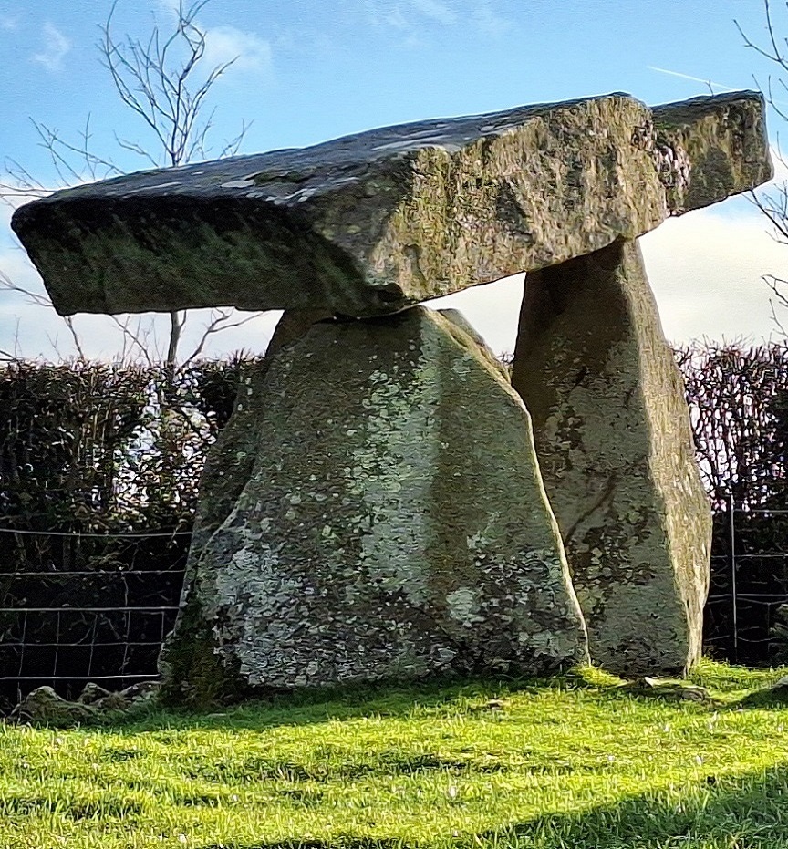
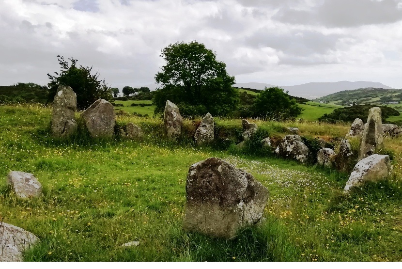
- You’ll see super mountain scenery as you drive around the Ring Of Gullion area. Also learn about the area’s past linen industry, visit a National Trust woodland house, an ancient church and significant monastic site, a nelithic tomb dating back thousands of years… and more!
- Having created the new standard trail version we’ve even squeezed in an extra optional site to see en-route in both versions of this murder mystery, the tripod dolmen shown in the top photo! You can read about this tomb here.
- The standard version of this trail has a route of only 19 miles, or 31 km! The recommended time to solve the case is 3-4 hours.
- There is about 2½ miles / 4 km of walking in total, spread across numerous clue stops along the route.
 The deluxe version of this trail also visits a graveyard where the brother of Robert The Bruce is buried, a ruined castle, and a holy shrine – it has 39 clues in a bumper-sized booklet that we suggest allowing at least five hours to solve. The deluxe route is about 40 miles / 64 km with an extra ½ mile of walking.
- Accessibility – it is mostly fairly flat where the clues are to be found.
- There are several bars, cafes, coffee shops, and convenience stores along the route.
- Note: in April 2024 a parking charge of £5 was introduced by Slieve Gullion Forest Park. It is possible to avoid this with additional walking (and we’ve given instructions in the booklet if necessary), but for all this investigative fun we think that this fee on top of the price of the Whodunit booklet is still incredible value!
To pay using Paypal click here (or in the menu) to order this, or any other, Whodunit Hunt.
To purchase this Whodunit Hunt with credit / debit / Amex card please click here.
The starting point is shown in the map below:
(c) 2023 – the term ‘Whodunit Hunt’, associated logo, website content, and all Hunt routes, ideas, photos, are all protected by copyright. Any copying, impersonation or distribution of anything embraced by our copyright is intellectual theft and therefore unlawful and illegal. Please respect the law as well as all of our hard work.
Who Massacred Martin In The Mourne Mountains?
Martin McIntyre has been found murdered in the main village car park of Restrevor, County Down, though it is considered that the murder was not committed here and may have occurred somewhere outside of the village. Investigators have uncovered few leads and need your help to solve the murder.
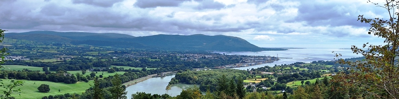
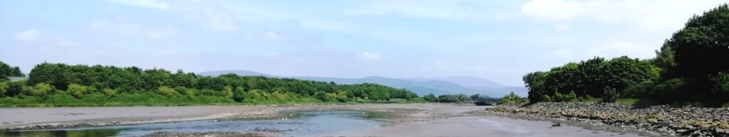
 This Mourne Mountains Whodunit Hunt is a self-guided, driving murder mystery trail. It starts at Narrow Water Castle near Warrenpoint and ends at Bryansford, near Newcastle.
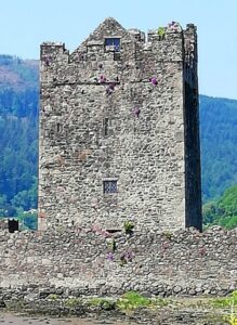
- See superb scenery in the Carlingford Lough and Mourne Mountains areas while learning about the history of the towns and villages en-route, established hundreds of years ago, and the people that helped shape them. Along the way you’ll see a castle, an ancient Irish Cross, a ruined church, a neolithic tomb… and more!
- Over 30 clues to solve in a booklet that includes extra historical and tourist information!
- The driving route is only 23 miles, or 37 km, from the start to the end point.
 There is about 1 ¼ miles / 2 km of walking in total, spread across the various clue stops of the route. At the end there is the opportunity to have a walk in beautiful Tollymore Forest Park, if time allows.
- We suggest allowing 3-4 hours to solve this murder mystery, excluding refreshment stops.
- Accessibility – it is fairly flat where all of the clues are to be found.
To pay using Paypal click here (or in the menu) to order this, or any other, Whodunit Hunt.
To purchase this Whodunit Hunt with credit / debit / Amex card please click here.
The starting point is shown in the map below:
(c) 2023 – the term ‘Whodunit Hunt’, associated logo, website content, and all Hunt routes, ideas, photos, are all protected by copyright. Any copying, impersonation or distribution of anything embraced by our copyright is intellectual theft and therefore unlawful and illegal. Please respect the law as well as all of our hard work.
Who Offed Raymond In Rathfriland?
Raymond McKnight has been found murdered in the historic hilltop town of Rathfriland, County Down. Although his body was found at the bus depot, we believe that this was not where the murder occurred. Our investigators are under pressure to make progress solving the crime, and thus urgently need your help.
 The Rathfriland Whodunit Hunt starts and ends at the town’s main bus terminus and car park where there is unlimited-time free car parking; see map below.
- This is a self-guided, walking murder mystery trail.
- Learn about the surprising amount of history that this little town has to offer, with connections to another continent, a political figure, and history dating back hundreds of years when there was a castle at the highest point of the town.
- The route is just under a mile, or about 1.5 km.
- The recommended time for this murder mystery, excluding refreshment stops, is about two hours.
- Accessibility – this is mostly a fairly flat route, but there are some slight inclines and two short but fairly steep hills; there are no steps on the route.
- Refreshments – Rathfriland has a few cafes and convenience stores; nearby Hilltown can provide more extensive options.
To purchase this Whodunit Hunt with credit / debit / Amex card please click here.
To pay using Paypal click here (or in the menu) to order this, or any other, Whodunit Hunt.
(c) 2023 – the term ‘Whodunit Hunt’, associated logo, website content, and all Hunt routes, ideas, images and photos, are protected by copyright. Any copying/distribution of anything embraced by our copyright is intellectual theft and therefore unlawful and illegal. Please respect the law as well as numerous years of our hard work.
Who Liquidated Leonard in Lurgan?
Leonard McCloy has been found murdered at the railway station of Lurgan, although it is felt that this was not where the murder was committed. Our local detective in the town has been spending more time eating Ulster fries than trying to crack the case and so we need your help to solve the murder!
 The Lurgan Whodunit Hunt is a self-guided, walking murder mystery trail.
- Discover the surprising amount of history that the town has to offer, including the impressively ornate Brownlow House and nearby park, learn of the town’s former significant linen industry, more than one world-record breaking sporting character… and more!
- The route is 2 ½ miles, or about 4 km. It starts / finishes at the car park at the end of Robert Street, where there is unlimited-time free car parking; see map below.
- The recommended time for this murder mystery, excluding refreshment stops, is 2 ½ – 3 hours.
- Accessibility – this is a generally flat route, with little in the way of gradient and no steps.
- Refreshments – there is quite a good lunch-time restaurant in Brownlow House. There are other options in the town.
- NOTE: Brownlow House is closed Sundays and Mondays, so if doing the Lurgan Whodunit Hunt on these days you’d have to use at least one of your clue helps (and possibly all depending on if the gates are open or not). Thus it’s ideally best to do it on one of the other days of the week.
To pay using Paypal click here (or in the menu) to order this, or any other, Whodunit Hunt.
To purchase this Whodunit Hunt with credit / debit / Amex card please click here.
The starting point is at the car park at the end of Robert Street next to Lurgan Park:
(c) 2023 – the term ‘Whodunit Hunt’, associated logo, website content, and all Hunt routes, ideas, images and photos, are protected by copyright. Any copying/distribution of anything embraced by our copyright is intellectual theft and therefore unlawful and illegal. Please respect the law as well as numerous years of our hard work.
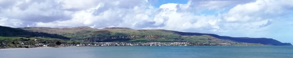
Who Archived Ann At The Antrim Coast?
Ann Collins has been found murdered on the beach at Ballygally, Northern Ireland, although crime scene technicians concluded that she didn’t drown and was killed elsewhere. Our best investigators have uncovered few leads and thus need your help to solve the crime.
 The Antrim Coast Whodunit Hunt starts at the junction of Tower Road in Larne and ends near Cushendall.
- This is a self-guided, non-circular driving murder mystery trail.
- Visit lovely villages and learn about key figures in the history of the area hundreds of years ago… and its geology tens of millions of years ago. See castles and towers, historic memorials and ruined churches, stunning coastline too… and even the Scottish coast on a clear day!
- Over 30 clues to solve now we’ve squeezed even more fun into this Whodunit trail!
- For Games Of Thrones fans there are two filming locations along the clue route to spot!
- The clue driving route is only 25 miles, or 40km! There is about 2 miles / 3km of walking in total, spread across all clues.
- The recommended time for this murder mystery, excluding refreshment stops, is 4-5 hours.
- Accessibility – it is generally flat where clues are found. However the last clue has quite a steep slope down to it, though it has been recently improved; sensible shoes for this clue are therefore strongly recommended.
- Note: if you live a way along the clue route and it’s inconvenient to drive to the start, simply begin with the clue that is closest to you and, once you get to the end, drive to the start and solve the rest of the clues!
To purchase this Whodunit Hunt with credit / debit / Amex card please click here.
To pay using Paypal click here (or in the menu) to order this, or any other, Whodunit Hunt.
The starting point is at the junction of Tower Road in Larne:
(c) 2023 – the term ‘Whodunit Hunt’, associated logo, website content, and all Whodunit Hunt routes, ideas, photos, are all protected by copyright. Any copying, impersonation or distribution of anything embraced by our copyright is intellectual theft and therefore unlawful and illegal. Please respect the law as well as all of our hard work.
